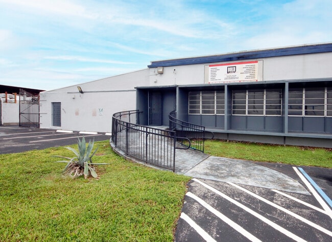
Property Record
6721 Nw 36Th Ave, Miami, FL 33147


NEARBY LISTINGS FOR SALE OR LEASE
Property Detail
6721 Nw 36Th Ave
Miami-Miami Beach-Kendall, FL
Pinemount 2Nd
30-3116-010-0140
16 53 41 2.61 AC M/L PB 52-24 CENTRAL INDUSTRIAL SITES SEC 1 LOTS 13 THRU 15 LESS PORT OF LOT 15 DESC BEG NE COR OF LOT 15 W356FT S18.53FT E355.93FT N10.99FT TO POB LOT SIZE 113974 SQ FT OR 17111-0944 0296 1 COC 22692-3655 09 2004 1
Foodprocessing
Miami/Dade
AH
Florida
12086C0284L
13-15
2024
2.62 AC
2025
Hialeah
000903
South Florida
56,608 SF
DEMOGRAPHICS near 6721 Nw 36Th Ave
1 Mile
3 Mile
5 Mile
2024 Total Population
12,672
184,413
543,222
2029 Population
12,264
178,839
530,443
Pop Growth 2024-2029
(3.22%)
(3.02%)
(2.35%)
Average Age
43
42
42
2024 Total Households
3,990
61,572
195,381
HH Growth 2024-2029
(3.48%)
(3.35%)
(2.47%)
Median Household Inc
$41,277
$37,762
$41,278
Avg Household Size
3.00
2.80
2.60
2024 Avg HH Vehicles
2.00
2.00
1.00
Median Home Value
$281,921
$313,780
$335,748
Median Year Built
1958
1960
1968
Nearby Places
Map Layers
Map Styles
 Street
 Aerial
- Restaurants
- Banks
- Shops
- Fitness
- Groceries
PUBLIC TRANSPORTATION
COMMUTER RAIL
Tri-Rail And Metrorail Transfer Station (Metrorail Green Line - South Florida Regional Transportation Authority (Tri-Rail), Tri-County Commuter - South Florida Regional Transportation Authority (Tri-Rail))
DRIVE
WALK
Distance
Tri-Rail And Metrorail Transfer Station (Metrorail Green Line - South Florida Regional Transportation Authority (Tri-Rail), Tri-County Commuter - South Florida Regional Transportation Authority (Tri-Rail))
2 min
18 min
0.9 mi
Northside (Metrorail Green Line - Miami-Dade Transit (Metrorail/Metromover))
DRIVE
WALK
Distance
Northside (Metrorail Green Line - Miami-Dade Transit (Metrorail/Metromover))
3 min
1.1 mi
AIRPORT
Miami International
DRIVE
WALK
Distance
Miami International
18 min
6.9 mi
Fort Lauderdale/Hollywood International
DRIVE
WALK
Distance
Fort Lauderdale/Hollywood International
34 min
21.6 mi
Freight Ports
Port of Miami
DRIVE
WALK
Distance
Port of Miami
20 min
9.6 mi
SALE & LEASE HISTORY
LISTING DATE
SALE/LEASE

May 16, 2018
For Sale
Jun 21, 2021
For Lease
Jun 21, 2021
For Sale
Jul 07, 2023
For Lease
Jul 02, 2020
For Lease
Jan 19, 2021
For Lease
Jan 19, 2021
For Sale
Aug 01, 2018
For Sale
Nearby Properties
Address
Land Use
TOTAL SIZE
Lot Size
Zoning
Address
Land Use
TOTAL SIZE
Lot Size
Zoning
2,789,683 SF
33.23 AC
7300
Address
Land Use
TOTAL SIZE
Lot Size
Zoning
256,089 SF
20.35 AC
7600
Address
Land Use
TOTAL SIZE
Lot Size
Zoning
7.62 AC
7200
Address
Land Use
TOTAL SIZE
Lot Size
Zoning
1,700 SF
7.24 AC
7100
Address
Land Use
TOTAL SIZE
Lot Size
Zoning
648,350 SF
9.78 AC
6118
Address
Land Use
TOTAL SIZE
Lot Size
Zoning
451,817 SF
6400
Address
Land Use
TOTAL SIZE
Lot Size
Zoning
803,285 SF
63.32 AC
7100
Address
Land Use
TOTAL SIZE
Lot Size
Zoning
2 SF
154.10 AC
8900
Address
Land Use
TOTAL SIZE
Lot Size
Zoning
603,504 SF
27.15 AC
7100
Address
Land Use
TOTAL SIZE
Lot Size
Zoning
393,093 SF
3.61 AC
6400
Address
Land Use
TOTAL SIZE
Lot Size
Zoning
239,869 SF
5 AC
8000
Address
Land Use
TOTAL SIZE
Lot Size
Zoning
207,475 SF
51.47 AC
7100
Address
Land Use
TOTAL SIZE
Lot Size
Zoning
363,010 SF
19.13 AC
8000
Address
Land Use
TOTAL SIZE
Lot Size
Zoning
510,373 SF
154.10 AC
8900
Address
Land Use
TOTAL SIZE
Lot Size
Zoning
530,479 SF
10.13 AC
6400
Address
Land Use
TOTAL SIZE
Lot Size
Zoning
680,945 SF
35.56 AC
6400
Address
Land Use
TOTAL SIZE
Lot Size
Zoning
214,855 SF
3.91 AC
7300
Address
Land Use
TOTAL SIZE
Lot Size
Zoning
569,763 SF
31.75 AC
3900
Address
Land Use
TOTAL SIZE
Lot Size
Zoning
281,761 SF
26.88 AC
7100
Address
Land Use
TOTAL SIZE
Lot Size
Zoning
366,063 SF
57.35 AC
7100
Address
Land Use
TOTAL SIZE
Lot Size
Zoning
412,149 SF
19.40 AC
7100
Address
Land Use
TOTAL SIZE
Lot Size
Zoning
203,234 SF
28.88 AC
8000
Address
Land Use
TOTAL SIZE
Lot Size
Zoning
330,942 SF
4.80 AC
7600
Address
Land Use
TOTAL SIZE
Lot Size
Zoning
197,181 SF
7.95 AC
6062
Address
Land Use
TOTAL SIZE
Lot Size
Zoning
304,073 SF
6 AC
6200
Address
Land Use
TOTAL SIZE
Lot Size
Zoning
485,478 SF
18.10 AC
7100
Address
Land Use
TOTAL SIZE
Lot Size
Zoning
565,961 SF
17.98 AC
7300
Address
Land Use
TOTAL SIZE
Lot Size
Zoning
219,849 SF
3.72 AC
8000
Address
Land Use
TOTAL SIZE
Lot Size
Zoning
283,103 SF
18.68 AC
7100
The World's #1 Commercial Real Estate Marketplace
Connect with us
© 2026 CoStar Group
The information above has been obtained from sources believed reliable. While we do not doubt its accuracy we have not verified it and make no guarantee, warranty or representation about it. It is your responsibility to independently confirm its accuracy and completeness. Any projections, opinions, assumptions, or estimates used are for example only and do not represent the current or future performance of the property. The value of this transaction to you depends on tax and other factors which should be evaluated by your tax, financial, and legal advisors. You and your advisors should conduct a careful, independent investigation of the property to determine to your satisfaction the suitability of the property for your needs.