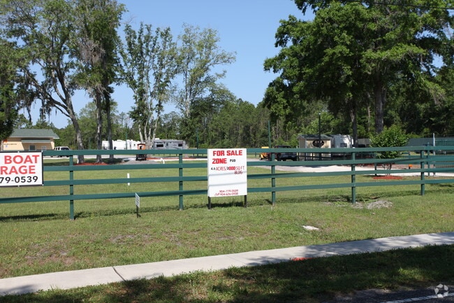
Property Record
6728 Firestone Rd, Jacksonville, FL 32244


NEARBY LISTINGS FOR SALE OR LEASE
Property Detail
6728 Firestone Rd
015752-0000
Jax Heights Sec
Shipyard
5-93 23-3S-25E 4.51 JACKSONVILLE HEIGHTS N1/2 TRACT 16(EX PT IN R/W) BLK 1
X
Duval
12019C0060E
Florida
2025
4.66 AC
2026
Riverside
013523
Jacksonville (Florida)
2,695 SF
Jacksonville, FL
DEMOGRAPHICS near 6728 Firestone Rd
1 mile
3 mile
5 mile
2024 Total Population
8,179
77,552
196,745
2029 Population
8,632
81,148
208,436
Pop Growth 2024-2029
+ 5.54%
+ 4.64%
+ 5.94%
Average Age
36
37
38
2024 Total Households
2,881
29,066
74,391
HH Growth 2024-2029
+ 5.62%
+ 4.73%
+ 6.05%
Median Household Inc
$56,374
$54,387
$59,066
Avg Household Size
2.80
2.60
2.60
2024 Avg HH Vehicles
2.00
2.00
2.00
Median Home Value
$173,428
$175,554
$202,607
Median Year Built
1995
1988
1987
Nearby Places
Map Layers
Map Styles
 Street
 Aerial
Transit
 Traffic
 Biking
Places
Listings with unknown addresses are not visible on the map
- Restaurants
- Banks
- Shops
- Fitness
- Groceries
PUBLIC TRANSPORTATION
AIRPORT
Jacksonville International
Drive
Walk
Distance
Jacksonville International
35 min
23.3 mi
Freight Ports
Jacksonville Port
Drive
Walk
Distance
Jacksonville Port
28 min
17.1 mi
Nearby Properties
Address
Land Use
TOTAL SIZE
Lot Size
Zoning
Address
Land Use
TOTAL SIZE
Lot Size
Zoning
411,303 SF
26.71 AC
RMD-C
Address
Land Use
TOTAL SIZE
Lot Size
Zoning
246,982 SF
24.84 AC
PUD
Address
Land Use
TOTAL SIZE
Lot Size
Zoning
402,240 SF
20.66 AC
PUD
Address
Land Use
TOTAL SIZE
Lot Size
Zoning
355,124 SF
18.80 AC
PUD
Address
Land Use
TOTAL SIZE
Lot Size
Zoning
290,919 SF
18.75 AC
PUD
Address
Land Use
TOTAL SIZE
Lot Size
Zoning
348,247 SF
31.85 AC
PUD
Address
Land Use
TOTAL SIZE
Lot Size
Zoning
244,004 SF
24.97 AC
PUD
Address
Land Use
TOTAL SIZE
Lot Size
Zoning
188,666 SF
17.76 AC
PUD
Address
Land Use
TOTAL SIZE
Lot Size
Zoning
272,076 SF
54.84 AC
PUD
Address
Land Use
TOTAL SIZE
Lot Size
Zoning
188,578 SF
13.44 AC
RMD-D
Address
Land Use
TOTAL SIZE
Lot Size
Zoning
216,883 SF
18.80 AC
CCG-1
Address
Land Use
TOTAL SIZE
Lot Size
Zoning
228,290 SF
12.65 AC
RMD-D
Address
Land Use
TOTAL SIZE
Lot Size
Zoning
207,697 SF
16.06 AC
PUD
Address
Land Use
TOTAL SIZE
Lot Size
Zoning
96,314 SF
21.05 AC
CCG-1
Address
Land Use
TOTAL SIZE
Lot Size
Zoning
137,636 SF
9.73 AC
RMD-D
Address
Land Use
TOTAL SIZE
Lot Size
Zoning
171,412 SF
16.44 AC
RMD-D
Address
Land Use
TOTAL SIZE
Lot Size
Zoning
182,070 SF
12.73 AC
PUD
Address
Land Use
TOTAL SIZE
Lot Size
Zoning
169,084 SF
13 AC
CCG-1
Address
Land Use
TOTAL SIZE
Lot Size
Zoning
229,441 SF
17.48 AC
PUD
Address
Land Use
TOTAL SIZE
Lot Size
Zoning
67,581 SF
24.24 AC
PUD
Address
Land Use
TOTAL SIZE
Lot Size
Zoning
113,479 SF
7.32 AC
PUD
Address
Land Use
TOTAL SIZE
Lot Size
Zoning
103,833 SF
19.32 AC
PUD
Address
Land Use
TOTAL SIZE
Lot Size
Zoning
10,588 SF
36.70 AC
RMD-MH
Address
Land Use
TOTAL SIZE
Lot Size
Zoning
162,739 SF
15.79 AC
PUD
Address
Land Use
TOTAL SIZE
Lot Size
Zoning
209,238 SF
10.31 AC
RMD-D
Address
Land Use
TOTAL SIZE
Lot Size
Zoning
193,478 SF
10.13 AC
RMD-D
Address
Land Use
TOTAL SIZE
Lot Size
Zoning
50,150 SF
38.63 AC
RMD-MH
Address
Land Use
TOTAL SIZE
Lot Size
Zoning
178,740 SF
17.06 AC
PUD
Address
Land Use
TOTAL SIZE
Lot Size
Zoning
101,208 SF
9.22 AC
CCG-1
Address
Land Use
TOTAL SIZE
Lot Size
Zoning
160,634 SF
16.36 AC
RMD-D
The World's #1 Commercial Real Estate Marketplace
Connect with us
© 2026 CoStar Group
The information above has been obtained from sources believed reliable. While we do not doubt its accuracy we have not verified it and make no guarantee, warranty or representation about it. It is your responsibility to independently confirm its accuracy and completeness. Any projections, opinions, assumptions, or estimates used are for example only and do not represent the current or future performance of the property. The value of this transaction to you depends on tax and other factors which should be evaluated by your tax, financial, and legal advisors. You and your advisors should conduct a careful, independent investigation of the property to determine to your satisfaction the suitability of the property for your needs.