Property Record
6728 Theodore Dawes Rd, Theodore, AL 36582


Property Detail
6728 Theodore Dawes Rd
Mobile, AL
PCL B - PART LOT 324 CAROL PLANTATION UNIT 2 MBK 4 P 272 DESC AS FOLL BEG SE COR SD FARM TH NWLY 202.3 FT N 245 FT(S) TH E
38-03-05-1-002-010
MOBILE
Vacantlandnec
Alabama
B and X Area of moderate flood hazard, usually the area between the limits of the 100-year and 500-year floods.
324
2025
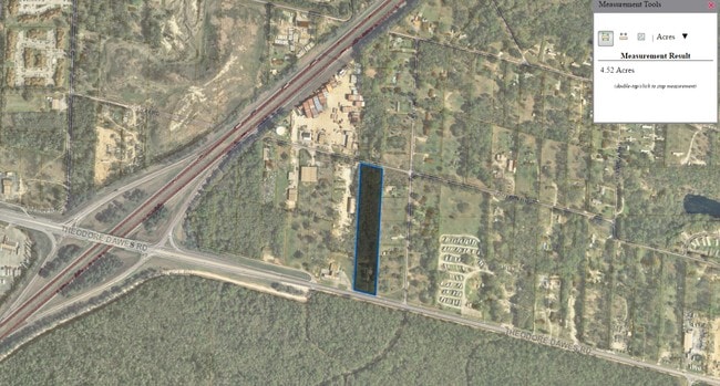
1.22 AC
2025
Outlying Mobile County
007102
Mobile
NEARBY LISTINGS FOR SALE OR LEASE
-
-
-
-
-
-
-
No Photo
-
View all Theodore listings for sale on LoopNet.com
DEMOGRAPHICS near 6728 Theodore Dawes Rd
1 mile
3 mile
5 mile
2024 Total Population
3,378
24,319
48,269
2029 Population
3,360
24,126
47,795
Pop Growth 2024-2029
(0.53%)
(0.79%)
(0.98%)
Average Age
38
39
40
2024 Total Households
1,327
9,477
18,945
HH Growth 2024-2029
(0.68%)
(0.82%)
(0.99%)
Median Household Inc
$41,704
$54,460
$63,611
Avg Household Size
2.50
2.50
2.50
2024 Avg HH Vehicles
2.00
2.00
2.00
Median Home Value
$148,730
$155,038
$189,055
Median Year Built
1989
1984
1986
Nearby Places
Map Layers
Map Styles
 Street
 Aerial
Transit
 Traffic
 Biking
Places
Listings with unknown addresses are not visible on the map
- Restaurants
- Banks
- Shops
- Fitness
- Groceries
PUBLIC TRANSPORTATION
AIRPORT
Mobile International
Drive
Walk
Distance
Mobile International
16 min
11.2 mi
Mobile Regional
Drive
Walk
Distance
Mobile Regional
26 min
12.1 mi
Freight Ports
Port of Mobile
Drive
Walk
Distance
Port of Mobile
19 min
14.6 mi
SALE & LEASE HISTORY
LISTING DATE
SALE/LEASE

Sep 24, 2016
For Sale
Nearby Properties
Address
Land Use
TOTAL SIZE
Lot Size
Zoning
Address
Land Use
TOTAL SIZE
Lot Size
Zoning
362,880 SF
32.55 AC
Address
Land Use
TOTAL SIZE
Lot Size
Zoning
117,000 SF
Address
Land Use
TOTAL SIZE
Lot Size
Zoning
202,866 SF
8.52 AC
Address
Land Use
TOTAL SIZE
Lot Size
Zoning
155,320 SF
21.48 AC
Address
Land Use
TOTAL SIZE
Lot Size
Zoning
342,598 SF
11.94 AC
Address
Land Use
TOTAL SIZE
Lot Size
Zoning
78,750 SF
27.51 AC
Address
Land Use
TOTAL SIZE
Lot Size
Zoning
167,968 SF
12.40 AC
Address
Land Use
TOTAL SIZE
Lot Size
Zoning
26,933 SF
82.37 AC
Address
Land Use
TOTAL SIZE
Lot Size
Zoning
86,168 SF
42 AC
Address
Land Use
TOTAL SIZE
Lot Size
Zoning
27,580 SF
4.69 AC
Address
Land Use
TOTAL SIZE
Lot Size
Zoning
78,750 SF
24 AC
Address
Land Use
TOTAL SIZE
Lot Size
Zoning
193,452 SF
17.61 AC
Address
Land Use
TOTAL SIZE
Lot Size
Zoning
66,382 SF
1.71 AC
Address
Land Use
TOTAL SIZE
Lot Size
Zoning
12,071 SF
6.87 AC
Address
Land Use
TOTAL SIZE
Lot Size
Zoning
70,838 SF
181.63 AC
Address
Land Use
TOTAL SIZE
Lot Size
Zoning
86,820 SF
4.50 AC
Address
Land Use
TOTAL SIZE
Lot Size
Zoning
94,116 SF
7.11 AC
Address
Land Use
TOTAL SIZE
Lot Size
Zoning
396.69 AC
Address
Land Use
TOTAL SIZE
Lot Size
Zoning
60,630 SF
6.70 AC
Address
Land Use
TOTAL SIZE
Lot Size
Zoning
58,306 SF
3.11 AC
Address
Land Use
TOTAL SIZE
Lot Size
Zoning
204,776 SF
39.94 AC
Address
Land Use
TOTAL SIZE
Lot Size
Zoning
79,503 SF
17.97 AC
Address
Land Use
TOTAL SIZE
Lot Size
Zoning
62,546 SF
10 AC
Address
Land Use
TOTAL SIZE
Lot Size
Zoning
73,199 SF
6.90 AC
Address
Land Use
TOTAL SIZE
Lot Size
Zoning
77,250 SF
10.64 AC
Address
Land Use
TOTAL SIZE
Lot Size
Zoning
158,516 SF
9.15 AC
Address
Land Use
TOTAL SIZE
Lot Size
Zoning
104,623 SF
10.19 AC
Address
Land Use
TOTAL SIZE
Lot Size
Zoning
41,333 SF
6.35 AC
Address
Land Use
TOTAL SIZE
Lot Size
Zoning
107,156 SF
42.22 AC
Address
Land Use
TOTAL SIZE
Lot Size
Zoning
57,530 SF
2.02 AC
The World's #1 Commercial Real Estate Marketplace
Connect with us
© 2026 CoStar Group
The information above has been obtained from sources believed reliable. While we do not doubt its accuracy we have not verified it and make no guarantee, warranty or representation about it. It is your responsibility to independently confirm its accuracy and completeness. Any projections, opinions, assumptions, or estimates used are for example only and do not represent the current or future performance of the property. The value of this transaction to you depends on tax and other factors which should be evaluated by your tax, financial, and legal advisors. You and your advisors should conduct a careful, independent investigation of the property to determine to your satisfaction the suitability of the property for your needs.