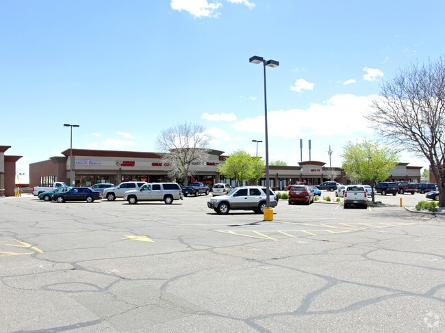
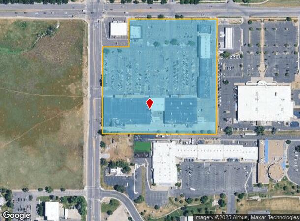
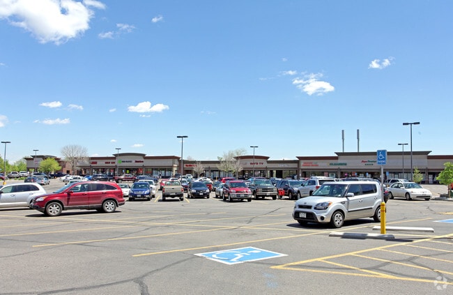
Property Record
6730 S Pierce St, Littleton, CO 80128

NEARBY LISTINGS FOR SALE OR LEASE
Property Detail
6730 S Pierce St
Denver-Aurora-Lakewood, CO
Columbine Knolls Flg 1 Ex Sur 1
59-252-04-003
SECTION 25 TOWNSHIP 05 RANGE 69 QTR NW SUBDIVISIONCD 150850 SUBDIVISIONNAME COLUMBINE KNOLLS FLG 1 EX SUR 1 BLOCK LOT 0001 SIZE: 464611 TRACT VALUE: 10.666
Commercialnec
Jefferson
X
Colorado
0800460252H
1
2023
10.67 AC
2024
Southwest
012051
Denver
119,540 SF
DEMOGRAPHICS near 6730 S Pierce St
1 Mile
3 Mile
5 Mile
2024 Total Population
11,773
89,482
230,119
2029 Population
11,520
88,559
231,844
Pop Growth 2024-2029
(2.15%)
(1.03%)
+ 0.75%
Average Age
44
42
42
2024 Total Households
4,341
35,926
93,714
HH Growth 2024-2029
(2.30%)
(1.05%)
+ 0.89%
Median Household Inc
$120,032
$106,941
$96,926
Avg Household Size
2.60
2.40
2.40
2024 Avg HH Vehicles
2.00
2.00
2.00
Median Home Value
$544,990
$565,549
$541,923
Median Year Built
1975
1984
1984
Nearby Places
Map Layers
Map Styles
 Street
 Aerial
- Restaurants
- Banks
- Shops
- Fitness
- Groceries
PUBLIC TRANSPORTATION
AIRPORT
Denver International
DRIVE
WALK
Distance
Denver International
53 min
36.6 mi
SALE & LEASE HISTORY
LISTING DATE
SALE/LEASE

Sep 25, 2016
For Lease
Feb 11, 2020
For Lease
Nearby Properties
Address
Land Use
TOTAL SIZE
Lot Size
Zoning
Address
Land Use
TOTAL SIZE
Lot Size
Zoning
251,583 SF
38.03 AC
Address
Land Use
TOTAL SIZE
Lot Size
Zoning
381,135 SF
35.02 AC
Address
Land Use
TOTAL SIZE
Lot Size
Zoning
14,029 SF
23.97 AC
Address
Land Use
TOTAL SIZE
Lot Size
Zoning
600,847 SF
32.41 AC
PD
Address
Land Use
TOTAL SIZE
Lot Size
Zoning
600,847 SF
35.87 AC
PD
Address
Land Use
TOTAL SIZE
Lot Size
Zoning
133,908 SF
9.39 AC
LPD-C
Address
Land Use
TOTAL SIZE
Lot Size
Zoning
391,595 SF
27.94 AC
Address
Land Use
TOTAL SIZE
Lot Size
Zoning
178,421 SF
12.31 AC
PD
Address
Land Use
TOTAL SIZE
Lot Size
Zoning
293,292 SF
13.78 AC
S-CC
Address
Land Use
TOTAL SIZE
Lot Size
Zoning
304,475 SF
22.32 AC
Address
Land Use
TOTAL SIZE
Lot Size
Zoning
123,843 SF
6.03 AC
Address
Land Use
TOTAL SIZE
Lot Size
Zoning
329,538 SF
14.64 AC
B-4
Address
Land Use
TOTAL SIZE
Lot Size
Zoning
296,034 SF
14.26 AC
R-2-A
Address
Land Use
TOTAL SIZE
Lot Size
Zoning
189,672 SF
16.74 AC
PD
Address
Land Use
TOTAL SIZE
Lot Size
Zoning
133,594 SF
25.03 AC
Address
Land Use
TOTAL SIZE
Lot Size
Zoning
92,913 SF
8.47 AC
LRE
Address
Land Use
TOTAL SIZE
Lot Size
Zoning
94,367 SF
10.02 AC
R-2
Address
Land Use
TOTAL SIZE
Lot Size
Zoning
87,291 SF
9.25 AC
Address
Land Use
TOTAL SIZE
Lot Size
Zoning
351,792 SF
16.99 AC
LPD-C
Address
Land Use
TOTAL SIZE
Lot Size
Zoning
221,819 SF
33.64 AC
A1
Address
Land Use
TOTAL SIZE
Lot Size
Zoning
183,858 SF
9.30 AC
PUD
Address
Land Use
TOTAL SIZE
Lot Size
Zoning
101,795 SF
12.61 AC
PD
Address
Land Use
TOTAL SIZE
Lot Size
Zoning
105,093 SF
9.32 AC
B-2
Address
Land Use
TOTAL SIZE
Lot Size
Zoning
81,037 SF
15.31 AC
LPD-C
Address
Land Use
TOTAL SIZE
Lot Size
Zoning
308,134 SF
14.56 AC
LPD-C
Address
Land Use
TOTAL SIZE
Lot Size
Zoning
279,023 SF
13.15 AC
LPD-R
Address
Land Use
TOTAL SIZE
Lot Size
Zoning
297,003 SF
26.77 AC
PD
Address
Land Use
TOTAL SIZE
Lot Size
Zoning
221,123 SF
14.82 AC
PD
Address
Land Use
TOTAL SIZE
Lot Size
Zoning
97,000 SF
9.88 AC
PD
The World's #1 Commercial Real Estate Marketplace
Connect with us
© 2025 CoStar Group
The information above has been obtained from sources believed reliable. While we do not doubt its accuracy we have not verified it and make no guarantee, warranty or representation about it. It is your responsibility to independently confirm its accuracy and completeness. Any projections, opinions, assumptions, or estimates used are for example only and do not represent the current or future performance of the property. The value of this transaction to you depends on tax and other factors which should be evaluated by your tax, financial, and legal advisors. You and your advisors should conduct a careful, independent investigation of the property to determine to your satisfaction the suitability of the property for your needs.