Property Record
6731 Ames Rd, Cleveland, OH 44129


Current Lease Availabilities
Property Detail
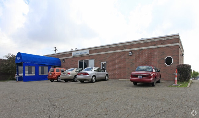
6731 Ames Rd
449-27-017
9 0001
Medicalbuilding
CUYAHOGA
RB
Ohio
B and X Area of moderate flood hazard, usually the area between the limits of the 100-year and 500-year floods.
1
2025
0.83 AC
2025
Southwest
177606
Cleveland
6,570 SF
Cleveland-Elyria, OH
NEARBY LISTINGS FOR SALE OR LEASE
DEMOGRAPHICS near 6731 Ames Rd
1 mile
3 mile
5 mile
2025 Total Population
15,783
99,621
239,788
2030 Population
15,579
98,022
236,245
Pop Growth 2025-2030
(1.29%)
(1.61%)
(1.48%)
Average Age
43
43
43
2025 Total Households
7,328
43,116
104,491
HH Growth 2025-2030
(1.45%)
(1.71%)
(1.61%)
Median Household Inc
$56,968
$69,112
$68,458
Avg Household Size
2.10
2.20
2.20
2025 Avg HH Vehicles
2.00
2.00
2.00
Median Home Value
$168,199
$174,696
$179,811
Median Year Built
1959
1958
1959
Nearby Places
Map Layers
Map Styles
 Street
 Aerial
Transit
 Traffic
 Biking
Places
Listings with unknown addresses are not visible on the map
- Restaurants
- Banks
- Shops
- Fitness
- Groceries
PUBLIC TRANSPORTATION
COMMUTER RAIL
Drive
Walk
Distance
18 min
8.4 mi
Drive
Walk
Distance
19 min
8.9 mi
AIRPORT
Cleveland-Hopkins International
Drive
Walk
Distance
Cleveland-Hopkins International
19 min
8.5 mi
Akron-Canton Regional
Drive
Walk
Distance
Akron-Canton Regional
63 min
45.0 mi
Nearby Properties
Address
Land Use
TOTAL SIZE
Lot Size
Zoning
Address
Land Use
TOTAL SIZE
Lot Size
Zoning
668,882 SF
41.27 AC
SC
Address
Land Use
TOTAL SIZE
Lot Size
Zoning
477,641 SF
14.07 AC
MF-1
Address
Land Use
TOTAL SIZE
Lot Size
Zoning
725,585 SF
76.92 AC
SF-A
Address
Land Use
TOTAL SIZE
Lot Size
Zoning
245,255 SF
14 AC
Address
Land Use
TOTAL SIZE
Lot Size
Zoning
505,418 SF
33.99 AC
SC
Address
Land Use
TOTAL SIZE
Lot Size
Zoning
632,686 SF
16.44 AC
MF-3
Address
Land Use
TOTAL SIZE
Lot Size
Zoning
33.27 AC
IA
Address
Land Use
TOTAL SIZE
Lot Size
Zoning
355,701 SF
16.35 AC
OB
Address
Land Use
TOTAL SIZE
Lot Size
Zoning
281,600 SF
18.73 AC
SF-A
Address
Land Use
TOTAL SIZE
Lot Size
Zoning
78,622 SF
11.78 AC
CB
Address
Land Use
TOTAL SIZE
Lot Size
Zoning
132.06 AC
IA
Address
Land Use
TOTAL SIZE
Lot Size
Zoning
107,427 SF
30 AC
SF-A
Address
Land Use
TOTAL SIZE
Lot Size
Zoning
86,081 SF
14.45 AC
B
Address
Land Use
TOTAL SIZE
Lot Size
Zoning
263,926 SF
95.55 AC
GI
Address
Land Use
TOTAL SIZE
Lot Size
Zoning
111,220 SF
23.65 AC
IA
Address
Land Use
TOTAL SIZE
Lot Size
Zoning
83,375 SF
9.29 AC
MF-1
Address
Land Use
TOTAL SIZE
Lot Size
Zoning
74,731 SF
15.23 AC
A
Address
Land Use
TOTAL SIZE
Lot Size
Zoning
88,328 SF
35.11 AC
RM
Address
Land Use
TOTAL SIZE
Lot Size
Zoning
239,222 SF
22.87 AC
G-B
Address
Land Use
TOTAL SIZE
Lot Size
Zoning
315,434 SF
3.48 AC
A
Address
Land Use
TOTAL SIZE
Lot Size
Zoning
154,579 SF
18.46 AC
A
Address
Land Use
TOTAL SIZE
Lot Size
Zoning
250,995 SF
15.94 AC
IP
Address
Land Use
TOTAL SIZE
Lot Size
Zoning
107,240 SF
19.19 AC
MF-1
Address
Land Use
TOTAL SIZE
Lot Size
Zoning
9.07 AC
Address
Land Use
TOTAL SIZE
Lot Size
Zoning
24.22 AC
PF
Address
Land Use
TOTAL SIZE
Lot Size
Zoning
166,370 SF
8.64 AC
HB
Address
Land Use
TOTAL SIZE
Lot Size
Zoning
21,333 SF
17.61 AC
MF-1
Address
Land Use
TOTAL SIZE
Lot Size
Zoning
99,522 SF
52.18 AC
A
Address
Land Use
TOTAL SIZE
Lot Size
Zoning
114,101 SF
4.40 AC
SF-AA
Address
Land Use
TOTAL SIZE
Lot Size
Zoning
185,022 SF
14.23 AC
The World's #1 Commercial Real Estate Marketplace
Connect with us
© 2026 CoStar Group
The information above has been obtained from sources believed reliable. While we do not doubt its accuracy we have not verified it and make no guarantee, warranty or representation about it. It is your responsibility to independently confirm its accuracy and completeness. Any projections, opinions, assumptions, or estimates used are for example only and do not represent the current or future performance of the property. The value of this transaction to you depends on tax and other factors which should be evaluated by your tax, financial, and legal advisors. You and your advisors should conduct a careful, independent investigation of the property to determine to your satisfaction the suitability of the property for your needs.