Property Record
6735 N Peoria Ave, Tulsa, OK 74126

NEARBY LISTINGS FOR SALE OR LEASE
Property Detail
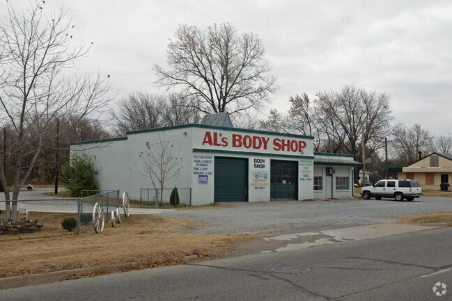
6735 N Peoria Ave
Tulsa, OK
Miller Addn Resub L7-8 B11 Golden Hills
53625-13-31-03750
LT-1-
Storebuilding
Tulsa
X
Oklahoma
40143C0115L
1
2025
1.24 AC
2025
Northwest Tulsa
009104
Tulsa
1,110 SF
DEMOGRAPHICS near 6735 N Peoria Ave
1 Mile
3 Mile
5 Mile
2024 Total Population
2,758
17,901
40,272
2029 Population
2,926
18,872
42,295
Pop Growth 2024-2029
+ 6.09%
+ 5.42%
+ 5.02%
Average Age
41
38
37
2024 Total Households
1,091
6,486
15,010
HH Growth 2024-2029
+ 6.14%
+ 5.46%
+ 5.06%
Median Household Inc
$40,989
$34,497
$35,286
Avg Household Size
2.50
2.60
2.60
2024 Avg HH Vehicles
2.00
2.00
2.00
Median Home Value
$70,267
$67,673
$86,182
Median Year Built
1965
1961
1963
Nearby Places
Map Layers
Map Styles
 Street
 Aerial
- Restaurants
- Banks
- Shops
- Fitness
- Groceries
PUBLIC TRANSPORTATION
AIRPORT
Tulsa International
DRIVE
WALK
Distance
Tulsa International
17 min
8.8 mi
Freight Ports
DRIVE
WALK
Distance
27 min
16.9 mi
Nearby Properties
Address
Land Use
TOTAL SIZE
Lot Size
Zoning
Address
Land Use
TOTAL SIZE
Lot Size
Zoning
29,589 SF
12.37 AC
AG
Address
Land Use
TOTAL SIZE
Lot Size
Zoning
16,196 SF
9.73 AC
IL
Address
Land Use
TOTAL SIZE
Lot Size
Zoning
33,340 SF
10.08 AC
AG
Address
Land Use
TOTAL SIZE
Lot Size
Zoning
45,883 SF
10.29 AC
RS3
Address
Land Use
TOTAL SIZE
Lot Size
Zoning
55,867 SF
7.94 AC
RS
Address
Land Use
TOTAL SIZE
Lot Size
Zoning
5,670 SF
96.05 AC
AG
Address
Land Use
TOTAL SIZE
Lot Size
Zoning
473,599 SF
56.42 AC
IM
Address
Land Use
TOTAL SIZE
Lot Size
Zoning
27,403 SF
70.91 AC
AG
Address
Land Use
TOTAL SIZE
Lot Size
Zoning
31,154 SF
9.74 AC
RS3
Address
Land Use
TOTAL SIZE
Lot Size
Zoning
29,065 SF
111.30 AC
RS
Address
Land Use
TOTAL SIZE
Lot Size
Zoning
1 SF
228.69 AC
AG
Address
Land Use
TOTAL SIZE
Lot Size
Zoning
1,200 SF
38.79 AC
AG
Address
Land Use
TOTAL SIZE
Lot Size
Zoning
5,704 SF
0.55 AC
CH
Address
Land Use
TOTAL SIZE
Lot Size
Zoning
9,450 SF
7.66 AC
AG
Address
Land Use
TOTAL SIZE
Lot Size
Zoning
7,129 SF
4.15 AC
IM
Address
Land Use
TOTAL SIZE
Lot Size
Zoning
1,375 SF
15.01 AC
RS3
Address
Land Use
TOTAL SIZE
Lot Size
Zoning
8,159 SF
2.05 AC
AG
Address
Land Use
TOTAL SIZE
Lot Size
Zoning
11,843 SF
8.90 AC
CS
Address
Land Use
TOTAL SIZE
Lot Size
Zoning
11,598 SF
5 AC
RS
Address
Land Use
TOTAL SIZE
Lot Size
Zoning
16,619 SF
2.31 AC
AG
Address
Land Use
TOTAL SIZE
Lot Size
Zoning
13,055 SF
9.84 AC
RS3
Address
Land Use
TOTAL SIZE
Lot Size
Zoning
9,646 SF
3.09 AC
RS3
Address
Land Use
TOTAL SIZE
Lot Size
Zoning
14,632 SF
2.38 AC
RS
Address
Land Use
TOTAL SIZE
Lot Size
Zoning
58,592 SF
9.63 AC
IM
Address
Land Use
TOTAL SIZE
Lot Size
Zoning
7,625 SF
0.91 AC
RS3
Address
Land Use
TOTAL SIZE
Lot Size
Zoning
357.68 AC
RS3
Address
Land Use
TOTAL SIZE
Lot Size
Zoning
3,525 SF
2.66 AC
RS3
Address
Land Use
TOTAL SIZE
Lot Size
Zoning
7,800 SF
5 AC
AG
Address
Land Use
TOTAL SIZE
Lot Size
Zoning
3,509 SF
10.95 AC
RMH
Address
Land Use
TOTAL SIZE
Lot Size
Zoning
9,264 SF
3.03 AC
RS3
The World's #1 Commercial Real Estate Marketplace
Connect with us
© 2026 CoStar Group
The information above has been obtained from sources believed reliable. While we do not doubt its accuracy we have not verified it and make no guarantee, warranty or representation about it. It is your responsibility to independently confirm its accuracy and completeness. Any projections, opinions, assumptions, or estimates used are for example only and do not represent the current or future performance of the property. The value of this transaction to you depends on tax and other factors which should be evaluated by your tax, financial, and legal advisors. You and your advisors should conduct a careful, independent investigation of the property to determine to your satisfaction the suitability of the property for your needs.