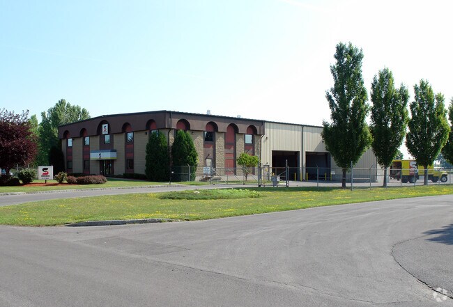
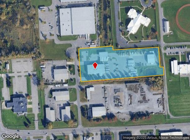
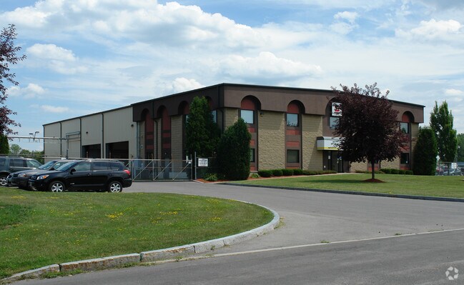
Property Record
6741 Vip Pkwy, Syracuse, NY 13211
NEARBY LISTINGS FOR SALE OR LEASE
Property Detail
6741 Vip Pkwy
312689-015-000-0001-015-000-0000
FL 9
Warehouse
Onondaga
X
New York
36067C0226F
15.000
2025
4.79 AC
2024
SE Outer Onondaga County
014400
Syracuse
12,868 SF
Syracuse, NY
DEMOGRAPHICS near 6741 Vip Pkwy
1 Mile
3 Mile
5 Mile
2024 Total Population
645
66,439
176,481
2029 Population
628
64,448
172,215
Pop Growth 2024-2029
(2.64%)
(3.00%)
(2.42%)
Average Age
40
41
39
2024 Total Households
263
28,784
74,549
HH Growth 2024-2029
(2.66%)
(3.16%)
(2.45%)
Median Household Inc
$66,710
$57,221
$53,686
Avg Household Size
2.30
2.20
2.20
2024 Avg HH Vehicles
2.00
1.00
1.00
Median Home Value
$88,157
$130,187
$145,864
Median Year Built
1953
1952
1956
Nearby Places
- Restaurants
- Banks
- Shops
- Fitness
- Groceries
PUBLIC TRANSPORTATION
COMMUTER RAIL
DRIVE
WALK
Distance
9 min
4.2 mi
DRIVE
WALK
Distance
9 min
4.3 mi
AIRPORT
Syracuse Hancock International
DRIVE
WALK
Distance
Syracuse Hancock International
12 min
4.5 mi
Nearby Properties
Address
Land Use
TOTAL SIZE
Lot Size
Zoning
Address
Land Use
TOTAL SIZE
Lot Size
Zoning
569,463 SF
94.77 AC
06 - INDUS
Address
Land Use
TOTAL SIZE
Lot Size
Zoning
12,836 SF
148.95 AC
06 - INDUS
Address
Land Use
TOTAL SIZE
Lot Size
Zoning
116,580 SF
18.46 AC
06 - INDUS
Address
Land Use
TOTAL SIZE
Lot Size
Zoning
169,752 SF
12.81 AC
04 - FARM
Address
Land Use
TOTAL SIZE
Lot Size
Zoning
432,246 SF
37.21 AC
05 - COMME
Address
Land Use
TOTAL SIZE
Lot Size
Zoning
22.16 AC
06 - INDUS
Address
Land Use
TOTAL SIZE
Lot Size
Zoning
11,484 SF
16.36 AC
03 - MULTI
Address
Land Use
TOTAL SIZE
Lot Size
Zoning
157,497 SF
14.56 AC
06 - INDUS
Address
Land Use
TOTAL SIZE
Lot Size
Zoning
47,122 SF
42.77 AC
06 - INDUS
Address
Land Use
TOTAL SIZE
Lot Size
Zoning
110,105 SF
26.68 AC
06 - INDUS
Address
Land Use
TOTAL SIZE
Lot Size
Zoning
89,985 SF
11.37 AC
06 - INDUS
Address
Land Use
TOTAL SIZE
Lot Size
Zoning
218,439 SF
18.85 AC
Address
Land Use
TOTAL SIZE
Lot Size
Zoning
2,025 SF
267.94 AC
06 - INDUS
Address
Land Use
TOTAL SIZE
Lot Size
Zoning
165,954 SF
10.66 AC
06 - INDUS
Address
Land Use
TOTAL SIZE
Lot Size
Zoning
196,620 SF
11.73 AC
01 - NOT Z
Address
Land Use
TOTAL SIZE
Lot Size
Zoning
246,172 SF
16.65 AC
Address
Land Use
TOTAL SIZE
Lot Size
Zoning
32,840 SF
26.60 AC
05 - COMME
Address
Land Use
TOTAL SIZE
Lot Size
Zoning
38,595 SF
0.67 AC
06 - INDUS
Address
Land Use
TOTAL SIZE
Lot Size
Zoning
110,811 SF
11.46 AC
06 - INDUS
Address
Land Use
TOTAL SIZE
Lot Size
Zoning
169,511 SF
4.25 AC
01 - NOT Z
Address
Land Use
TOTAL SIZE
Lot Size
Zoning
206,807 SF
46 AC
06 - INDUS
Address
Land Use
TOTAL SIZE
Lot Size
Zoning
38,000 SF
9.90 AC
22
Address
Land Use
TOTAL SIZE
Lot Size
Zoning
354,429 SF
27.14 AC
06 - INDUS
Address
Land Use
TOTAL SIZE
Lot Size
Zoning
128,998 SF
2.52 AC
02 - SINGL
Address
Land Use
TOTAL SIZE
Lot Size
Zoning
125,684 SF
25.61 AC
06 - INDUS
Address
Land Use
TOTAL SIZE
Lot Size
Zoning
92,538 SF
19.96 AC
06 - INDUS
Address
Land Use
TOTAL SIZE
Lot Size
Zoning
37,955 SF
10 AC
06 - INDUS
Address
Land Use
TOTAL SIZE
Lot Size
Zoning
120,068 SF
9.26 AC
GCPLUS
Address
Land Use
TOTAL SIZE
Lot Size
Zoning
296.49 AC
06 - INDUS
The World's #1 Commercial Real Estate Marketplace
Connect with us
© 2025 CoStar Group
The information above has been obtained from sources believed reliable. While we do not doubt its accuracy we have not verified it and make no guarantee, warranty or representation about it. It is your responsibility to independently confirm its accuracy and completeness. Any projections, opinions, assumptions, or estimates used are for example only and do not represent the current or future performance of the property. The value of this transaction to you depends on tax and other factors which should be evaluated by your tax, financial, and legal advisors. You and your advisors should conduct a careful, independent investigation of the property to determine to your satisfaction the suitability of the property for your needs.