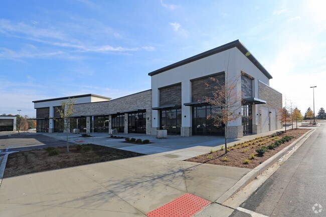
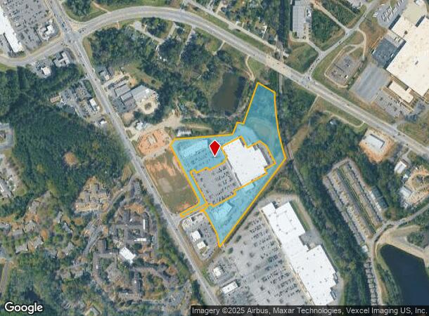
Property Record
675 Mullins Colony Dr, Evans, GA 30809
NEARBY LISTINGS FOR SALE OR LEASE
Property Detail
675 Mullins Colony Dr
Augusta-Richmond County, GA-SC
The Mullins Colony
078-138G
LOT H2 11.27 ACS; THE MULLINS COLONY
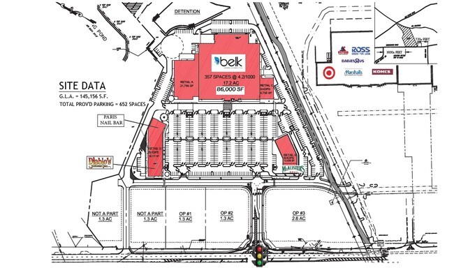
Stripcommercialcenter
Columbia
X
Georgia
13073C0163E
h2
2025
11.27 AC
2025
Evans/Martinez
030311
Augusta/Richmond County
19,878 SF
DEMOGRAPHICS near 675 Mullins Colony Dr
1 Mile
3 Mile
5 Mile
2024 Total Population
7,383
53,700
124,413
2029 Population
8,202
59,231
134,237
Pop Growth 2024-2029
+ 11.09%
+ 10.30%
+ 7.90%
Average Age
44
42
40
2024 Total Households
2,881
20,685
48,766
HH Growth 2024-2029
+ 10.38%
+ 9.38%
+ 6.51%
Median Household Inc
$80,260
$79,087
$80,797
Avg Household Size
2.30
2.50
2.50
2024 Avg HH Vehicles
2.00
2.00
2.00
Median Home Value
$190,307
$225,148
$244,162
Median Year Built
1990
1988
1992
Nearby Places
Map Layers
Map Styles
 Street
 Aerial
- Restaurants
- Banks
- Shops
- Fitness
- Groceries
PUBLIC TRANSPORTATION
AIRPORT
Augusta Regional at Bush Field
DRIVE
WALK
Distance
Augusta Regional at Bush Field
28 min
16.5 mi
Freight Ports
Georgia Ports - Savannah
DRIVE
WALK
Distance
Georgia Ports - Savannah
162 min
125.6 mi
SALE & LEASE HISTORY
LISTING DATE
SALE/LEASE

Oct 31, 2017
For Lease
Nearby Properties
Address
Land Use
TOTAL SIZE
Lot Size
Zoning
Address
Land Use
TOTAL SIZE
Lot Size
Zoning
4,077 SF
20.88 AC
C-2;GEN CO
Address
Land Use
TOTAL SIZE
Lot Size
Zoning
7,749 SF
17.02 AC
R2
Address
Land Use
TOTAL SIZE
Lot Size
Zoning
57,341 SF
54.33 AC
Address
Land Use
TOTAL SIZE
Lot Size
Zoning
3,680 SF
13.42 AC
B-2
Address
Land Use
TOTAL SIZE
Lot Size
Zoning
92,482 SF
14.77 AC
Address
Land Use
TOTAL SIZE
Lot Size
Zoning
392 SF
19.66 AC
Address
Land Use
TOTAL SIZE
Lot Size
Zoning
100 SF
16.05 AC
Address
Land Use
TOTAL SIZE
Lot Size
Zoning
35,844 SF
38.03 AC
PUD
Address
Land Use
TOTAL SIZE
Lot Size
Zoning
53,653 SF
11.26 AC
Address
Land Use
TOTAL SIZE
Lot Size
Zoning
2,508 SF
14.61 AC
A-R;APARTM
Address
Land Use
TOTAL SIZE
Lot Size
Zoning
199,464 SF
45.19 AC
Address
Land Use
TOTAL SIZE
Lot Size
Zoning
61,473 SF
PUD
Address
Land Use
TOTAL SIZE
Lot Size
Zoning
997 SF
19.16 AC
Address
Land Use
TOTAL SIZE
Lot Size
Zoning
6,000 SF
Address
Land Use
TOTAL SIZE
Lot Size
Zoning
6,000 SF
Address
Land Use
TOTAL SIZE
Lot Size
Zoning
150,263 SF
18.75 AC
PUD
Address
Land Use
TOTAL SIZE
Lot Size
Zoning
112,947 SF
14.91 AC
Address
Land Use
TOTAL SIZE
Lot Size
Zoning
98,188 SF
13.29 AC
Address
Land Use
TOTAL SIZE
Lot Size
Zoning
129,068 SF
8.74 AC
Address
Land Use
TOTAL SIZE
Lot Size
Zoning
125,466 SF
15.98 AC
B-2
Address
Land Use
TOTAL SIZE
Lot Size
Zoning
17,977 SF
21.43 AC
Address
Land Use
TOTAL SIZE
Lot Size
Zoning
6,580 SF
50.62 AC
Address
Land Use
TOTAL SIZE
Lot Size
Zoning
6,960 SF
5.39 AC
S1
Address
Land Use
TOTAL SIZE
Lot Size
Zoning
13,788 SF
55.14 AC
Address
Land Use
TOTAL SIZE
Lot Size
Zoning
203,927 SF
25.80 AC
C-2;GEN CO
Address
Land Use
TOTAL SIZE
Lot Size
Zoning
2,494 SF
11.76 AC
A-R;APARTM
Address
Land Use
TOTAL SIZE
Lot Size
Zoning
26,965 SF
11.18 AC
Address
Land Use
TOTAL SIZE
Lot Size
Zoning
135,920 SF
16.29 AC
Address
Land Use
TOTAL SIZE
Lot Size
Zoning
14,910 SF
12.17 AC
Address
Land Use
TOTAL SIZE
Lot Size
Zoning
9,952 SF
11 AC
C-2;GEN CO
The World's #1 Commercial Real Estate Marketplace
Connect with us
© 2026 CoStar Group
The information above has been obtained from sources believed reliable. While we do not doubt its accuracy we have not verified it and make no guarantee, warranty or representation about it. It is your responsibility to independently confirm its accuracy and completeness. Any projections, opinions, assumptions, or estimates used are for example only and do not represent the current or future performance of the property. The value of this transaction to you depends on tax and other factors which should be evaluated by your tax, financial, and legal advisors. You and your advisors should conduct a careful, independent investigation of the property to determine to your satisfaction the suitability of the property for your needs.