Property Record
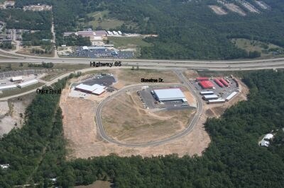
675 Stonetree Dr, Branson, MO 65616

Property Detail
675 Stonetree Dr
Branson, MO
HIGH ROAD PLAZA -AMD PLAT; LOT 4A;AMD PLAT OF LTS
08-3.0-08-000-000-020.012
TANEY
Commercialnec
Missouri
B and X Area of moderate flood hazard, usually the area between the limits of the 100-year and 500-year floods.
4a
2024
2.68 AC
2025
Branson
480208
Other Market Areas
21,600 SF
NEARBY LISTINGS FOR SALE OR LEASE
-
-
View all Branson listings for sale on LoopNet.com
DEMOGRAPHICS near 675 Stonetree Dr
1 mile
3 mile
5 mile
2025 Total Population
1,105
9,137
21,150
2030 Population
1,062
8,972
20,837
Pop Growth 2025-2030
(3.89%)
(1.81%)
(1.48%)
Average Age
36
40
41
2025 Total Households
387
3,622
8,425
HH Growth 2025-2030
(3.88%)
(1.93%)
(1.46%)
Median Household Inc
$64,539
$65,439
$62,991
Avg Household Size
2.70
2.40
2.40
2025 Avg HH Vehicles
2.00
2.00
2.00
Median Home Value
$298,437
$267,693
$256,131
Median Year Built
1994
1997
1995
Nearby Places
Map Layers
Map Styles
 Street
 Aerial
Layers
 Traffic
 Biking
Places
Listings with unknown addresses are not visible on the map
- Restaurants
- Banks
- Shops
- Fitness
- Groceries
Nearby Properties
Address
Land Use
TOTAL SIZE
Lot Size
Zoning
Address
Land Use
TOTAL SIZE
Lot Size
Zoning
123,377 SF
13.05 AC
Address
Land Use
TOTAL SIZE
Lot Size
Zoning
271.32 AC
Address
Land Use
TOTAL SIZE
Lot Size
Zoning
63,890 SF
14.45 AC
Address
Land Use
TOTAL SIZE
Lot Size
Zoning
104,868 SF
13.61 AC
Address
Land Use
TOTAL SIZE
Lot Size
Zoning
167.53 AC
Address
Land Use
TOTAL SIZE
Lot Size
Zoning
25,760 SF
6.47 AC
Address
Land Use
TOTAL SIZE
Lot Size
Zoning
18,308 SF
2.59 AC
Address
Land Use
TOTAL SIZE
Lot Size
Zoning
1,804,046 SF
23.86 AC
Address
Land Use
TOTAL SIZE
Lot Size
Zoning
15,605 SF
3.13 AC
Address
Land Use
TOTAL SIZE
Lot Size
Zoning
33,184 SF
16.14 AC
Address
Land Use
TOTAL SIZE
Lot Size
Zoning
71,120 SF
43.42 AC
Address
Land Use
TOTAL SIZE
Lot Size
Zoning
68,610 SF
5.04 AC
Address
Land Use
TOTAL SIZE
Lot Size
Zoning
81.50 AC
Address
Land Use
TOTAL SIZE
Lot Size
Zoning
41.50 AC
Address
Land Use
TOTAL SIZE
Lot Size
Zoning
63,904 SF
6.55 AC
Address
Land Use
TOTAL SIZE
Lot Size
Zoning
30,873 SF
0.60 AC
Address
Land Use
TOTAL SIZE
Lot Size
Zoning
39,171 SF
18.11 AC
Address
Land Use
TOTAL SIZE
Lot Size
Zoning
32,736 SF
6.05 AC
Address
Land Use
TOTAL SIZE
Lot Size
Zoning
21,710 SF
6.03 AC
Address
Land Use
TOTAL SIZE
Lot Size
Zoning
51.38 AC
Address
Land Use
TOTAL SIZE
Lot Size
Zoning
27,424 SF
10 AC
Address
Land Use
TOTAL SIZE
Lot Size
Zoning
9,362 SF
1.66 AC
Address
Land Use
TOTAL SIZE
Lot Size
Zoning
35,316 SF
12.70 AC
Address
Land Use
TOTAL SIZE
Lot Size
Zoning
35,421 SF
0.65 AC
Address
Land Use
TOTAL SIZE
Lot Size
Zoning
38,840 SF
16.71 AC
Address
Land Use
TOTAL SIZE
Lot Size
Zoning
14,609 SF
0.33 AC
Address
Land Use
TOTAL SIZE
Lot Size
Zoning
12,000 SF
1.44 AC
The World's #1 Commercial Real Estate Marketplace
Connect with us
© 2026 CoStar Group
The information above has been obtained from sources believed reliable. While we do not doubt its accuracy we have not verified it and make no guarantee, warranty or representation about it. It is your responsibility to independently confirm its accuracy and completeness. Any projections, opinions, assumptions, or estimates used are for example only and do not represent the current or future performance of the property. The value of this transaction to you depends on tax and other factors which should be evaluated by your tax, financial, and legal advisors. You and your advisors should conduct a careful, independent investigation of the property to determine to your satisfaction the suitability of the property for your needs.