Property Record
675 W Fleming Dr, Morganton, NC 28655
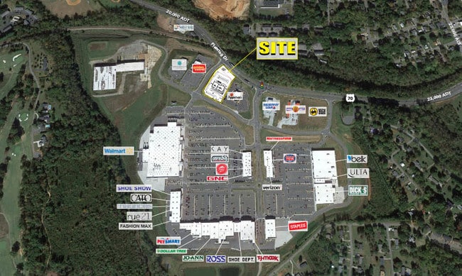

Property Detail
675 W Fleming Dr
60993
MORGANTON HEIGHTS LO5 PL43-97
Restaurantbuilding
Burke
CONDITIONA
North Carolina
B and X Area of moderate flood hazard, usually the area between the limits of the 100-year and 500-year floods.
1.87 AC
2025
Burke County
2025
Charlotte
021400
Hickory-Lenoir-Morganton, NC
7,847 SF
NEARBY LISTINGS FOR SALE OR LEASE
DEMOGRAPHICS near 675 W Fleming Dr
1 mile
3 mile
5 mile
2025 Total Population
3,049
19,959
35,924
2030 Population
3,034
20,112
36,253
Pop Growth 2025-2030
(0.49%)
+ 0.77%
+ 0.92%
Average Age
40
42
43
2025 Total Households
1,178
7,928
14,206
HH Growth 2025-2030
(0.34%)
+ 0.90%
+ 1.04%
Median Household Inc
$49,763
$50,900
$52,528
Avg Household Size
2.40
2.30
2.40
2025 Avg HH Vehicles
2.00
2.00
2.00
Median Home Value
$270,338
$243,406
$229,265
Median Year Built
1966
1972
1976
Nearby Places
Map Layers
Map Styles
 Street
 Aerial
Layers
 Traffic
 Biking
Places
Listings with unknown addresses are not visible on the map
- Restaurants
- Banks
- Shops
- Fitness
- Groceries
SALE & LEASE HISTORY
LISTING DATE
SALE/LEASE

Nov 02, 2017
For Lease
Nearby Properties
Address
Land Use
TOTAL SIZE
Lot Size
Zoning
Address
Land Use
TOTAL SIZE
Lot Size
Zoning
STATE INST
Address
Land Use
TOTAL SIZE
Lot Size
Zoning
80,043 SF
72.72 AC
HIGH INTEN
Address
Land Use
TOTAL SIZE
Lot Size
Zoning
89,004 SF
STATE INST
Address
Land Use
TOTAL SIZE
Lot Size
Zoning
32,074 SF
HIGH INTEN
Address
Land Use
TOTAL SIZE
Lot Size
Zoning
87,530 SF
HIGH INTEN
Address
Land Use
TOTAL SIZE
Lot Size
Zoning
6,912 SF
24.27 AC
HIGH INTEN
Address
Land Use
TOTAL SIZE
Lot Size
Zoning
146,058 SF
52.85 AC
MEDIUM INT
Address
Land Use
TOTAL SIZE
Lot Size
Zoning
MEDIUM INT
Address
Land Use
TOTAL SIZE
Lot Size
Zoning
31,227 SF
RESIDENTIA
Address
Land Use
TOTAL SIZE
Lot Size
Zoning
MEDIUM INT
Address
Land Use
TOTAL SIZE
Lot Size
Zoning
HIGH INTEN
Address
Land Use
TOTAL SIZE
Lot Size
Zoning
23,970 SF
33.98 AC
CONDITIONA
Address
Land Use
TOTAL SIZE
Lot Size
Zoning
MEDIUM INT
Address
Land Use
TOTAL SIZE
Lot Size
Zoning
73,530 SF
Address
Land Use
TOTAL SIZE
Lot Size
Zoning
185,929 SF
32.01 AC
CONDITIONA
Address
Land Use
TOTAL SIZE
Lot Size
Zoning
6,052 SF
13.04 AC
MEDIUM INT
Address
Land Use
TOTAL SIZE
Lot Size
Zoning
37,366 SF
22.36 AC
HIGH INTEN
Address
Land Use
TOTAL SIZE
Lot Size
Zoning
250,292 SF
53.11 AC
EXCLUSIVE
Address
Land Use
TOTAL SIZE
Lot Size
Zoning
299,860 SF
39.81 AC
EXCLUSIVE
Address
Land Use
TOTAL SIZE
Lot Size
Zoning
2,160 SF
12.81 AC
MEDIUM INT
Address
Land Use
TOTAL SIZE
Lot Size
Zoning
6,402 SF
14.14 AC
MEDIUM INT
Address
Land Use
TOTAL SIZE
Lot Size
Zoning
52,977 SF
1.90 AC
MEDIUM INT
Address
Land Use
TOTAL SIZE
Lot Size
Zoning
135,387 SF
9.95 AC
HIGH INTEN
Address
Land Use
TOTAL SIZE
Lot Size
Zoning
32,698 SF
23 AC
MEDIUM INT
Address
Land Use
TOTAL SIZE
Lot Size
Zoning
25,986 SF
16.78 AC
HIGH INTEN
Address
Land Use
TOTAL SIZE
Lot Size
Zoning
HIGH INTEN
Address
Land Use
TOTAL SIZE
Lot Size
Zoning
58,998 SF
LOW INTENS
Address
Land Use
TOTAL SIZE
Lot Size
Zoning
71,060 SF
3.10 AC
HIGH INTEN
Address
Land Use
TOTAL SIZE
Lot Size
Zoning
40,056 SF
13.80 AC
CONDITIONA
Address
Land Use
TOTAL SIZE
Lot Size
Zoning
65,175 SF
13.48 AC
CONDITIONA
The World's #1 Commercial Real Estate Marketplace
Connect with us
© 2026 CoStar Group
The information above has been obtained from sources believed reliable. While we do not doubt its accuracy we have not verified it and make no guarantee, warranty or representation about it. It is your responsibility to independently confirm its accuracy and completeness. Any projections, opinions, assumptions, or estimates used are for example only and do not represent the current or future performance of the property. The value of this transaction to you depends on tax and other factors which should be evaluated by your tax, financial, and legal advisors. You and your advisors should conduct a careful, independent investigation of the property to determine to your satisfaction the suitability of the property for your needs.