Property Record
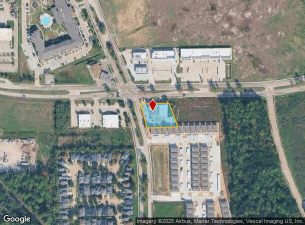
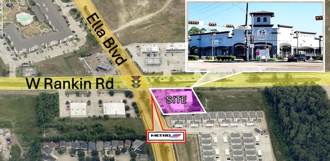
675 W Rankin Rd, Houston, TX 77067
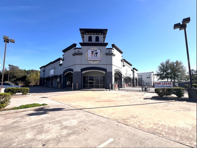
This Property Is For Sale
NEARBY LISTINGS FOR SALE OR LEASE
Property Detail
675 W Rankin Rd
1170710000003
Star Ella
Daycare
RES A1 STAR ELLA
X
Harris
48201C0460M
Texas
2024
0.76 AC
2025
FM 1960/I-45
550201
Houston
9,559 SF
Houston-The Woodlands-Sugar Land, TX
DEMOGRAPHICS near 675 W Rankin Rd
1 Mile
3 Mile
5 Mile
2024 Total Population
19,341
121,536
291,714
2029 Population
19,917
123,543
296,576
Pop Growth 2024-2029
+ 2.98%
+ 1.65%
+ 1.67%
Average Age
31
32
34
2024 Total Households
7,104
40,595
95,367
HH Growth 2024-2029
+ 2.87%
+ 1.85%
+ 1.78%
Median Household Inc
$35,054
$40,855
$45,974
Avg Household Size
2.60
2.90
3.00
2024 Avg HH Vehicles
1.00
2.00
2.00
Median Home Value
$169,775
$161,554
$169,311
Median Year Built
1987
1989
1987
Nearby Places
Map Layers
Map Styles
 Street
 Aerial
- Restaurants
- Banks
- Shops
- Fitness
- Groceries
PUBLIC TRANSPORTATION
AIRPORT
George Bush Intcntl/Houston
DRIVE
WALK
Distance
George Bush Intcntl/Houston
13 min
8.7 mi
William P Hobby
DRIVE
WALK
Distance
William P Hobby
42 min
28.0 mi
Freight Ports
Port of Houston
DRIVE
WALK
Distance
Port of Houston
34 min
23.6 mi
Nearby Properties
Address
Land Use
TOTAL SIZE
Lot Size
Zoning
Address
Land Use
TOTAL SIZE
Lot Size
Zoning
858,420 SF
60.71 AC
Address
Land Use
TOTAL SIZE
Lot Size
Zoning
145.62 AC
Address
Land Use
TOTAL SIZE
Lot Size
Zoning
739,141 SF
54 AC
Address
Land Use
TOTAL SIZE
Lot Size
Zoning
413,178 SF
21.45 AC
Address
Land Use
TOTAL SIZE
Lot Size
Zoning
764,495 SF
54.15 AC
Address
Land Use
TOTAL SIZE
Lot Size
Zoning
657,500 SF
36.24 AC
Address
Land Use
TOTAL SIZE
Lot Size
Zoning
790,262 SF
50.60 AC
Address
Land Use
TOTAL SIZE
Lot Size
Zoning
614,256 SF
31.25 AC
Address
Land Use
TOTAL SIZE
Lot Size
Zoning
608,784 SF
29.08 AC
Address
Land Use
TOTAL SIZE
Lot Size
Zoning
485,125 SF
28.55 AC
Address
Land Use
TOTAL SIZE
Lot Size
Zoning
504,000 SF
32.25 AC
Address
Land Use
TOTAL SIZE
Lot Size
Zoning
417,597 SF
16.98 AC
Address
Land Use
TOTAL SIZE
Lot Size
Zoning
356,900 SF
19.38 AC
Address
Land Use
TOTAL SIZE
Lot Size
Zoning
394,784 SF
22.47 AC
Address
Land Use
TOTAL SIZE
Lot Size
Zoning
350,500 SF
17.71 AC
Address
Land Use
TOTAL SIZE
Lot Size
Zoning
362,720 SF
20.23 AC
Address
Land Use
TOTAL SIZE
Lot Size
Zoning
356,622 SF
18.26 AC
Address
Land Use
TOTAL SIZE
Lot Size
Zoning
125,512 SF
18.26 AC
Address
Land Use
TOTAL SIZE
Lot Size
Zoning
423,730 SF
5.91 AC
Address
Land Use
TOTAL SIZE
Lot Size
Zoning
284,476 SF
20 AC
Address
Land Use
TOTAL SIZE
Lot Size
Zoning
284,687 SF
19.66 AC
Address
Land Use
TOTAL SIZE
Lot Size
Zoning
329,643 SF
19.99 AC
Address
Land Use
TOTAL SIZE
Lot Size
Zoning
57,551 SF
49.71 AC
Address
Land Use
TOTAL SIZE
Lot Size
Zoning
287,251 SF
18.12 AC
Address
Land Use
TOTAL SIZE
Lot Size
Zoning
288,525 SF
17.66 AC
Address
Land Use
TOTAL SIZE
Lot Size
Zoning
267,158 SF
12.96 AC
Address
Land Use
TOTAL SIZE
Lot Size
Zoning
383,451 SF
15.98 AC
Address
Land Use
TOTAL SIZE
Lot Size
Zoning
240,240 SF
14.35 AC
Address
Land Use
TOTAL SIZE
Lot Size
Zoning
251,812 SF
12.22 AC
Address
Land Use
TOTAL SIZE
Lot Size
Zoning
244,864 SF
12.30 AC
The World's #1 Commercial Real Estate Marketplace
Connect with us
© 2025 CoStar Group
The information above has been obtained from sources believed reliable. While we do not doubt its accuracy we have not verified it and make no guarantee, warranty or representation about it. It is your responsibility to independently confirm its accuracy and completeness. Any projections, opinions, assumptions, or estimates used are for example only and do not represent the current or future performance of the property. The value of this transaction to you depends on tax and other factors which should be evaluated by your tax, financial, and legal advisors. You and your advisors should conduct a careful, independent investigation of the property to determine to your satisfaction the suitability of the property for your needs.