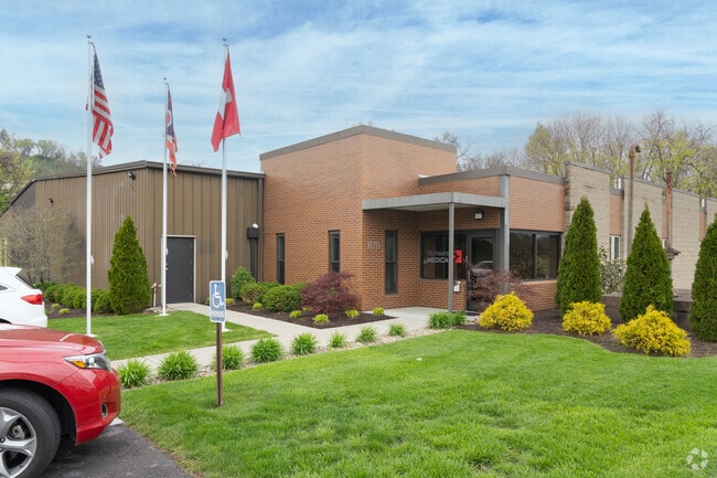
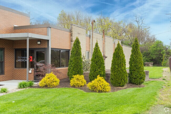
Property Record
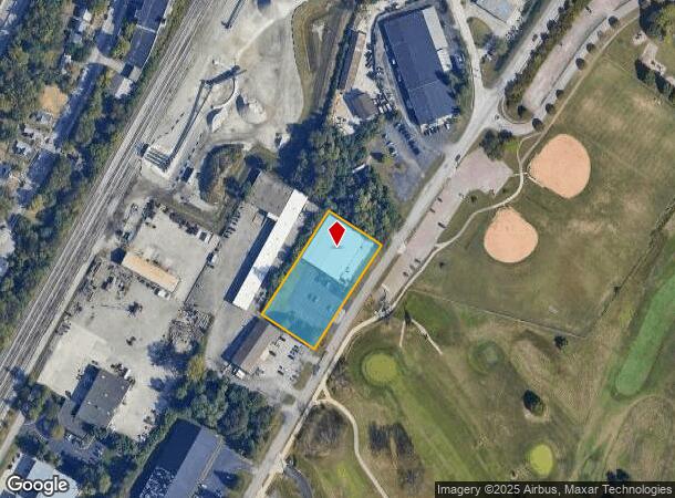
675 Wilmer Ave, Cincinnati, OH 45226
NEARBY LISTINGS FOR SALE OR LEASE
Property Detail
675 Wilmer Ave
Cincinnati, OH-KY-IN
Wilmer Industrialsub
015-0003-0050
WILMER AVE 340 X 180 FT LOT 7-8 WILMER INDUSTRIALSUB BL A PARS 50-51 CONS
Lightindustrial
Hamilton
AE
Ohio
39061C0356G
7-8
2024
1.34 AC
2024
Central/Midtown
004703
Cincinnati/Dayton
20,279 SF
DEMOGRAPHICS near 675 Wilmer Ave
1 Mile
3 Mile
5 Mile
2024 Total Population
4,262
66,034
228,007
2029 Population
4,209
65,398
227,944
Pop Growth 2024-2029
(1.24%)
(0.96%)
(0.03%)
Average Age
38
39
39
2024 Total Households
1,875
31,176
102,389
HH Growth 2024-2029
(1.39%)
(1.16%)
(0.11%)
Median Household Inc
$103,036
$92,562
$70,776
Avg Household Size
2.20
2.10
2.10
2024 Avg HH Vehicles
2.00
2.00
2.00
Median Home Value
$484,459
$335,614
$264,144
Median Year Built
1948
1953
1951
Nearby Places
Map Layers
Map Styles
 Street
 Aerial
- Restaurants
- Banks
- Shops
- Fitness
- Groceries
PUBLIC TRANSPORTATION
COMMUTER RAIL
DRIVE
WALK
Distance
19 min
9.2 mi
AIRPORT
Cincinnati/Northern Kentucky International
DRIVE
WALK
Distance
Cincinnati/Northern Kentucky International
38 min
20.7 mi
SALE & LEASE HISTORY
LISTING DATE
SALE/LEASE

Feb 20, 2024
For Lease
Nearby Properties
Address
Land Use
TOTAL SIZE
Lot Size
Zoning
Address
Land Use
TOTAL SIZE
Lot Size
Zoning
13.80 AC
Address
Land Use
TOTAL SIZE
Lot Size
Zoning
27.30 AC
M2
Address
Land Use
TOTAL SIZE
Lot Size
Zoning
11.68 AC
Address
Land Use
TOTAL SIZE
Lot Size
Zoning
26,453 SF
19.91 AC
M2
Address
Land Use
TOTAL SIZE
Lot Size
Zoning
148,748 SF
24.90 AC
CGA
Address
Land Use
TOTAL SIZE
Lot Size
Zoning
3.17 AC
R2PUD
Address
Land Use
TOTAL SIZE
Lot Size
Zoning
Address
Land Use
TOTAL SIZE
Lot Size
Zoning
6.93 AC
MG
Address
Land Use
TOTAL SIZE
Lot Size
Zoning
12.46 AC
Address
Land Use
TOTAL SIZE
Lot Size
Zoning
89,925 SF
1.72 AC
Address
Land Use
TOTAL SIZE
Lot Size
Zoning
83,122 SF
1.99 AC
Address
Land Use
TOTAL SIZE
Lot Size
Zoning
24,572 SF
4.70 AC
Address
Land Use
TOTAL SIZE
Lot Size
Zoning
3,864 SF
0.15 AC
PD
Address
Land Use
TOTAL SIZE
Lot Size
Zoning
4,706 SF
18.29 AC
RM20
Address
Land Use
TOTAL SIZE
Lot Size
Zoning
33,468 SF
1.04 AC
Address
Land Use
TOTAL SIZE
Lot Size
Zoning
2.17 AC
O
Address
Land Use
TOTAL SIZE
Lot Size
Zoning
9,515 SF
19.13 AC
Address
Land Use
TOTAL SIZE
Lot Size
Zoning
18.51 AC
RM20
Address
Land Use
TOTAL SIZE
Lot Size
Zoning
84,028 SF
0.52 AC
Address
Land Use
TOTAL SIZE
Lot Size
Zoning
81,670 SF
12.50 AC
SF20
Address
Land Use
TOTAL SIZE
Lot Size
Zoning
259.50 AC
RFR
Address
Land Use
TOTAL SIZE
Lot Size
Zoning
11.04 AC
SF20
Address
Land Use
TOTAL SIZE
Lot Size
Zoning
0.74 AC
R2PUD
Address
Land Use
TOTAL SIZE
Lot Size
Zoning
1.33 AC
R2PUD
Address
Land Use
TOTAL SIZE
Lot Size
Zoning
20.38 AC
Address
Land Use
TOTAL SIZE
Lot Size
Zoning
31,650 SF
14 AC
SF10
Address
Land Use
TOTAL SIZE
Lot Size
Zoning
182,404 SF
1.45 AC
RM07
Address
Land Use
TOTAL SIZE
Lot Size
Zoning
720 SF
1.58 AC
R2PUD
Address
Land Use
TOTAL SIZE
Lot Size
Zoning
Address
Land Use
TOTAL SIZE
Lot Size
Zoning
8.99 AC
The World's #1 Commercial Real Estate Marketplace
Connect with us
© 2025 CoStar Group
The information above has been obtained from sources believed reliable. While we do not doubt its accuracy we have not verified it and make no guarantee, warranty or representation about it. It is your responsibility to independently confirm its accuracy and completeness. Any projections, opinions, assumptions, or estimates used are for example only and do not represent the current or future performance of the property. The value of this transaction to you depends on tax and other factors which should be evaluated by your tax, financial, and legal advisors. You and your advisors should conduct a careful, independent investigation of the property to determine to your satisfaction the suitability of the property for your needs.