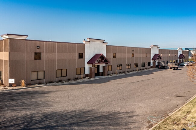
Property Record
6750 143Rd Ave Nw, Anoka, MN 55303


NEARBY LISTINGS FOR SALE OR LEASE
Property Detail
6750 143Rd Ave Nw
Minneapolis-St. Paul-Bloomington, MN-WI
Gateway No Ind Park No 5
27-32-25-43-0017
LOT 3 BLOCK 1 GATEWAY NO IND PARK NO 5
Industrialgeneral
Anoka
X
Minnesota
27053C0052F
3
2025
3.64 AC
2025
North Central
050228
Minneapolis/St Paul
47,190 SF
DEMOGRAPHICS near 6750 143Rd Ave Nw
1 Mile
3 Mile
5 Mile
2024 Total Population
4,620
36,465
81,267
2029 Population
4,816
37,976
84,039
Pop Growth 2024-2029
+ 4.24%
+ 4.14%
+ 3.41%
Average Age
35
39
40
2024 Total Households
1,696
13,308
30,544
HH Growth 2024-2029
+ 4.36%
+ 4.18%
+ 3.40%
Median Household Inc
$85,256
$96,830
$93,199
Avg Household Size
2.70
2.70
2.60
2024 Avg HH Vehicles
2.00
2.00
2.00
Median Home Value
$282,068
$316,682
$319,757
Median Year Built
2000
1994
1989
Nearby Places
Map Layers
Map Styles
 Street
 Aerial
- Restaurants
- Banks
- Shops
- Fitness
- Groceries
PUBLIC TRANSPORTATION
COMMUTER RAIL
DRIVE
WALK
Distance
4 min
1.6 mi
Anoka Station (Northstar Corridor - Northstar Commuter Rail)
DRIVE
WALK
Distance
Anoka Station (Northstar Corridor - Northstar Commuter Rail)
8 min
4.0 mi
AIRPORT
Minneapolis-St Paul International/Wold-Chamberlain
DRIVE
WALK
Distance
Minneapolis-St Paul International/Wold-Chamberlain
51 min
36.0 mi
SALE & LEASE HISTORY
LISTING DATE
SALE/LEASE

Apr 04, 2018
For Lease
Nearby Properties
Address
Land Use
TOTAL SIZE
Lot Size
Zoning
Address
Land Use
TOTAL SIZE
Lot Size
Zoning
3,491 SF
3.03 AC
Address
Land Use
TOTAL SIZE
Lot Size
Zoning
363,449 SF
82.99 AC
R-1
Address
Land Use
TOTAL SIZE
Lot Size
Zoning
68,362 SF
Address
Land Use
TOTAL SIZE
Lot Size
Zoning
382,508 SF
Address
Land Use
TOTAL SIZE
Lot Size
Zoning
229,457 SF
16.04 AC
Address
Land Use
TOTAL SIZE
Lot Size
Zoning
343,297 SF
25.42 AC
M-1
Address
Land Use
TOTAL SIZE
Lot Size
Zoning
153,964 SF
3.90 AC
Address
Land Use
TOTAL SIZE
Lot Size
Zoning
140,288 SF
5.12 AC
Address
Land Use
TOTAL SIZE
Lot Size
Zoning
300,547 SF
19.21 AC
Address
Land Use
TOTAL SIZE
Lot Size
Zoning
298,148 SF
17.70 AC
M-1
Address
Land Use
TOTAL SIZE
Lot Size
Zoning
319,019 SF
17.14 AC
Address
Land Use
TOTAL SIZE
Lot Size
Zoning
147,000 SF
Address
Land Use
TOTAL SIZE
Lot Size
Zoning
147,000 SF
Address
Land Use
TOTAL SIZE
Lot Size
Zoning
114,281 SF
3.19 AC
PRD-4
Address
Land Use
TOTAL SIZE
Lot Size
Zoning
319,664 SF
19.62 AC
M-1
Address
Land Use
TOTAL SIZE
Lot Size
Zoning
436,117 SF
17.75 AC
M-1
Address
Land Use
TOTAL SIZE
Lot Size
Zoning
190,285 SF
12.98 AC
Address
Land Use
TOTAL SIZE
Lot Size
Zoning
Address
Land Use
TOTAL SIZE
Lot Size
Zoning
201,859 SF
9.21 AC
Address
Land Use
TOTAL SIZE
Lot Size
Zoning
100 SF
5.42 AC
R-2
Address
Land Use
TOTAL SIZE
Lot Size
Zoning
60,588 SF
4.56 AC
Address
Land Use
TOTAL SIZE
Lot Size
Zoning
111,300 SF
Address
Land Use
TOTAL SIZE
Lot Size
Zoning
Address
Land Use
TOTAL SIZE
Lot Size
Zoning
83,357 SF
5.35 AC
Address
Land Use
TOTAL SIZE
Lot Size
Zoning
98,933 SF
9.61 AC
R-2
Address
Land Use
TOTAL SIZE
Lot Size
Zoning
172,332 SF
Address
Land Use
TOTAL SIZE
Lot Size
Zoning
98,770 SF
5.48 AC
R-2
Address
Land Use
TOTAL SIZE
Lot Size
Zoning
75,262 SF
6.54 AC
Address
Land Use
TOTAL SIZE
Lot Size
Zoning
84,201 SF
1.87 AC
Address
Land Use
TOTAL SIZE
Lot Size
Zoning
151,524 SF
18.10 AC
The World's #1 Commercial Real Estate Marketplace
Connect with us
© 2026 CoStar Group
The information above has been obtained from sources believed reliable. While we do not doubt its accuracy we have not verified it and make no guarantee, warranty or representation about it. It is your responsibility to independently confirm its accuracy and completeness. Any projections, opinions, assumptions, or estimates used are for example only and do not represent the current or future performance of the property. The value of this transaction to you depends on tax and other factors which should be evaluated by your tax, financial, and legal advisors. You and your advisors should conduct a careful, independent investigation of the property to determine to your satisfaction the suitability of the property for your needs.