Property Record
6750 Us Highway 64 E, Pottsville, AR 72858
NEARBY LISTINGS FOR SALE OR LEASE
Property Detail
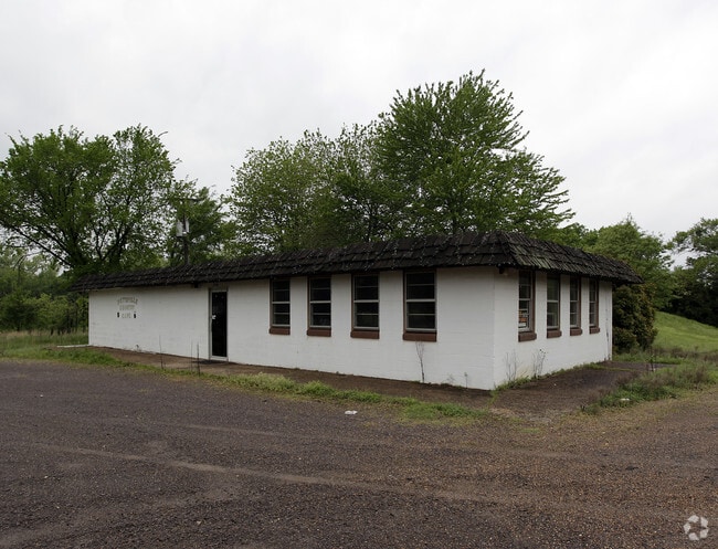
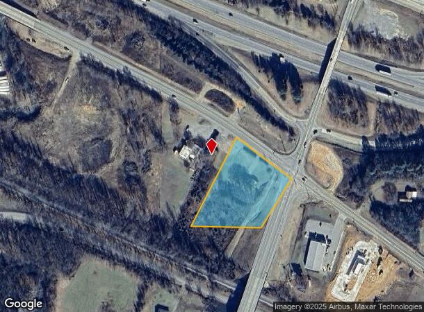
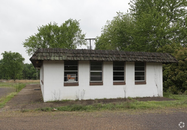
6750 Us Highway 64 E
907-00062-000C
Pottsville By Sections
Conveniencestore
PT SW SE CITY OF POTTSVILLE
A
Pope
05115C0500E
Arkansas
2024
1.59 AC
2025
Fort Smith/Russellville I-40
951202
Other Market Areas
1,256 SF
Russellville, AR
DEMOGRAPHICS near 6750 Us Highway 64 E
1 Mile
3 Mile
5 Mile
2024 Total Population
501
5,064
13,582
2029 Population
515
5,219
13,927
Pop Growth 2024-2029
+ 2.79%
+ 3.06%
+ 2.54%
Average Age
37
38
38
2024 Total Households
180
1,818
5,072
HH Growth 2024-2029
+ 2.78%
+ 3.08%
+ 2.52%
Median Household Inc
$49,499
$56,373
$53,321
Avg Household Size
2.70
2.70
2.60
2024 Avg HH Vehicles
2.00
2.00
2.00
Median Home Value
$142,000
$144,788
$151,837
Median Year Built
2001
1999
1993
Nearby Places
Map Layers
Map Styles
 Street
 Aerial
- Restaurants
- Banks
- Shops
- Fitness
- Groceries
Nearby Properties
Address
Land Use
TOTAL SIZE
Lot Size
Zoning
Address
Land Use
TOTAL SIZE
Lot Size
Zoning
293,355 SF
94.01 AC
Address
Land Use
TOTAL SIZE
Lot Size
Zoning
250,834 SF
25.20 AC
Address
Land Use
TOTAL SIZE
Lot Size
Zoning
194,164 SF
55.75 AC
Address
Land Use
TOTAL SIZE
Lot Size
Zoning
245,532 SF
25.93 AC
Address
Land Use
TOTAL SIZE
Lot Size
Zoning
97,230 SF
35.10 AC
Address
Land Use
TOTAL SIZE
Lot Size
Zoning
5,530 SF
6.95 AC
Address
Land Use
TOTAL SIZE
Lot Size
Zoning
40,500 SF
17.43 AC
Address
Land Use
TOTAL SIZE
Lot Size
Zoning
14,400 SF
10.23 AC
Address
Land Use
TOTAL SIZE
Lot Size
Zoning
13,955 SF
4.51 AC
Address
Land Use
TOTAL SIZE
Lot Size
Zoning
46,750 SF
10.23 AC
Address
Land Use
TOTAL SIZE
Lot Size
Zoning
80.53 AC
R1
Address
Land Use
TOTAL SIZE
Lot Size
Zoning
25,400 SF
4.93 AC
Address
Land Use
TOTAL SIZE
Lot Size
Zoning
59.83 AC
Address
Land Use
TOTAL SIZE
Lot Size
Zoning
1,568 SF
10 AC
Address
Land Use
TOTAL SIZE
Lot Size
Zoning
6,000 SF
4.78 AC
Address
Land Use
TOTAL SIZE
Lot Size
Zoning
1,538 SF
39.04 AC
Address
Land Use
TOTAL SIZE
Lot Size
Zoning
6,000 SF
1.16 AC
Address
Land Use
TOTAL SIZE
Lot Size
Zoning
10,800 SF
2.46 AC
Address
Land Use
TOTAL SIZE
Lot Size
Zoning
10,300 SF
2 AC
Address
Land Use
TOTAL SIZE
Lot Size
Zoning
23,800 SF
1.98 AC
Address
Land Use
TOTAL SIZE
Lot Size
Zoning
9,180 SF
1.55 AC
Address
Land Use
TOTAL SIZE
Lot Size
Zoning
9,012 SF
1.19 AC
Address
Land Use
TOTAL SIZE
Lot Size
Zoning
7,500 SF
1.70 AC
Address
Land Use
TOTAL SIZE
Lot Size
Zoning
8,963 SF
2.20 AC
Address
Land Use
TOTAL SIZE
Lot Size
Zoning
2,400 SF
1.14 AC
Address
Land Use
TOTAL SIZE
Lot Size
Zoning
3,440 SF
1.40 AC
Address
Land Use
TOTAL SIZE
Lot Size
Zoning
7,768 SF
1.80 AC
Address
Land Use
TOTAL SIZE
Lot Size
Zoning
4,792 SF
7.70 AC
Address
Land Use
TOTAL SIZE
Lot Size
Zoning
6,300 SF
2.54 AC
The World's #1 Commercial Real Estate Marketplace
Connect with us
© 2026 CoStar Group
The information above has been obtained from sources believed reliable. While we do not doubt its accuracy we have not verified it and make no guarantee, warranty or representation about it. It is your responsibility to independently confirm its accuracy and completeness. Any projections, opinions, assumptions, or estimates used are for example only and do not represent the current or future performance of the property. The value of this transaction to you depends on tax and other factors which should be evaluated by your tax, financial, and legal advisors. You and your advisors should conduct a careful, independent investigation of the property to determine to your satisfaction the suitability of the property for your needs.