Property Record
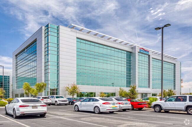
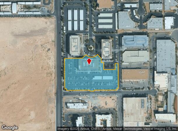
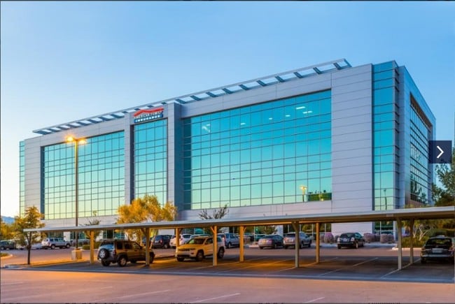
6750 Via Austi Pky, Las Vegas, NV 89119

NEARBY LISTINGS FOR SALE OR LEASE
Property Detail
6750 Via Austi Pky
Las Vegas-Henderson-Paradise, NV
Marnell Corporate Center Amd
177-04-610-007
MARNELL CORPORATE CENTER AMD PLAT BOOK 109 PAGE 100 PT LOT 1
Commercialnec
Clark
X
Nevada
32003C2560F
1
2025
4.28 AC
2025
South Las Vegas
002847
Las Vegas
100,394 SF
DEMOGRAPHICS near 6750 Via Austi Pky
1 Mile
3 Mile
5 Mile
2024 Total Population
1,148
68,953
367,819
2029 Population
1,221
74,048
395,867
Pop Growth 2024-2029
+ 6.36%
+ 7.39%
+ 7.63%
Average Age
45
41
40
2024 Total Households
424
29,135
152,947
HH Growth 2024-2029
+ 6.37%
+ 7.52%
+ 7.61%
Median Household Inc
$109,701
$60,765
$58,285
Avg Household Size
2.60
2.30
2.30
2024 Avg HH Vehicles
2.00
2.00
2.00
Median Home Value
$551,242
$385,612
$373,925
Median Year Built
1994
1994
1993
Nearby Places
Map Layers
Map Styles
 Street
 Aerial
- Restaurants
- Banks
- Shops
- Fitness
- Groceries
PUBLIC TRANSPORTATION
AIRPORT
Harry Reid International
DRIVE
WALK
Distance
Harry Reid International
6 min
3.1 mi
Boulder City Municipal
DRIVE
WALK
Distance
Boulder City Municipal
33 min
23.1 mi
Freight Ports
Port of Long Beach
DRIVE
WALK
Distance
Port of Long Beach
310 min
276.9 mi
SALE & LEASE HISTORY
LISTING DATE
SALE/LEASE

Sep 24, 2016
For Lease
Oct 27, 2017
For Sale
Oct 09, 2024
For Lease
Mar 08, 2018
For Lease
Aug 01, 2018
For Lease
Nearby Properties
Address
Land Use
TOTAL SIZE
Lot Size
Zoning
Address
Land Use
TOTAL SIZE
Lot Size
Zoning
2,000,377 SF
118.89 AC
Address
Land Use
TOTAL SIZE
Lot Size
Zoning
1,546,466 SF
61.43 AC
H1
Address
Land Use
TOTAL SIZE
Lot Size
Zoning
2,828,726 SF
101.88 AC
Address
Land Use
TOTAL SIZE
Lot Size
Zoning
937,376 SF
59.19 AC
Address
Land Use
TOTAL SIZE
Lot Size
Zoning
1,166,098 SF
57.58 AC
Address
Land Use
TOTAL SIZE
Lot Size
Zoning
225,512 SF
50.14 AC
Address
Land Use
TOTAL SIZE
Lot Size
Zoning
114,591 SF
20.60 AC
Address
Land Use
TOTAL SIZE
Lot Size
Zoning
742,547 SF
19.87 AC
H1
Address
Land Use
TOTAL SIZE
Lot Size
Zoning
79.03 AC
PF
Address
Land Use
TOTAL SIZE
Lot Size
Zoning
3,200 SF
16.74 AC
Address
Land Use
TOTAL SIZE
Lot Size
Zoning
764,918 SF
94.41 AC
H1
Address
Land Use
TOTAL SIZE
Lot Size
Zoning
323,696 SF
24.62 AC
H1
Address
Land Use
TOTAL SIZE
Lot Size
Zoning
76.93 AC
PF
Address
Land Use
TOTAL SIZE
Lot Size
Zoning
278,297 SF
35.11 AC
Address
Land Use
TOTAL SIZE
Lot Size
Zoning
611,977 SF
6.82 AC
Address
Land Use
TOTAL SIZE
Lot Size
Zoning
94,198 SF
34.53 AC
H1
Address
Land Use
TOTAL SIZE
Lot Size
Zoning
32,655 SF
2.40 AC
Address
Land Use
TOTAL SIZE
Lot Size
Zoning
949,035 SF
2.21 AC
C:H-1
Address
Land Use
TOTAL SIZE
Lot Size
Zoning
321,990 SF
76.15 AC
PF
Address
Land Use
TOTAL SIZE
Lot Size
Zoning
Address
Land Use
TOTAL SIZE
Lot Size
Zoning
391,021 SF
40.14 AC
Address
Land Use
TOTAL SIZE
Lot Size
Zoning
56.95 AC
PF
Address
Land Use
TOTAL SIZE
Lot Size
Zoning
13.26 AC
Address
Land Use
TOTAL SIZE
Lot Size
Zoning
35.25 AC
MD
Address
Land Use
TOTAL SIZE
Lot Size
Zoning
459,983 SF
12.65 AC
M1
Address
Land Use
TOTAL SIZE
Lot Size
Zoning
66.26 AC
RE
Address
Land Use
TOTAL SIZE
Lot Size
Zoning
527,044 SF
1.08 AC
H1
Address
Land Use
TOTAL SIZE
Lot Size
Zoning
353,690 SF
17.23 AC
Address
Land Use
TOTAL SIZE
Lot Size
Zoning
262,750 SF
17.95 AC
Address
Land Use
TOTAL SIZE
Lot Size
Zoning
94,442 SF
6.91 AC
H1
The World's #1 Commercial Real Estate Marketplace
Connect with us
© 2025 CoStar Group
The information above has been obtained from sources believed reliable. While we do not doubt its accuracy we have not verified it and make no guarantee, warranty or representation about it. It is your responsibility to independently confirm its accuracy and completeness. Any projections, opinions, assumptions, or estimates used are for example only and do not represent the current or future performance of the property. The value of this transaction to you depends on tax and other factors which should be evaluated by your tax, financial, and legal advisors. You and your advisors should conduct a careful, independent investigation of the property to determine to your satisfaction the suitability of the property for your needs.