Property Record
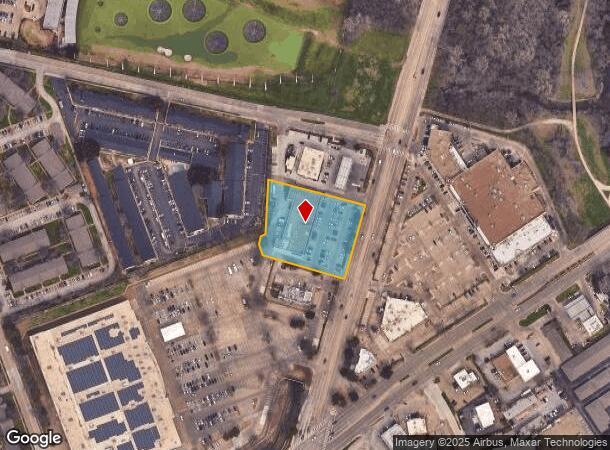
6751 Abrams Rd, Dallas, TX 75231


NEARBY LISTINGS FOR SALE OR LEASE
Property Detail
6751 Abrams Rd
Dallas-Fort Worth-Arlington, TX
Skillman Towne Crossing Ii
005217001603A0000
SKILLMAN TOWNE CROSSING II BLK 16/5217 LT 3A ACS 1.7629 INT202100334513 DD11042021 CO-DC 5217 016 03A00 7DA5217 016
Stripcommercialcenter
Dallas
X
Texas
48113C0355K
3a
2024
1.76 AC
2025
Upper Greenville
007833
Dallas/Ft Worth
17,907 SF
DEMOGRAPHICS near 6751 Abrams Rd
1 Mile
3 Mile
5 Mile
2024 Total Population
28,005
163,924
414,708
2029 Population
28,104
163,623
414,102
Pop Growth 2024-2029
+ 0.35%
(0.18%)
(0.15%)
Average Age
34
37
37
2024 Total Households
12,285
73,888
181,174
HH Growth 2024-2029
+ 0.32%
(0.13%)
(0.10%)
Median Household Inc
$42,067
$66,687
$68,422
Avg Household Size
2.20
2.10
2.20
2024 Avg HH Vehicles
1.00
2.00
2.00
Median Home Value
$428,004
$510,316
$487,117
Median Year Built
1977
1978
1978
Nearby Places
Map Layers
Map Styles
 Street
 Aerial
- Restaurants
- Banks
- Shops
- Fitness
- Groceries
PUBLIC TRANSPORTATION
COMMUTER RAIL
Victory Station (DART LIGHT RAIL - GREEN LINE - Dallas Area Rapid Transit (DART), DART LIGHT RAIL - ORANGE LINE - Dallas Area Rapid Transit (DART), TRINITY RAILWAY - Dallas Area Rapid Transit (DART))
DRIVE
WALK
Distance
Victory Station (DART LIGHT RAIL - GREEN LINE - Dallas Area Rapid Transit (DART), DART LIGHT RAIL - ORANGE LINE - Dallas Area Rapid Transit (DART), TRINITY RAILWAY - Dallas Area Rapid Transit (DART))
13 min
8.1 mi
Medical/Market Ctr Station (TRINITY RAILWAY - Dallas Area Rapid Transit (DART))
DRIVE
WALK
Distance
Medical/Market Ctr Station (TRINITY RAILWAY - Dallas Area Rapid Transit (DART))
16 min
9.7 mi
AIRPORT
Dallas Love Field
DRIVE
WALK
Distance
Dallas Love Field
18 min
8.3 mi
Dallas-Fort Worth International
DRIVE
WALK
Distance
Dallas-Fort Worth International
35 min
26.5 mi
Freight Ports
Port of Shreveport
DRIVE
WALK
Distance
Port of Shreveport
216 min
198.4 mi
SALE & LEASE HISTORY
LISTING DATE
SALE/LEASE

Nov 19, 2019
For Sale
May 23, 2017
For Lease
Mar 12, 2019
For Lease
Jun 14, 2022
For Lease
Feb 11, 2020
For Lease
Feb 11, 2020
For Sale
Apr 15, 2020
For Sale
Nearby Properties
Address
Land Use
TOTAL SIZE
Lot Size
Zoning
Address
Land Use
TOTAL SIZE
Lot Size
Zoning
1,634,356 SF
92.90 AC
Z421
Address
Land Use
TOTAL SIZE
Lot Size
Zoning
4,157,377 SF
76.79 AC
Z248
Address
Land Use
TOTAL SIZE
Lot Size
Zoning
858,872 SF
23.90 AC
Z421
Address
Land Use
TOTAL SIZE
Lot Size
Zoning
2,186,362 SF
48.27 AC
Z239
Address
Land Use
TOTAL SIZE
Lot Size
Zoning
502,529 SF
3.08 AC
Z239
Address
Land Use
TOTAL SIZE
Lot Size
Zoning
1,252,860 SF
57.08 AC
Z239
Address
Land Use
TOTAL SIZE
Lot Size
Zoning
100 SF
27.05 AC
Z421
Address
Land Use
TOTAL SIZE
Lot Size
Zoning
226,331 SF
1.12 AC
Address
Land Use
TOTAL SIZE
Lot Size
Zoning
77.76 AC
Z239
Address
Land Use
TOTAL SIZE
Lot Size
Zoning
1,086,919 SF
5.85 AC
Z239
Address
Land Use
TOTAL SIZE
Lot Size
Zoning
557,392 SF
10.06 AC
Z239
Address
Land Use
TOTAL SIZE
Lot Size
Zoning
814,976 SF
8.72 AC
Z151
Address
Land Use
TOTAL SIZE
Lot Size
Zoning
801,209 SF
1.57 AC
Z239
Address
Land Use
TOTAL SIZE
Lot Size
Zoning
395,377 SF
14.61 AC
Z163
Address
Land Use
TOTAL SIZE
Lot Size
Zoning
835,301 SF
9.29 AC
Z239
Address
Land Use
TOTAL SIZE
Lot Size
Zoning
674,474 SF
18.81 AC
Z164
Address
Land Use
TOTAL SIZE
Lot Size
Zoning
776,707 SF
8.47 AC
Address
Land Use
TOTAL SIZE
Lot Size
Zoning
717,809 SF
4.88 AC
Z239
Address
Land Use
TOTAL SIZE
Lot Size
Zoning
671,830 SF
3.16 AC
Z239
Address
Land Use
TOTAL SIZE
Lot Size
Zoning
611,755 SF
6.11 AC
Z151
Address
Land Use
TOTAL SIZE
Lot Size
Zoning
567,135 SF
4.09 AC
Z239
Address
Land Use
TOTAL SIZE
Lot Size
Zoning
215,548 SF
8.15 AC
Z192
Address
Land Use
TOTAL SIZE
Lot Size
Zoning
399,256 SF
13.19 AC
Z164
Address
Land Use
TOTAL SIZE
Lot Size
Zoning
184,388 SF
18.89 AC
Z298
Address
Land Use
TOTAL SIZE
Lot Size
Zoning
485,067 SF
14.87 AC
Z239
Address
Land Use
TOTAL SIZE
Lot Size
Zoning
611,288 SF
8.80 AC
Z163
Address
Land Use
TOTAL SIZE
Lot Size
Zoning
1,009,203 SF
33.32 AC
Z125
Address
Land Use
TOTAL SIZE
Lot Size
Zoning
441,400 SF
6.56 AC
Z239
Address
Land Use
TOTAL SIZE
Lot Size
Zoning
302,553 SF
15.59 AC
Z164
Address
Land Use
TOTAL SIZE
Lot Size
Zoning
403,339 SF
16.42 AC
Z239
The World's #1 Commercial Real Estate Marketplace
Connect with us
© 2025 CoStar Group
The information above has been obtained from sources believed reliable. While we do not doubt its accuracy we have not verified it and make no guarantee, warranty or representation about it. It is your responsibility to independently confirm its accuracy and completeness. Any projections, opinions, assumptions, or estimates used are for example only and do not represent the current or future performance of the property. The value of this transaction to you depends on tax and other factors which should be evaluated by your tax, financial, and legal advisors. You and your advisors should conduct a careful, independent investigation of the property to determine to your satisfaction the suitability of the property for your needs.