Property Record
6751 W Kings St, Springfield, MO 65802


NEARBY LISTINGS FOR SALE OR LEASE
Property Detail
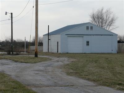
6751 W Kings St
Springfield, MO
Brookline Business
88-14-27-400-033
BROOKLINE BUSINESS PARK TRACK B LOT LINE ADJUSTMENT LOT B-2
Manufacturinglight
Greene
X
Missouri
29077C0308E
line
2025
7.95 AC
2025
Outlying Greene County
004805
Springfield
DEMOGRAPHICS near 6751 W Kings St
1 mile
3 mile
5 mile
2024 Total Population
163
7,540
38,647
2029 Population
169
7,833
40,064
Pop Growth 2024-2029
+ 3.68%
+ 3.89%
+ 3.67%
Average Age
39
38
39
2024 Total Households
59
2,883
15,138
HH Growth 2024-2029
+ 3.39%
+ 4.09%
+ 3.81%
Median Household Inc
$89,583
$78,870
$61,847
Avg Household Size
2.70
2.60
2.50
2024 Avg HH Vehicles
2.00
2.00
2.00
Median Home Value
$205,556
$179,489
$175,081
Median Year Built
1992
2001
1994
Nearby Places
Map Layers
Map Styles
 Street
 Aerial
Transit
 Traffic
 Biking
Places
Listings with unknown addresses are not visible on the map
- Restaurants
- Banks
- Shops
- Fitness
- Groceries
PUBLIC TRANSPORTATION
AIRPORT
Springfield-Branson Ntl
Drive
Walk
Distance
Springfield-Branson Ntl
19 min
9.1 mi
Freight Ports
Tulsa Port of Inola
Drive
Walk
Distance
Tulsa Port of Inola
182 min
164.2 mi
Nearby Properties
Address
Land Use
TOTAL SIZE
Lot Size
Zoning
Address
Land Use
TOTAL SIZE
Lot Size
Zoning
112.47 AC
INC.
Address
Land Use
TOTAL SIZE
Lot Size
Zoning
359,722 SF
117.25 AC
INC
Address
Land Use
TOTAL SIZE
Lot Size
Zoning
82.16 AC
Address
Land Use
TOTAL SIZE
Lot Size
Zoning
Address
Land Use
TOTAL SIZE
Lot Size
Zoning
5.02 AC
Address
Land Use
TOTAL SIZE
Lot Size
Zoning
1.55 AC
INC
Address
Land Use
TOTAL SIZE
Lot Size
Zoning
10.53 AC
INC.
Address
Land Use
TOTAL SIZE
Lot Size
Zoning
3.53 AC
INC
Address
Land Use
TOTAL SIZE
Lot Size
Zoning
Address
Land Use
TOTAL SIZE
Lot Size
Zoning
2,427 SF
Address
Land Use
TOTAL SIZE
Lot Size
Zoning
8.12 AC
INC
Address
Land Use
TOTAL SIZE
Lot Size
Zoning
28.99 AC
Address
Land Use
TOTAL SIZE
Lot Size
Zoning
13.80 AC
C-2
Address
Land Use
TOTAL SIZE
Lot Size
Zoning
Address
Land Use
TOTAL SIZE
Lot Size
Zoning
Address
Land Use
TOTAL SIZE
Lot Size
Zoning
11.87 AC
INC
Address
Land Use
TOTAL SIZE
Lot Size
Zoning
8.52 AC
INC
Address
Land Use
TOTAL SIZE
Lot Size
Zoning
6.15 AC
INC
Address
Land Use
TOTAL SIZE
Lot Size
Zoning
82.06 AC
MH-1
Address
Land Use
TOTAL SIZE
Lot Size
Zoning
12.44 AC
Address
Land Use
TOTAL SIZE
Lot Size
Zoning
7.99 AC
INC
Address
Land Use
TOTAL SIZE
Lot Size
Zoning
7.98 AC
INC
Address
Land Use
TOTAL SIZE
Lot Size
Zoning
Address
Land Use
TOTAL SIZE
Lot Size
Zoning
13.42 AC
INC
Address
Land Use
TOTAL SIZE
Lot Size
Zoning
3.12 AC
INC
Address
Land Use
TOTAL SIZE
Lot Size
Zoning
7.19 AC
O-2
Address
Land Use
TOTAL SIZE
Lot Size
Zoning
1,072 SF
9.17 AC
M-1
Address
Land Use
TOTAL SIZE
Lot Size
Zoning
2,400 SF
5.29 AC
INC
Address
Land Use
TOTAL SIZE
Lot Size
Zoning
13.19 AC
The World's #1 Commercial Real Estate Marketplace
Connect with us
© 2026 CoStar Group
The information above has been obtained from sources believed reliable. While we do not doubt its accuracy we have not verified it and make no guarantee, warranty or representation about it. It is your responsibility to independently confirm its accuracy and completeness. Any projections, opinions, assumptions, or estimates used are for example only and do not represent the current or future performance of the property. The value of this transaction to you depends on tax and other factors which should be evaluated by your tax, financial, and legal advisors. You and your advisors should conduct a careful, independent investigation of the property to determine to your satisfaction the suitability of the property for your needs.