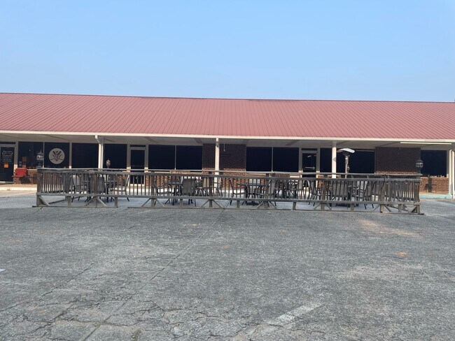
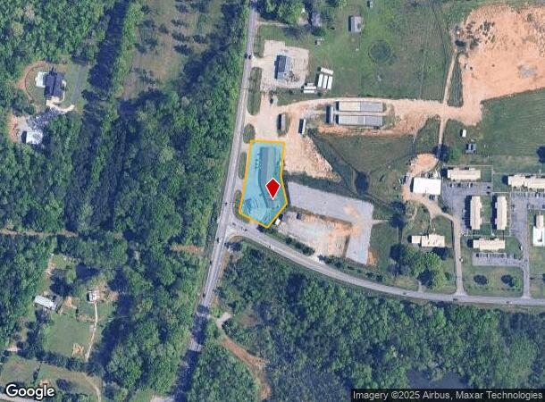
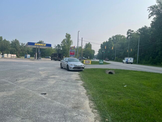
Property Record
6753 Highway 17, Alabaster, AL 35114
NEARBY LISTINGS FOR SALE OR LEASE
Property Detail
6753 Highway 17
13-8-33-0-000-035-004
BEG INT N ROW HWY 44 & E ROW HWY 17 N267 E120 S120 SE100.08 SW112.5 W117.9 TO POB
Storesoffices
Shelby
A
Alabama
01117C0380E
1 AC
2024
I-65 Corr/S Shelby County
2024
Birmingham
030320
Birmingham-Hoover, AL
3,185 SF
DEMOGRAPHICS near 6753 Highway 17
1 Mile
3 Mile
5 Mile
2024 Total Population
3,026
40,277
62,712
2029 Population
3,263
43,525
67,877
Pop Growth 2024-2029
+ 7.83%
+ 8.06%
+ 8.24%
Average Age
40
38
39
2024 Total Households
1,055
14,205
22,460
HH Growth 2024-2029
+ 7.96%
+ 8.23%
+ 8.39%
Median Household Inc
$122,803
$85,025
$86,983
Avg Household Size
2.80
2.80
2.70
2024 Avg HH Vehicles
2.00
2.00
2.00
Median Home Value
$253,046
$220,856
$237,452
Median Year Built
1999
1993
1995
Nearby Places
Map Layers
Map Styles
 Street
 Aerial
- Restaurants
- Banks
- Shops
- Fitness
- Groceries
PUBLIC TRANSPORTATION
AIRPORT
Birmingham-Shuttlesworth International
DRIVE
WALK
Distance
Birmingham-Shuttlesworth International
43 min
31.0 mi
Freight Ports
Port of Mobile
DRIVE
WALK
Distance
Port of Mobile
261 min
237.4 mi
SALE & LEASE HISTORY
LISTING DATE
SALE/LEASE

Jul 25, 2023
For Lease
Nearby Properties
Address
Land Use
TOTAL SIZE
Lot Size
Zoning
Address
Land Use
TOTAL SIZE
Lot Size
Zoning
228,107 SF
12 AC
Address
Land Use
TOTAL SIZE
Lot Size
Zoning
225,092 SF
53 AC
Address
Land Use
TOTAL SIZE
Lot Size
Zoning
2,100 SF
6.50 AC
Address
Land Use
TOTAL SIZE
Lot Size
Zoning
1,763 SF
21.99 AC
Address
Land Use
TOTAL SIZE
Lot Size
Zoning
61,602 SF
145.23 AC
Address
Land Use
TOTAL SIZE
Lot Size
Zoning
11,192 SF
26.78 AC
Address
Land Use
TOTAL SIZE
Lot Size
Zoning
226,790 SF
40 AC
Address
Land Use
TOTAL SIZE
Lot Size
Zoning
219,975 SF
14.90 AC
Address
Land Use
TOTAL SIZE
Lot Size
Zoning
161,753 SF
25 AC
Address
Land Use
TOTAL SIZE
Lot Size
Zoning
84,355 SF
15.65 AC
Address
Land Use
TOTAL SIZE
Lot Size
Zoning
118,642 SF
16 AC
Address
Land Use
TOTAL SIZE
Lot Size
Zoning
6,864 SF
6.11 AC
Address
Land Use
TOTAL SIZE
Lot Size
Zoning
137,068 SF
9.08 AC
Address
Land Use
TOTAL SIZE
Lot Size
Zoning
120,043 SF
30 AC
Address
Land Use
TOTAL SIZE
Lot Size
Zoning
77,365 SF
24.97 AC
Address
Land Use
TOTAL SIZE
Lot Size
Zoning
43,903 SF
10.21 AC
Address
Land Use
TOTAL SIZE
Lot Size
Zoning
Address
Land Use
TOTAL SIZE
Lot Size
Zoning
51,264 SF
6.98 AC
Address
Land Use
TOTAL SIZE
Lot Size
Zoning
92,690 SF
14 AC
Address
Land Use
TOTAL SIZE
Lot Size
Zoning
41,120 SF
10.24 AC
Address
Land Use
TOTAL SIZE
Lot Size
Zoning
122,715 SF
16.54 AC
Address
Land Use
TOTAL SIZE
Lot Size
Zoning
11,668 SF
18.72 AC
Address
Land Use
TOTAL SIZE
Lot Size
Zoning
37,074 SF
6.70 AC
Address
Land Use
TOTAL SIZE
Lot Size
Zoning
42,097 SF
8.03 AC
Address
Land Use
TOTAL SIZE
Lot Size
Zoning
26,980 SF
3.50 AC
Address
Land Use
TOTAL SIZE
Lot Size
Zoning
6,136 SF
18 AC
Address
Land Use
TOTAL SIZE
Lot Size
Zoning
21,160 SF
20.19 AC
Address
Land Use
TOTAL SIZE
Lot Size
Zoning
60,800 SF
4.27 AC
Address
Land Use
TOTAL SIZE
Lot Size
Zoning
32,815 SF
6.09 AC
The World's #1 Commercial Real Estate Marketplace
Connect with us
© 2025 CoStar Group
The information above has been obtained from sources believed reliable. While we do not doubt its accuracy we have not verified it and make no guarantee, warranty or representation about it. It is your responsibility to independently confirm its accuracy and completeness. Any projections, opinions, assumptions, or estimates used are for example only and do not represent the current or future performance of the property. The value of this transaction to you depends on tax and other factors which should be evaluated by your tax, financial, and legal advisors. You and your advisors should conduct a careful, independent investigation of the property to determine to your satisfaction the suitability of the property for your needs.