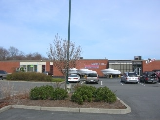
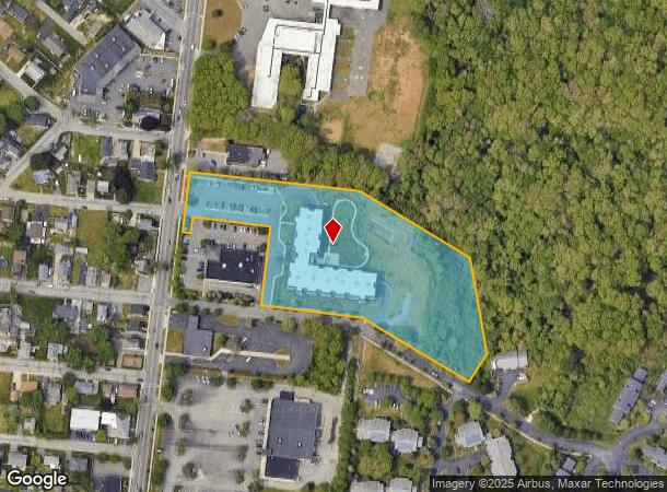
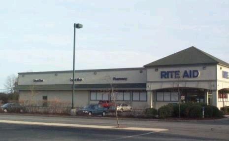
Property Record
676 Dartmouth St, South Dartmouth, MA 02748
NEARBY LISTINGS FOR SALE OR LEASE
-
-
-
-
-
-
No Photo
-
-
View all South Dartmouth listings for sale on LoopNet.com
Property Detail
676 Dartmouth St
DART-000133-000241
Yenom Inc Dartmouth
Apartment
Bristol
X
Massachusetts
25005C0477G
5.09 AC
2025
Attleboro/New Bedford
2025
Boston
653301
Providence-Warwick, RI-MA
76,014 SF
DEMOGRAPHICS near 676 Dartmouth St
1 Mile
3 Mile
5 Mile
2024 Total Population
8,232
61,247
116,594
2029 Population
8,169
60,002
114,503
Pop Growth 2024-2029
(0.77%)
(2.03%)
(1.79%)
Average Age
46
41
41
2024 Total Households
3,530
25,578
47,853
HH Growth 2024-2029
(0.59%)
(2.07%)
(1.83%)
Median Household Inc
$67,011
$54,210
$55,508
Avg Household Size
2.20
2.30
2.30
2024 Avg HH Vehicles
2.00
1.00
2.00
Median Home Value
$388,719
$349,879
$354,005
Median Year Built
1956
1948
1948
Nearby Places
- Restaurants
- Banks
- Shops
- Fitness
- Groceries
PUBLIC TRANSPORTATION
AIRPORT
Rhode Island Tf Green International
DRIVE
WALK
Distance
Rhode Island Tf Green International
60 min
39.9 mi
Freight Ports
Port of New Bedford Harbor
DRIVE
WALK
Distance
Port of New Bedford Harbor
8 min
2.9 mi
Nearby Properties
Address
Land Use
TOTAL SIZE
Lot Size
Zoning
Address
Land Use
TOTAL SIZE
Lot Size
Zoning
10.29 AC
RA
Address
Land Use
TOTAL SIZE
Lot Size
Zoning
23.71 AC
RA
Address
Land Use
TOTAL SIZE
Lot Size
Zoning
228,726 SF
5.51 AC
MUB
Address
Land Use
TOTAL SIZE
Lot Size
Zoning
265,000 SF
39.70 AC
SRB
Address
Land Use
TOTAL SIZE
Lot Size
Zoning
269,020 SF
2.26 AC
MUB
Address
Land Use
TOTAL SIZE
Lot Size
Zoning
74.70 AC
SRA
Address
Land Use
TOTAL SIZE
Lot Size
Zoning
Address
Land Use
TOTAL SIZE
Lot Size
Zoning
127,514 SF
4.23 AC
MUB
Address
Land Use
TOTAL SIZE
Lot Size
Zoning
5,716 SF
35.18 AC
GR
Address
Land Use
TOTAL SIZE
Lot Size
Zoning
5.59 AC
RC
Address
Land Use
TOTAL SIZE
Lot Size
Zoning
183,450 SF
2.51 AC
RA
Address
Land Use
TOTAL SIZE
Lot Size
Zoning
146,081 SF
2.15 AC
MUB
Address
Land Use
TOTAL SIZE
Lot Size
Zoning
111,337 SF
11.30 AC
RB
Address
Land Use
TOTAL SIZE
Lot Size
Zoning
147,850 SF
2.50 AC
RC
Address
Land Use
TOTAL SIZE
Lot Size
Zoning
130,060 SF
18.34 AC
SRA
Address
Land Use
TOTAL SIZE
Lot Size
Zoning
212,875 SF
7.24 AC
WI
Address
Land Use
TOTAL SIZE
Lot Size
Zoning
2,190 SF
9.73 AC
IA
Address
Land Use
TOTAL SIZE
Lot Size
Zoning
48.78 AC
RA
Address
Land Use
TOTAL SIZE
Lot Size
Zoning
91,660 SF
1.26 AC
MUB
Address
Land Use
TOTAL SIZE
Lot Size
Zoning
9.51 AC
SRA
Address
Land Use
TOTAL SIZE
Lot Size
Zoning
3.15 AC
RA
Address
Land Use
TOTAL SIZE
Lot Size
Zoning
101,289 SF
1.98 AC
RC
Address
Land Use
TOTAL SIZE
Lot Size
Zoning
128,298 SF
1.99 AC
MUB
Address
Land Use
TOTAL SIZE
Lot Size
Zoning
40,446 SF
4.36 AC
WI
Address
Land Use
TOTAL SIZE
Lot Size
Zoning
18.30 AC
RA
Address
Land Use
TOTAL SIZE
Lot Size
Zoning
70,167 SF
4.84 AC
RC
Address
Land Use
TOTAL SIZE
Lot Size
Zoning
30.17 AC
RB
Address
Land Use
TOTAL SIZE
Lot Size
Zoning
38.29 AC
RB
Address
Land Use
TOTAL SIZE
Lot Size
Zoning
92,628 SF
0.96 AC
MUB
Address
Land Use
TOTAL SIZE
Lot Size
Zoning
10.01 AC
MUB
The World's #1 Commercial Real Estate Marketplace
Connect with us
© 2025 CoStar Group
The information above has been obtained from sources believed reliable. While we do not doubt its accuracy we have not verified it and make no guarantee, warranty or representation about it. It is your responsibility to independently confirm its accuracy and completeness. Any projections, opinions, assumptions, or estimates used are for example only and do not represent the current or future performance of the property. The value of this transaction to you depends on tax and other factors which should be evaluated by your tax, financial, and legal advisors. You and your advisors should conduct a careful, independent investigation of the property to determine to your satisfaction the suitability of the property for your needs.