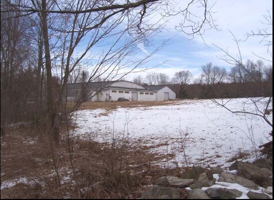
Property Record
676 Northfield Rd, Watertown, CT 06795


NEARBY LISTINGS FOR SALE OR LEASE
Property Detail
676 Northfield Rd
Torrington, CT
Litchfield
WATE-000055-000086-000013A
Connecticut
Industrialacreage
13a
2025
3.88 AC
2025
SE Litchfield County
360200
Hartford
19,070 SF
DEMOGRAPHICS near 676 Northfield Rd
1 Mile
3 Mile
5 Mile
2024 Total Population
1,012
16,782
50,851
2029 Population
1,013
16,671
50,639
Pop Growth 2024-2029
+ 0.10%
(0.66%)
(0.42%)
Average Age
46
44
42
2024 Total Households
416
6,805
19,969
HH Growth 2024-2029
0.00%
(0.65%)
(0.43%)
Median Household Inc
$69,592
$87,454
$77,901
Avg Household Size
2.40
2.40
2.50
2024 Avg HH Vehicles
2.00
2.00
2.00
Median Home Value
$300,370
$282,737
$253,460
Median Year Built
1982
1970
1969
Nearby Places
Map Layers
Map Styles
 Street
 Aerial
- Restaurants
- Banks
- Shops
- Fitness
- Groceries
PUBLIC TRANSPORTATION
COMMUTER RAIL
Waterbury Station (New Haven Line - Metro-North Commuter Railroad Company (Metro-North))
DRIVE
WALK
Distance
Waterbury Station (New Haven Line - Metro-North Commuter Railroad Company (Metro-North))
15 min
7.5 mi
AIRPORT
Tweed/New Haven
DRIVE
WALK
Distance
Tweed/New Haven
57 min
33.9 mi
Bradley International
DRIVE
WALK
Distance
Bradley International
69 min
46.0 mi
Freight Ports
Port of New Haven
DRIVE
WALK
Distance
Port of New Haven
51 min
31.7 mi
Nearby Properties
Address
Land Use
TOTAL SIZE
Lot Size
Zoning
Address
Land Use
TOTAL SIZE
Lot Size
Zoning
75 AC
R20
Address
Land Use
TOTAL SIZE
Lot Size
Zoning
201,817 SF
34.84 AC
R125
Address
Land Use
TOTAL SIZE
Lot Size
Zoning
140,700 SF
25.55 AC
R30
Address
Land Use
TOTAL SIZE
Lot Size
Zoning
65,974 SF
20.70 AC
RA15
Address
Land Use
TOTAL SIZE
Lot Size
Zoning
72,336 SF
15.39 AC
R30
Address
Land Use
TOTAL SIZE
Lot Size
Zoning
70.40 AC
R70
Address
Land Use
TOTAL SIZE
Lot Size
Zoning
326,357 SF
53.34 AC
IR200
Address
Land Use
TOTAL SIZE
Lot Size
Zoning
15 AC
M1
Address
Land Use
TOTAL SIZE
Lot Size
Zoning
60,703 SF
6.60 AC
R125
Address
Land Use
TOTAL SIZE
Lot Size
Zoning
178,860 SF
52.98 AC
IR200
Address
Land Use
TOTAL SIZE
Lot Size
Zoning
1,154 SF
435 AC
R90
Address
Land Use
TOTAL SIZE
Lot Size
Zoning
14.98 AC
IR200
Address
Land Use
TOTAL SIZE
Lot Size
Zoning
182,765 SF
9.08 AC
IG20F
Address
Land Use
TOTAL SIZE
Lot Size
Zoning
128,480 SF
19.91 AC
IR200
Address
Land Use
TOTAL SIZE
Lot Size
Zoning
132,377 SF
11.91 AC
IG20
Address
Land Use
TOTAL SIZE
Lot Size
Zoning
125,770 SF
19 AC
IR200
Address
Land Use
TOTAL SIZE
Lot Size
Zoning
19,508 SF
2.10 AC
BC
Address
Land Use
TOTAL SIZE
Lot Size
Zoning
96,721 SF
7.08 AC
IR200
Address
Land Use
TOTAL SIZE
Lot Size
Zoning
8.50 AC
BG
Address
Land Use
TOTAL SIZE
Lot Size
Zoning
31.56 AC
IR8
Address
Land Use
TOTAL SIZE
Lot Size
Zoning
6.94 AC
R30
Address
Land Use
TOTAL SIZE
Lot Size
Zoning
65,041 SF
10 AC
IR8
Address
Land Use
TOTAL SIZE
Lot Size
Zoning
110,250 SF
31.74 AC
IR200
Address
Land Use
TOTAL SIZE
Lot Size
Zoning
89.72 AC
R125
Address
Land Use
TOTAL SIZE
Lot Size
Zoning
2.22 AC
BC
Address
Land Use
TOTAL SIZE
Lot Size
Zoning
16 AC
R70
Address
Land Use
TOTAL SIZE
Lot Size
Zoning
37,880 SF
3.89 AC
BG
Address
Land Use
TOTAL SIZE
Lot Size
Zoning
66,409 SF
13.59 AC
IR8
Address
Land Use
TOTAL SIZE
Lot Size
Zoning
28,808 SF
8.70 AC
R10
Address
Land Use
TOTAL SIZE
Lot Size
Zoning
25,326 SF
10.02 AC
BMG
The World's #1 Commercial Real Estate Marketplace
Connect with us
© 2026 CoStar Group
The information above has been obtained from sources believed reliable. While we do not doubt its accuracy we have not verified it and make no guarantee, warranty or representation about it. It is your responsibility to independently confirm its accuracy and completeness. Any projections, opinions, assumptions, or estimates used are for example only and do not represent the current or future performance of the property. The value of this transaction to you depends on tax and other factors which should be evaluated by your tax, financial, and legal advisors. You and your advisors should conduct a careful, independent investigation of the property to determine to your satisfaction the suitability of the property for your needs.