Property Record
67660 Ogden Rd, Montrose, CO 81401

NEARBY LISTINGS FOR SALE OR LEASE
Property Detail
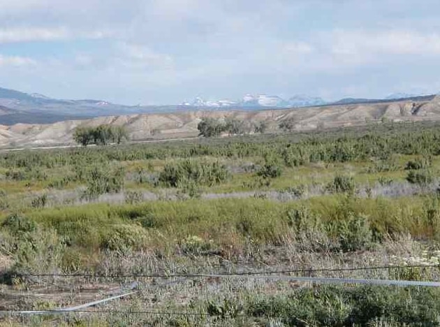
67660 Ogden Rd
Montrose, CO
S: 2 T: 48 R: 9 (GOV) LOT 15 AND THE WEST 3/8 OF LOT 16 AS AMENDED BY BNDRY AGRMNT RECPT# 665744 EXCEPT A TRACT OF LAND IN
R0017722
Montrose
Pasture
Colorado
AE
15-16
08085C0779D
53.47 AC
2024
Colorado Southwest Area
2024
Other Market Areas
966501
DEMOGRAPHICS near 67660 Ogden Rd
1 Mile
3 Mile
5 Mile
2024 Total Population
1,115
13,530
29,563
2029 Population
1,210
14,597
31,994
Pop Growth 2024-2029
+ 8.52%
+ 7.89%
+ 8.22%
Average Age
48
46
44
2024 Total Households
466
5,855
12,431
HH Growth 2024-2029
+ 8.37%
+ 7.81%
+ 8.11%
Median Household Inc
$89,655
$61,850
$57,541
Avg Household Size
2.30
2.20
2.30
2024 Avg HH Vehicles
2.00
2.00
2.00
Median Home Value
$515,385
$345,477
$293,201
Median Year Built
2002
1995
1993
Nearby Places
Map Layers
Map Styles
 Street
 Aerial
- Restaurants
- Banks
- Shops
- Fitness
- Groceries
PUBLIC TRANSPORTATION
AIRPORT
Montrose Regional
DRIVE
WALK
Distance
Montrose Regional
22 min
8.2 mi
Freight Ports
Port of San Diego
DRIVE
WALK
Distance
Port of San Diego
961 min
902.1 mi
SALE & LEASE HISTORY
LISTING DATE
SALE/LEASE

May 24, 2018
For Sale
Nearby Properties
Address
Land Use
TOTAL SIZE
Lot Size
Zoning
Address
Land Use
TOTAL SIZE
Lot Size
Zoning
82,754 SF
21.29 AC
Address
Land Use
TOTAL SIZE
Lot Size
Zoning
104,240 SF
29.39 AC
Address
Land Use
TOTAL SIZE
Lot Size
Zoning
84,927 SF
15.45 AC
Address
Land Use
TOTAL SIZE
Lot Size
Zoning
83,990 SF
Address
Land Use
TOTAL SIZE
Lot Size
Zoning
52,533 SF
3.73 AC
Address
Land Use
TOTAL SIZE
Lot Size
Zoning
204,041 SF
17.30 AC
Address
Land Use
TOTAL SIZE
Lot Size
Zoning
63,757 SF
2.14 AC
Address
Land Use
TOTAL SIZE
Lot Size
Zoning
9,607 SF
17.78 AC
Address
Land Use
TOTAL SIZE
Lot Size
Zoning
128,307 SF
10.88 AC
Address
Land Use
TOTAL SIZE
Lot Size
Zoning
48,096 SF
33.43 AC
B2
Address
Land Use
TOTAL SIZE
Lot Size
Zoning
68,768 SF
7.73 AC
Address
Land Use
TOTAL SIZE
Lot Size
Zoning
33,554 SF
10 AC
Address
Land Use
TOTAL SIZE
Lot Size
Zoning
23,617 SF
16.03 AC
Address
Land Use
TOTAL SIZE
Lot Size
Zoning
13,091 SF
0.86 AC
MR
Address
Land Use
TOTAL SIZE
Lot Size
Zoning
250,620 SF
21.70 AC
Address
Land Use
TOTAL SIZE
Lot Size
Zoning
97,056 SF
11.51 AC
Address
Land Use
TOTAL SIZE
Lot Size
Zoning
26,915 SF
8.51 AC
Address
Land Use
TOTAL SIZE
Lot Size
Zoning
44,918 SF
4.49 AC
Address
Land Use
TOTAL SIZE
Lot Size
Zoning
48,396 SF
7.94 AC
Address
Land Use
TOTAL SIZE
Lot Size
Zoning
18,074 SF
8.70 AC
Address
Land Use
TOTAL SIZE
Lot Size
Zoning
16,745 SF
2.28 AC
Address
Land Use
TOTAL SIZE
Lot Size
Zoning
72,270 SF
17.24 AC
Address
Land Use
TOTAL SIZE
Lot Size
Zoning
49,960 SF
4.73 AC
B2
Address
Land Use
TOTAL SIZE
Lot Size
Zoning
34,971 SF
1.46 AC
Address
Land Use
TOTAL SIZE
Lot Size
Zoning
25,066 SF
6.84 AC
Address
Land Use
TOTAL SIZE
Lot Size
Zoning
40,461 SF
3.14 AC
Address
Land Use
TOTAL SIZE
Lot Size
Zoning
7,197 SF
4 AC
Address
Land Use
TOTAL SIZE
Lot Size
Zoning
19,243 SF
3.13 AC
Address
Land Use
TOTAL SIZE
Lot Size
Zoning
10,331 SF
2.46 AC
Address
Land Use
TOTAL SIZE
Lot Size
Zoning
34,571 SF
4.21 AC
The World's #1 Commercial Real Estate Marketplace
Connect with us
© 2026 CoStar Group
The information above has been obtained from sources believed reliable. While we do not doubt its accuracy we have not verified it and make no guarantee, warranty or representation about it. It is your responsibility to independently confirm its accuracy and completeness. Any projections, opinions, assumptions, or estimates used are for example only and do not represent the current or future performance of the property. The value of this transaction to you depends on tax and other factors which should be evaluated by your tax, financial, and legal advisors. You and your advisors should conduct a careful, independent investigation of the property to determine to your satisfaction the suitability of the property for your needs.