Property Record
6770 5Th St, Northport, AL 35476
NEARBY LISTINGS FOR SALE OR LEASE
Property Detail
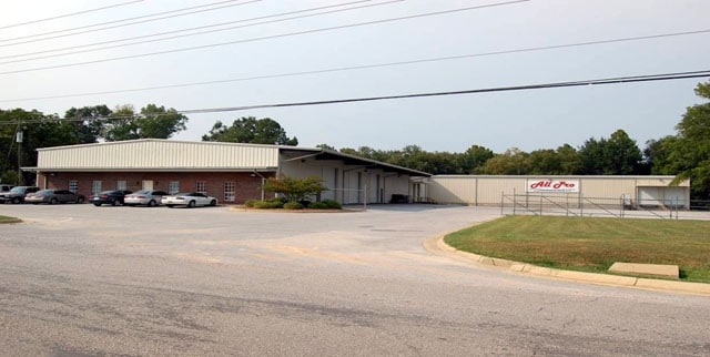
6770 5Th St
Tuscaloosa, AL
Terry Vaughn S/D
31-04-18-2-001-014.005
COM SE COR LOT 3 TERRY VAUGHN S/D; NLY ALG E BDRY OF SAID LOT 218.6 TO POB; E 127.8 TO THE TOP OF THE CREEK; RUN ALG SAID CREEK BANK 249.1; W 17.2; SWLY 150 TO POBNW S18 T21 R10
Autorepair
Tuscaloosa
AE
Alabama
01125C0501G
3
2024
2.43 AC
2024
Tuscaloosa
010302
Birmingham
29,750 SF
DEMOGRAPHICS near 6770 5Th St
1 Mile
3 Mile
5 Mile
2024 Total Population
2,223
18,018
75,462
2029 Population
2,520
20,293
84,597
Pop Growth 2024-2029
+ 13.36%
+ 12.63%
+ 12.11%
Average Age
38
41
35
2024 Total Households
823
6,804
27,357
HH Growth 2024-2029
+ 13.37%
+ 12.45%
+ 14.16%
Median Household Inc
$59,261
$60,260
$43,796
Avg Household Size
2.60
2.40
2.20
2024 Avg HH Vehicles
2.00
2.00
2.00
Median Home Value
$176,423
$188,930
$198,933
Median Year Built
1990
1982
1986
Nearby Places
Map Layers
Map Styles
 Street
 Aerial
- Restaurants
- Banks
- Shops
- Fitness
- Groceries
PUBLIC TRANSPORTATION
COMMUTER RAIL
DRIVE
WALK
Distance
12 min
6.3 mi
Nearby Properties
Address
Land Use
TOTAL SIZE
Lot Size
Zoning
Address
Land Use
TOTAL SIZE
Lot Size
Zoning
24,360 SF
142 AC
Address
Land Use
TOTAL SIZE
Lot Size
Zoning
174,000 SF
28.67 AC
R1
Address
Land Use
TOTAL SIZE
Lot Size
Zoning
361,935 SF
133.67 AC
MH
Address
Land Use
TOTAL SIZE
Lot Size
Zoning
301,560 SF
15 AC
ML
Address
Land Use
TOTAL SIZE
Lot Size
Zoning
10,440 SF
12 AC
Address
Land Use
TOTAL SIZE
Lot Size
Zoning
32,640 SF
9.80 AC
C6
Address
Land Use
TOTAL SIZE
Lot Size
Zoning
143,038 SF
36 AC
O-I
Address
Land Use
TOTAL SIZE
Lot Size
Zoning
50,652 SF
19.03 AC
ML
Address
Land Use
TOTAL SIZE
Lot Size
Zoning
208,996 SF
25 AC
C-6
Address
Land Use
TOTAL SIZE
Lot Size
Zoning
140,412 SF
14.35 AC
C6
Address
Land Use
TOTAL SIZE
Lot Size
Zoning
213,549 SF
8.80 AC
ML
Address
Land Use
TOTAL SIZE
Lot Size
Zoning
211,838 SF
11.71 AC
ML
Address
Land Use
TOTAL SIZE
Lot Size
Zoning
176,846 SF
21.27 AC
ML
Address
Land Use
TOTAL SIZE
Lot Size
Zoning
108,000 SF
11.87 AC
Address
Land Use
TOTAL SIZE
Lot Size
Zoning
16,920 SF
6.84 AC
AG
Address
Land Use
TOTAL SIZE
Lot Size
Zoning
8,160 SF
3.18 AC
MFH
Address
Land Use
TOTAL SIZE
Lot Size
Zoning
89,820 SF
5.33 AC
MH
Address
Land Use
TOTAL SIZE
Lot Size
Zoning
8,152 SF
18 AC
ML
Address
Land Use
TOTAL SIZE
Lot Size
Zoning
7,376 SF
10.50 AC
ML
Address
Land Use
TOTAL SIZE
Lot Size
Zoning
8,952 SF
5 AC
RM2
Address
Land Use
TOTAL SIZE
Lot Size
Zoning
11,244 SF
5.60 AC
RM2
Address
Land Use
TOTAL SIZE
Lot Size
Zoning
17,304 SF
7.20 AC
C6
Address
Land Use
TOTAL SIZE
Lot Size
Zoning
7,208 SF
6.10 AC
RM2
Address
Land Use
TOTAL SIZE
Lot Size
Zoning
65,900 SF
3.45 AC
BAN
Address
Land Use
TOTAL SIZE
Lot Size
Zoning
6,882 SF
11.10 AC
RMF1
Address
Land Use
TOTAL SIZE
Lot Size
Zoning
1,800 SF
142 AC
I
Address
Land Use
TOTAL SIZE
Lot Size
Zoning
2,400 SF
11 AC
ML
Address
Land Use
TOTAL SIZE
Lot Size
Zoning
97,250 SF
4.79 AC
ML
Address
Land Use
TOTAL SIZE
Lot Size
Zoning
43,320 SF
5.30 AC
C-6
Address
Land Use
TOTAL SIZE
Lot Size
Zoning
18,750 SF
SMR
The World's #1 Commercial Real Estate Marketplace
Connect with us
© 2026 CoStar Group
The information above has been obtained from sources believed reliable. While we do not doubt its accuracy we have not verified it and make no guarantee, warranty or representation about it. It is your responsibility to independently confirm its accuracy and completeness. Any projections, opinions, assumptions, or estimates used are for example only and do not represent the current or future performance of the property. The value of this transaction to you depends on tax and other factors which should be evaluated by your tax, financial, and legal advisors. You and your advisors should conduct a careful, independent investigation of the property to determine to your satisfaction the suitability of the property for your needs.