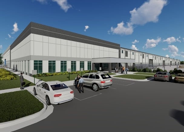
Property Record
6770 Stonecrest Industrial Way, Lithonia, GA 30058

NEARBY LISTINGS FOR SALE OR LEASE
Property Detail
6770 Stonecrest Industrial Way
16-132-02-007
23 X 98 X 128 X 412 X
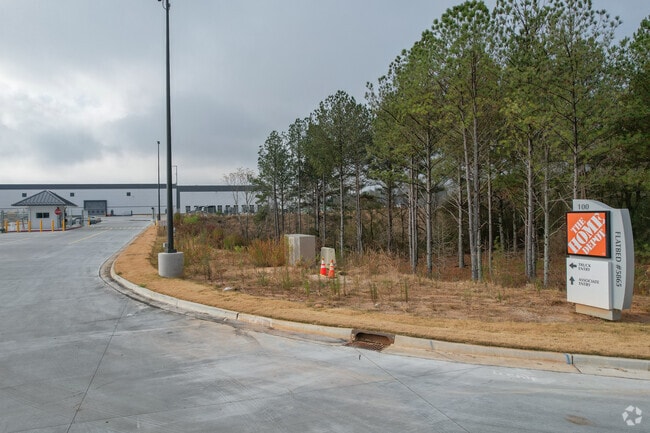
Warehouse
DeKalb
X
Georgia
13247C0080D
97.30 AC
2025
Snapfinger
2025
Atlanta
023313
Atlanta-Sandy Springs-Roswell, GA
614,505 SF
DEMOGRAPHICS near 6770 Stonecrest Industrial Way
1 Mile
3 Mile
5 Mile
2024 Total Population
3,007
60,357
150,046
2029 Population
3,033
60,146
149,773
Pop Growth 2024-2029
+ 0.86%
(0.35%)
(0.18%)
Average Age
38
38
38
2024 Total Households
995
21,288
54,474
HH Growth 2024-2029
+ 0.90%
(0.39%)
(0.32%)
Median Household Inc
$80,000
$64,490
$63,853
Avg Household Size
2.90
2.80
2.70
2024 Avg HH Vehicles
2.00
2.00
2.00
Median Home Value
$186,581
$191,516
$202,073
Median Year Built
1998
1993
1989
Nearby Places
Map Layers
Map Styles
 Street
 Aerial
- Restaurants
- Banks
- Shops
- Fitness
- Groceries
PUBLIC TRANSPORTATION
AIRPORT
Hartsfield - Jackson Atlanta International
DRIVE
WALK
Distance
Hartsfield - Jackson Atlanta International
37 min
24.0 mi
Freight Ports
Georgia Ports - Savannah
DRIVE
WALK
Distance
Georgia Ports - Savannah
287 min
244.3 mi
Nearby Properties
Address
Land Use
TOTAL SIZE
Lot Size
Zoning
Address
Land Use
TOTAL SIZE
Lot Size
Zoning
208,447 SF
26.56 AC
RM100
Address
Land Use
TOTAL SIZE
Lot Size
Zoning
764,622 SF
48.38 AC
M
Address
Land Use
TOTAL SIZE
Lot Size
Zoning
240,744 SF
23.93 AC
RM100
Address
Land Use
TOTAL SIZE
Lot Size
Zoning
271,666 SF
33.72 AC
RM100
Address
Land Use
TOTAL SIZE
Lot Size
Zoning
235,521 SF
15.36 AC
RM75
Address
Land Use
TOTAL SIZE
Lot Size
Zoning
118,007 SF
14.31 AC
Address
Land Use
TOTAL SIZE
Lot Size
Zoning
314,474 SF
24.04 AC
RM75
Address
Land Use
TOTAL SIZE
Lot Size
Zoning
81,537 SF
9.27 AC
C1
Address
Land Use
TOTAL SIZE
Lot Size
Zoning
267,899 SF
47.90 AC
X
Address
Land Use
TOTAL SIZE
Lot Size
Zoning
283,988 SF
29 AC
RM100
Address
Land Use
TOTAL SIZE
Lot Size
Zoning
198,140 SF
18 AC
RM100
Address
Land Use
TOTAL SIZE
Lot Size
Zoning
218,152 SF
18.80 AC
RM100
Address
Land Use
TOTAL SIZE
Lot Size
Zoning
36,951 SF
8 AC
Address
Land Use
TOTAL SIZE
Lot Size
Zoning
138,876 SF
20 AC
RM100
Address
Land Use
TOTAL SIZE
Lot Size
Zoning
7,384 SF
15.80 AC
M
Address
Land Use
TOTAL SIZE
Lot Size
Zoning
215,422 SF
33.84 AC
M
Address
Land Use
TOTAL SIZE
Lot Size
Zoning
227,648 SF
14.56 AC
X
Address
Land Use
TOTAL SIZE
Lot Size
Zoning
72,755 SF
5.17 AC
C1
Address
Land Use
TOTAL SIZE
Lot Size
Zoning
18,099 SF
1,412.45 AC
M2
Address
Land Use
TOTAL SIZE
Lot Size
Zoning
207,446 SF
12.21 AC
M
Address
Land Use
TOTAL SIZE
Lot Size
Zoning
92,416 SF
5.48 AC
OD
Address
Land Use
TOTAL SIZE
Lot Size
Zoning
26,760 SF
2.50 AC
C1
Address
Land Use
TOTAL SIZE
Lot Size
Zoning
253,861 SF
19.28 AC
X
Address
Land Use
TOTAL SIZE
Lot Size
Zoning
38.94 AC
M
Address
Land Use
TOTAL SIZE
Lot Size
Zoning
142,160 SF
9.50 AC
M
Address
Land Use
TOTAL SIZE
Lot Size
Zoning
135,659 SF
22.76 AC
RM100
Address
Land Use
TOTAL SIZE
Lot Size
Zoning
96,679 SF
8.38 AC
RM75
Address
Land Use
TOTAL SIZE
Lot Size
Zoning
27,542 SF
1.75 AC
C1
Address
Land Use
TOTAL SIZE
Lot Size
Zoning
34,241 SF
9.30 AC
M
The World's #1 Commercial Real Estate Marketplace
Connect with us
© 2026 CoStar Group
The information above has been obtained from sources believed reliable. While we do not doubt its accuracy we have not verified it and make no guarantee, warranty or representation about it. It is your responsibility to independently confirm its accuracy and completeness. Any projections, opinions, assumptions, or estimates used are for example only and do not represent the current or future performance of the property. The value of this transaction to you depends on tax and other factors which should be evaluated by your tax, financial, and legal advisors. You and your advisors should conduct a careful, independent investigation of the property to determine to your satisfaction the suitability of the property for your needs.