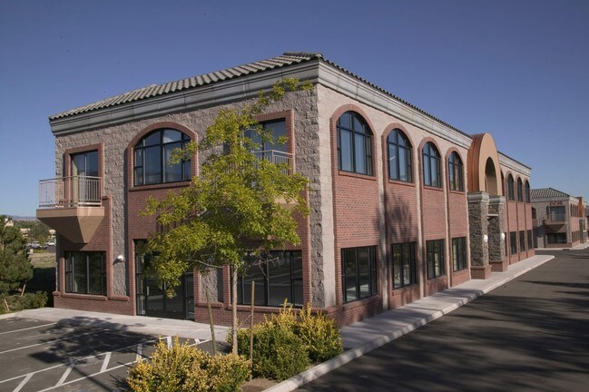
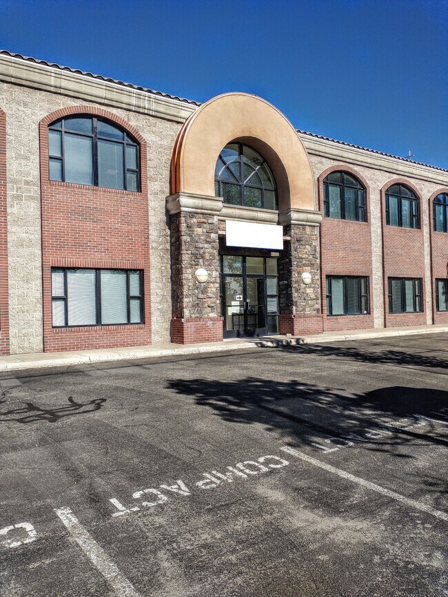
Property Record
6774 S Mccarran Blvd, Reno, NV 89509

NEARBY LISTINGS FOR SALE OR LEASE
Property Detail
6774 S Mccarran Blvd
Reno, NV
_Unspecified
040-880-21
PM 3783 LT 2
Officebuilding
Washoe
X
Nevada
32031C3231G
2
2025
0.11 AC
2026
Meadowood
001012
Reno/Sparks
9,600 SF
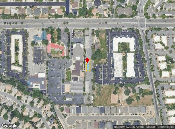
DEMOGRAPHICS near 6774 S Mccarran Blvd
1 Mile
3 Mile
5 Mile
2024 Total Population
8,662
77,351
180,006
2029 Population
9,164
81,383
189,538
Pop Growth 2024-2029
+ 5.80%
+ 5.21%
+ 5.30%
Average Age
45
41
41
2024 Total Households
3,855
33,434
77,454
HH Growth 2024-2029
+ 5.78%
+ 5.35%
+ 5.40%
Median Household Inc
$82,302
$66,440
$65,924
Avg Household Size
2.20
2.30
2.20
2024 Avg HH Vehicles
2.00
2.00
2.00
Median Home Value
$611,141
$492,929
$497,586
Median Year Built
1982
1977
1981
Nearby Places
Map Layers
Map Styles
 Street
 Aerial
- Restaurants
- Banks
- Shops
- Fitness
- Groceries
PUBLIC TRANSPORTATION
COMMUTER RAIL
DRIVE
WALK
Distance
11 min
4.4 mi
AIRPORT
Reno/Tahoe International
DRIVE
WALK
Distance
Reno/Tahoe International
24 min
6.3 mi
SALE & LEASE HISTORY
LISTING DATE
SALE/LEASE

Oct 12, 2022
For Lease
Oct 12, 2022
For Lease
Nov 27, 2017
For Sale
Jul 01, 2022
For Sale
Jan 08, 2022
For Lease
Nearby Properties
Address
Land Use
TOTAL SIZE
Lot Size
Zoning
Address
Land Use
TOTAL SIZE
Lot Size
Zoning
1,638,272 SF
17.11 AC
MU
Address
Land Use
TOTAL SIZE
Lot Size
Zoning
762,384 SF
1,131.28 AC
MA
Address
Land Use
TOTAL SIZE
Lot Size
Zoning
799,762 SF
13.30 AC
MU
Address
Land Use
TOTAL SIZE
Lot Size
Zoning
390,743 SF
22.20 AC
IC
Address
Land Use
TOTAL SIZE
Lot Size
Zoning
1,051,043 SF
78.81 AC
PD
Address
Land Use
TOTAL SIZE
Lot Size
Zoning
425,118 SF
30.37 AC
IC
Address
Land Use
TOTAL SIZE
Lot Size
Zoning
759,161 SF
37.37 AC
MU
Address
Land Use
TOTAL SIZE
Lot Size
Zoning
893,055 SF
52.71 AC
MA
Address
Land Use
TOTAL SIZE
Lot Size
Zoning
451,635 SF
15 AC
PD
Address
Land Use
TOTAL SIZE
Lot Size
Zoning
497,928 SF
3.52 AC
MU
Address
Land Use
TOTAL SIZE
Lot Size
Zoning
645,699 SF
4.53 AC
MU
Address
Land Use
TOTAL SIZE
Lot Size
Zoning
421,744 SF
12.07 AC
MS
Address
Land Use
TOTAL SIZE
Lot Size
Zoning
500,079 SF
45.66 AC
SPD
Address
Land Use
TOTAL SIZE
Lot Size
Zoning
342,019 SF
23.32 AC
MF14
Address
Land Use
TOTAL SIZE
Lot Size
Zoning
231,329 SF
8.37 AC
GC
Address
Land Use
TOTAL SIZE
Lot Size
Zoning
591,000 SF
5.46 AC
MU
Address
Land Use
TOTAL SIZE
Lot Size
Zoning
322,180 SF
2.87 AC
MU
Address
Land Use
TOTAL SIZE
Lot Size
Zoning
149,324 SF
4.34 AC
PD
Address
Land Use
TOTAL SIZE
Lot Size
Zoning
270,950 SF
14.86 AC
IC
Address
Land Use
TOTAL SIZE
Lot Size
Zoning
170,507 SF
17.24 AC
GC
Address
Land Use
TOTAL SIZE
Lot Size
Zoning
80,970 SF
5.28 AC
MS
Address
Land Use
TOTAL SIZE
Lot Size
Zoning
181,296 SF
2.65 AC
MU
Address
Land Use
TOTAL SIZE
Lot Size
Zoning
117,360 SF
1.75 AC
MU
Address
Land Use
TOTAL SIZE
Lot Size
Zoning
7.82 AC
PF
Address
Land Use
TOTAL SIZE
Lot Size
Zoning
249,191 SF
9.38 AC
PF
Address
Land Use
TOTAL SIZE
Lot Size
Zoning
452,732 SF
19.30 AC
IC
Address
Land Use
TOTAL SIZE
Lot Size
Zoning
149,194 SF
2.75 AC
GC
Address
Land Use
TOTAL SIZE
Lot Size
Zoning
243,567 SF
12.22 AC
GC 83% / M
Address
Land Use
TOTAL SIZE
Lot Size
Zoning
205,936 SF
6.93 AC
MF30
Address
Land Use
TOTAL SIZE
Lot Size
Zoning
395,488 SF
19.97 AC
IC
The World's #1 Commercial Real Estate Marketplace
Connect with us
© 2025 CoStar Group
The information above has been obtained from sources believed reliable. While we do not doubt its accuracy we have not verified it and make no guarantee, warranty or representation about it. It is your responsibility to independently confirm its accuracy and completeness. Any projections, opinions, assumptions, or estimates used are for example only and do not represent the current or future performance of the property. The value of this transaction to you depends on tax and other factors which should be evaluated by your tax, financial, and legal advisors. You and your advisors should conduct a careful, independent investigation of the property to determine to your satisfaction the suitability of the property for your needs.