Property Record
6776 York St, Denver, CO 80229
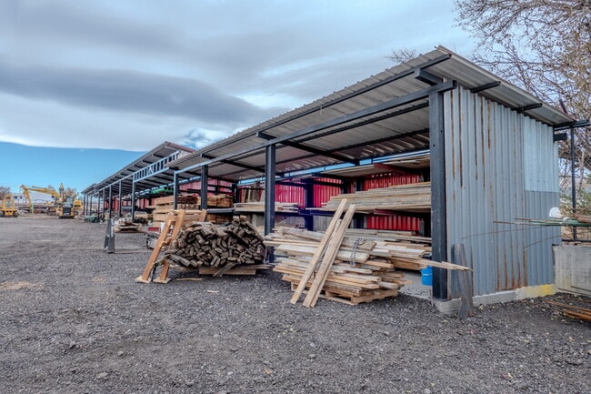


Property Detail
6776 York St
Denver-Aurora-Centennial, CO
Gardeners Ditch Land Development Co
1825-01-3-02-001
SUB:GARDENERS DITCH LAND DEVELOPMENT CO BLK:5 LOT:1
Sfr
Adams
X
Colorado
08005C0025K
1
2024
0.61 AC
2025
Northeast Denver
015000
Denver
2,094 SF
NEARBY LISTINGS FOR SALE OR LEASE
DEMOGRAPHICS near 6776 York St
1 mile
3 mile
5 mile
2024 Total Population
848
77,582
295,036
2029 Population
865
79,668
302,132
Pop Growth 2024-2029
+ 2.00%
+ 2.69%
+ 2.41%
Average Age
38
36
36
2024 Total Households
274
24,895
110,301
HH Growth 2024-2029
+ 1.82%
+ 2.74%
+ 2.31%
Median Household Inc
$53,125
$63,196
$73,574
Avg Household Size
3.00
3.00
2.60
2024 Avg HH Vehicles
2.00
2.00
2.00
Median Home Value
$210,526
$339,995
$407,609
Median Year Built
1969
1968
1977
Nearby Places
Map Layers
Map Styles
 Street
 Aerial
Transit
 Traffic
 Biking
Places
Listings with unknown addresses are not visible on the map
- Restaurants
- Banks
- Shops
- Fitness
- Groceries
PUBLIC TRANSPORTATION
COMMUTER RAIL
Drive
Walk
Distance
7 min
2.4 mi
Drive
Walk
Distance
10 min
3.4 mi
AIRPORT
Denver International
Drive
Walk
Distance
Denver International
30 min
22.1 mi
SALE & LEASE HISTORY
LISTING DATE
SALE/LEASE

Nov 27, 2024
For Sale
Nearby Properties
Address
Land Use
TOTAL SIZE
Lot Size
Zoning
Address
Land Use
TOTAL SIZE
Lot Size
Zoning
396,741 SF
8.12 AC
A1
Address
Land Use
TOTAL SIZE
Lot Size
Zoning
1.64 AC
CMP
Address
Land Use
TOTAL SIZE
Lot Size
Zoning
256,155 SF
3.84 AC
Address
Land Use
TOTAL SIZE
Lot Size
Zoning
106,680 SF
17.39 AC
Address
Land Use
TOTAL SIZE
Lot Size
Zoning
140,328 SF
6.54 AC
PUD
Address
Land Use
TOTAL SIZE
Lot Size
Zoning
17,063 SF
2.01 AC
Address
Land Use
TOTAL SIZE
Lot Size
Zoning
649,540 SF
33.65 AC
Address
Land Use
TOTAL SIZE
Lot Size
Zoning
170,210 SF
9 AC
Address
Land Use
TOTAL SIZE
Lot Size
Zoning
446,845 SF
10.43 AC
CMP-NWC-G
Address
Land Use
TOTAL SIZE
Lot Size
Zoning
134,729 SF
5.57 AC
Address
Land Use
TOTAL SIZE
Lot Size
Zoning
551,915 SF
25.76 AC
Address
Land Use
TOTAL SIZE
Lot Size
Zoning
599,680 SF
43.94 AC
Address
Land Use
TOTAL SIZE
Lot Size
Zoning
74,106 SF
3.95 AC
PUD
Address
Land Use
TOTAL SIZE
Lot Size
Zoning
470,539 SF
23.59 AC
Address
Land Use
TOTAL SIZE
Lot Size
Zoning
595,017 SF
11.62 AC
I-B
Address
Land Use
TOTAL SIZE
Lot Size
Zoning
116,502 SF
4.08 AC
Address
Land Use
TOTAL SIZE
Lot Size
Zoning
344,689 SF
11.77 AC
I-B
Address
Land Use
TOTAL SIZE
Lot Size
Zoning
110,878 SF
4.65 AC
Address
Land Use
TOTAL SIZE
Lot Size
Zoning
727,307 SF
38.44 AC
I-B
Address
Land Use
TOTAL SIZE
Lot Size
Zoning
94,213 SF
3.84 AC
A1
Address
Land Use
TOTAL SIZE
Lot Size
Zoning
419,745 SF
24.75 AC
Address
Land Use
TOTAL SIZE
Lot Size
Zoning
146,217 SF
5.28 AC
I-MX-8
Address
Land Use
TOTAL SIZE
Lot Size
Zoning
439,200 SF
25.09 AC
Address
Land Use
TOTAL SIZE
Lot Size
Zoning
90,760 SF
6.48 AC
Address
Land Use
TOTAL SIZE
Lot Size
Zoning
147,009 SF
36.94 AC
I3
Address
Land Use
TOTAL SIZE
Lot Size
Zoning
6.69 AC
B-3
Address
Land Use
TOTAL SIZE
Lot Size
Zoning
179,691 SF
4.05 AC
I-MX-8
Address
Land Use
TOTAL SIZE
Lot Size
Zoning
376,598 SF
19.28 AC
Address
Land Use
TOTAL SIZE
Lot Size
Zoning
370,741 SF
19.53 AC
I3
Address
Land Use
TOTAL SIZE
Lot Size
Zoning
329,903 SF
21.97 AC
The World's #1 Commercial Real Estate Marketplace
Connect with us
© 2026 CoStar Group
The information above has been obtained from sources believed reliable. While we do not doubt its accuracy we have not verified it and make no guarantee, warranty or representation about it. It is your responsibility to independently confirm its accuracy and completeness. Any projections, opinions, assumptions, or estimates used are for example only and do not represent the current or future performance of the property. The value of this transaction to you depends on tax and other factors which should be evaluated by your tax, financial, and legal advisors. You and your advisors should conduct a careful, independent investigation of the property to determine to your satisfaction the suitability of the property for your needs.