Property Record
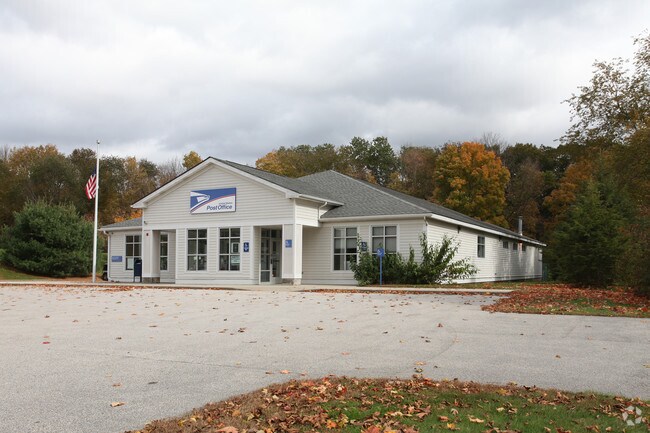
679 Route 169, Woodstock, CT 06281


NEARBY LISTINGS FOR SALE OR LEASE
Property Detail
679 Route 169
Worcester, MA-CT
Windham
WOOD-007280-000029-000061D
Connecticut
Commercialbuilding
61d
2024
2.30 AC
2025
Windham County
901102
Hartford
4,752 SF
DEMOGRAPHICS near 679 Route 169
1 Mile
3 Mile
5 Mile
2024 Total Population
648
3,853
18,328
2029 Population
649
3,860
18,321
Pop Growth 2024-2029
+ 0.15%
+ 0.18%
(0.04%)
Average Age
43
43
42
2024 Total Households
250
1,505
7,541
HH Growth 2024-2029
+ 0.40%
+ 0.27%
+ 0.01%
Median Household Inc
$95,689
$89,847
$80,857
Avg Household Size
2.60
2.50
2.40
2024 Avg HH Vehicles
2.00
2.00
2.00
Median Home Value
$313,750
$314,583
$272,051
Median Year Built
1982
1981
1971
Nearby Places
Map Layers
Map Styles
 Street
 Aerial
- Restaurants
- Banks
- Shops
- Fitness
- Groceries
PUBLIC TRANSPORTATION
AIRPORT
Worcester Regional
DRIVE
WALK
Distance
Worcester Regional
51 min
29.1 mi
Freight Ports
Port of Davisville, RI
DRIVE
WALK
Distance
Port of Davisville, RI
75 min
55.0 mi
Nearby Properties
Address
Land Use
TOTAL SIZE
Lot Size
Zoning
Address
Land Use
TOTAL SIZE
Lot Size
Zoning
119.01 AC
Address
Land Use
TOTAL SIZE
Lot Size
Zoning
55,340 SF
4 AC
0
Address
Land Use
TOTAL SIZE
Lot Size
Zoning
62,370 SF
46.40 AC
0
Address
Land Use
TOTAL SIZE
Lot Size
Zoning
135,012 SF
31.12 AC
0
Address
Land Use
TOTAL SIZE
Lot Size
Zoning
16,771 SF
4.04 AC
0
Address
Land Use
TOTAL SIZE
Lot Size
Zoning
1.20 AC
0
Address
Land Use
TOTAL SIZE
Lot Size
Zoning
32,700 SF
2.61 AC
0
Address
Land Use
TOTAL SIZE
Lot Size
Zoning
43.90 AC
0
Address
Land Use
TOTAL SIZE
Lot Size
Zoning
17.90 AC
0
Address
Land Use
TOTAL SIZE
Lot Size
Zoning
7,450 SF
0.70 AC
0
Address
Land Use
TOTAL SIZE
Lot Size
Zoning
16,224 SF
6.30 AC
Address
Land Use
TOTAL SIZE
Lot Size
Zoning
3,698 SF
93.55 AC
0
Address
Land Use
TOTAL SIZE
Lot Size
Zoning
52,350 SF
2 AC
0
Address
Land Use
TOTAL SIZE
Lot Size
Zoning
34.20 AC
0
Address
Land Use
TOTAL SIZE
Lot Size
Zoning
6,602 SF
3.60 AC
0
Address
Land Use
TOTAL SIZE
Lot Size
Zoning
94.01 AC
0
Address
Land Use
TOTAL SIZE
Lot Size
Zoning
8.30 AC
0
Address
Land Use
TOTAL SIZE
Lot Size
Zoning
197.55 AC
0
Address
Land Use
TOTAL SIZE
Lot Size
Zoning
8,426 SF
8.31 AC
0
Address
Land Use
TOTAL SIZE
Lot Size
Zoning
7,078 SF
2.90 AC
0
Address
Land Use
TOTAL SIZE
Lot Size
Zoning
22 AC
0
Address
Land Use
TOTAL SIZE
Lot Size
Zoning
4.60 AC
0
Address
Land Use
TOTAL SIZE
Lot Size
Zoning
Address
Land Use
TOTAL SIZE
Lot Size
Zoning
9,248 SF
2.10 AC
0
Address
Land Use
TOTAL SIZE
Lot Size
Zoning
5,210 SF
25.06 AC
Address
Land Use
TOTAL SIZE
Lot Size
Zoning
3.84 AC
0
Address
Land Use
TOTAL SIZE
Lot Size
Zoning
3.20 AC
0
Address
Land Use
TOTAL SIZE
Lot Size
Zoning
4,115 SF
4 AC
0
Address
Land Use
TOTAL SIZE
Lot Size
Zoning
544 SF
5.12 AC
The World's #1 Commercial Real Estate Marketplace
Connect with us
© 2026 CoStar Group
The information above has been obtained from sources believed reliable. While we do not doubt its accuracy we have not verified it and make no guarantee, warranty or representation about it. It is your responsibility to independently confirm its accuracy and completeness. Any projections, opinions, assumptions, or estimates used are for example only and do not represent the current or future performance of the property. The value of this transaction to you depends on tax and other factors which should be evaluated by your tax, financial, and legal advisors. You and your advisors should conduct a careful, independent investigation of the property to determine to your satisfaction the suitability of the property for your needs.