Property Record
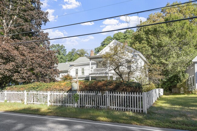
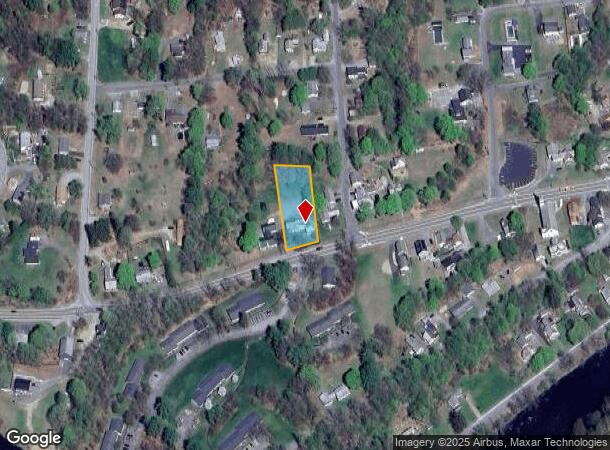
68 Brattleboro Rd, Hinsdale, NH 03451
This Property Is For Sale
NEARBY LISTINGS FOR SALE OR LEASE
-
-
View all Hinsdale listings for sale on LoopNet.com
Property Detail
68 Brattleboro Rd
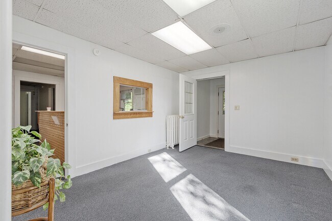
Commercialbuilding
Cheshire
X
New Hampshire
33005C0386E
0.55 AC
2024
Manchester/New Hampshire South Area
2024
Other Market Areas
971600
Keene, NH
2,904 SF
HNDL-000046-000000-000047
DEMOGRAPHICS near 68 Brattleboro Rd
1 Mile
3 Mile
5 Mile
2024 Total Population
1,494
4,574
8,133
2029 Population
1,500
4,559
8,115
Pop Growth 2024-2029
+ 0.40%
(0.33%)
(0.22%)
Average Age
44
45
45
2024 Total Households
639
1,921
3,460
HH Growth 2024-2029
+ 0.31%
(0.36%)
(0.23%)
Median Household Inc
$74,718
$80,640
$79,324
Avg Household Size
2.30
2.40
2.30
2024 Avg HH Vehicles
2.00
2.00
2.00
Median Home Value
$204,221
$225,262
$241,006
Median Year Built
1966
1975
1977
Nearby Places
Map Layers
Map Styles
 Street
 Aerial
- Restaurants
- Banks
- Shops
- Fitness
- Groceries
PUBLIC TRANSPORTATION
COMMUTER RAIL
Brattleboro Amtrak Station (Vermonter - Amtrak)
DRIVE
WALK
Distance
Brattleboro Amtrak Station (Vermonter - Amtrak)
11 min
6.5 mi
Freight Ports
Albany, NY Port
DRIVE
WALK
Distance
Albany, NY Port
144 min
87.9 mi
Nearby Properties
Address
Land Use
TOTAL SIZE
Lot Size
Zoning
Address
Land Use
TOTAL SIZE
Lot Size
Zoning
Address
Land Use
TOTAL SIZE
Lot Size
Zoning
144.79 AC
Address
Land Use
TOTAL SIZE
Lot Size
Zoning
144.79 AC
Address
Land Use
TOTAL SIZE
Lot Size
Zoning
330.23 AC
Address
Land Use
TOTAL SIZE
Lot Size
Zoning
160,772 SF
20.62 AC
RC
Address
Land Use
TOTAL SIZE
Lot Size
Zoning
Address
Land Use
TOTAL SIZE
Lot Size
Zoning
71,730 SF
4.60 AC
RA
Address
Land Use
TOTAL SIZE
Lot Size
Zoning
50,620 SF
3.09 AC
RA
Address
Land Use
TOTAL SIZE
Lot Size
Zoning
540 SF
130.47 AC
RA
Address
Land Use
TOTAL SIZE
Lot Size
Zoning
Address
Land Use
TOTAL SIZE
Lot Size
Zoning
4,500 SF
7.03 AC
RC
Address
Land Use
TOTAL SIZE
Lot Size
Zoning
0.95 AC
AGRI
Address
Land Use
TOTAL SIZE
Lot Size
Zoning
3,710 SF
10.12 AC
RES
Address
Land Use
TOTAL SIZE
Lot Size
Zoning
1,120 SF
11.10 AC
RES
Address
Land Use
TOTAL SIZE
Lot Size
Zoning
10.32 AC
Address
Land Use
TOTAL SIZE
Lot Size
Zoning
17,830 SF
4 AC
RC
Address
Land Use
TOTAL SIZE
Lot Size
Zoning
9,748 SF
0.26 AC
BUS
Address
Land Use
TOTAL SIZE
Lot Size
Zoning
294 SF
30 AC
RA
Address
Land Use
TOTAL SIZE
Lot Size
Zoning
Address
Land Use
TOTAL SIZE
Lot Size
Zoning
23.25 AC
Address
Land Use
TOTAL SIZE
Lot Size
Zoning
274.51 AC
Address
Land Use
TOTAL SIZE
Lot Size
Zoning
51,200 SF
4.78 AC
IND
Address
Land Use
TOTAL SIZE
Lot Size
Zoning
4,454 SF
4.44 AC
BUS
Address
Land Use
TOTAL SIZE
Lot Size
Zoning
4.10 AC
Address
Land Use
TOTAL SIZE
Lot Size
Zoning
44.30 AC
RA
Address
Land Use
TOTAL SIZE
Lot Size
Zoning
26,590 SF
4.24 AC
IND
Address
Land Use
TOTAL SIZE
Lot Size
Zoning
1,800 SF
0.13 AC
RC
Address
Land Use
TOTAL SIZE
Lot Size
Zoning
Address
Land Use
TOTAL SIZE
Lot Size
Zoning
2,152 SF
11.80 AC
IND
Address
Land Use
TOTAL SIZE
Lot Size
Zoning
4,420 SF
0.39 AC
BUS
The World's #1 Commercial Real Estate Marketplace
Connect with us
© 2026 CoStar Group
The information above has been obtained from sources believed reliable. While we do not doubt its accuracy we have not verified it and make no guarantee, warranty or representation about it. It is your responsibility to independently confirm its accuracy and completeness. Any projections, opinions, assumptions, or estimates used are for example only and do not represent the current or future performance of the property. The value of this transaction to you depends on tax and other factors which should be evaluated by your tax, financial, and legal advisors. You and your advisors should conduct a careful, independent investigation of the property to determine to your satisfaction the suitability of the property for your needs.