Property Record
68 Echo Rd, Mashpee, MA 02649


Save to a Folder
{{folder.Name}}
{{folder.ListingIds.length}} Properties
{{folder.ListingIds.length}} Property
Create a New Folder
Property Detail
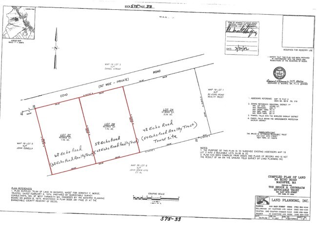
68 Echo Rd
Commercialbuilding
Barnstable
I1
Massachusetts
B and X Area of moderate flood hazard, usually the area between the limits of the 100-year and 500-year floods.
1.38 AC
2025
Cape Cod
2025
Other Market Areas
015002
Barnstable Town, MA
9,920 SF
MASH-000019-000014
NEARBY LISTINGS FOR SALE OR LEASE
DEMOGRAPHICS near 68 Echo Rd
1 mile
3 mile
5 mile
2025 Total Population
451
15,857
35,368
2030 Population
445
15,308
34,303
Pop Growth 2025-2030
(1.33%)
(3.46%)
(3.01%)
Average Age
48
47
47
2025 Total Households
194
6,558
14,398
HH Growth 2025-2030
(1.55%)
(3.55%)
(3.18%)
Median Household Inc
$74,999
$99,516
$104,156
Avg Household Size
2.20
2.40
2.40
2025 Avg HH Vehicles
2.00
2.00
2.00
Median Home Value
$544,118
$559,746
$620,402
Median Year Built
1986
1986
1985
Nearby Places
Map Layers
Map Styles
 Street
 Aerial
Layers
 Traffic
 Biking
Places
Listings with unknown addresses are not visible on the map
- Restaurants
- Banks
- Shops
- Fitness
- Groceries
PUBLIC TRANSPORTATION
AIRPORT
Martha's Vineyard
Drive
Walk
Distance
Martha's Vineyard
92 min
30.9 mi
Freight Ports
Port of New Bedford Harbor
Drive
Walk
Distance
Port of New Bedford Harbor
62 min
41.8 mi
Nearby Properties
Address
Land Use
TOTAL SIZE
Lot Size
Zoning
Address
Land Use
TOTAL SIZE
Lot Size
Zoning
12,713 SF
29.28 AC
C1
Address
Land Use
TOTAL SIZE
Lot Size
Zoning
181,756 SF
135.43 AC
R5
Address
Land Use
TOTAL SIZE
Lot Size
Zoning
2,295.68 AC
BUSINE
Address
Land Use
TOTAL SIZE
Lot Size
Zoning
15.10 AC
C1
Address
Land Use
TOTAL SIZE
Lot Size
Zoning
24.40 AC
R3
Address
Land Use
TOTAL SIZE
Lot Size
Zoning
73.40 AC
R-2
Address
Land Use
TOTAL SIZE
Lot Size
Zoning
65,930 SF
3.97 AC
C1
Address
Land Use
TOTAL SIZE
Lot Size
Zoning
47.35 AC
R-2
Address
Land Use
TOTAL SIZE
Lot Size
Zoning
24.50 AC
C2
Address
Land Use
TOTAL SIZE
Lot Size
Zoning
27.80 AC
R3
Address
Land Use
TOTAL SIZE
Lot Size
Zoning
13.30 AC
I1
Address
Land Use
TOTAL SIZE
Lot Size
Zoning
8,910 SF
31.84 AC
R5
Address
Land Use
TOTAL SIZE
Lot Size
Zoning
Address
Land Use
TOTAL SIZE
Lot Size
Zoning
7,241 SF
209.72 AC
GD
Address
Land Use
TOTAL SIZE
Lot Size
Zoning
33.20 AC
R5
Address
Land Use
TOTAL SIZE
Lot Size
Zoning
21,396 SF
1.90 AC
C1
Address
Land Use
TOTAL SIZE
Lot Size
Zoning
36,419 SF
7.29 AC
R3
Address
Land Use
TOTAL SIZE
Lot Size
Zoning
183.73 AC
R5
Address
Land Use
TOTAL SIZE
Lot Size
Zoning
8 AC
R5
Address
Land Use
TOTAL SIZE
Lot Size
Zoning
65.40 AC
R5
Address
Land Use
TOTAL SIZE
Lot Size
Zoning
9 AC
C1
Address
Land Use
TOTAL SIZE
Lot Size
Zoning
96,760 SF
3.57 AC
R5
Address
Land Use
TOTAL SIZE
Lot Size
Zoning
5.48 AC
R3
Address
Land Use
TOTAL SIZE
Lot Size
Zoning
136.85 AC
R-2
Address
Land Use
TOTAL SIZE
Lot Size
Zoning
13.20 AC
C1
Address
Land Use
TOTAL SIZE
Lot Size
Zoning
46.15 AC
R
Address
Land Use
TOTAL SIZE
Lot Size
Zoning
45,376 SF
4.09 AC
R5
Address
Land Use
TOTAL SIZE
Lot Size
Zoning
3,000 SF
53.30 AC
R5
Address
Land Use
TOTAL SIZE
Lot Size
Zoning
7.12 AC
C2
Address
Land Use
TOTAL SIZE
Lot Size
Zoning
1.27 AC
C1
The World's #1 Commercial Real Estate Marketplace
Connect with us
© 2026 CoStar Group
The information above has been obtained from sources believed reliable. While we do not doubt its accuracy we have not verified it and make no guarantee, warranty or representation about it. It is your responsibility to independently confirm its accuracy and completeness. Any projections, opinions, assumptions, or estimates used are for example only and do not represent the current or future performance of the property. The value of this transaction to you depends on tax and other factors which should be evaluated by your tax, financial, and legal advisors. You and your advisors should conduct a careful, independent investigation of the property to determine to your satisfaction the suitability of the property for your needs.