Property Record
68 Feeding Hills Rd, Southwick, MA 01077
NEARBY LISTINGS FOR SALE OR LEASE
-
-
View all Southwick listings for sale on LoopNet.com
Property Detail
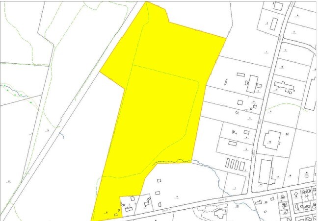
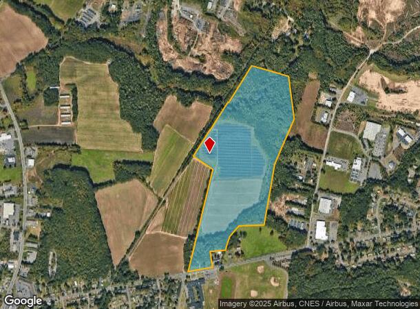
68 Feeding Hills Rd
SWIC-000066-000000-000006
Hampden
Privateutilityelectricwatergasnuclearsolarwindetc
Massachusetts
X
6
25013C0359E
76.24 AC
2025
Hampden County
2025
Hartford
813101
Springfield, MA
DEMOGRAPHICS near 68 Feeding Hills Rd
1 Mile
3 Mile
5 Mile
2024 Total Population
1,106
15,025
55,409
2029 Population
1,095
14,811
54,565
Pop Growth 2024-2029
(0.99%)
(1.42%)
(1.52%)
Average Age
45
44
42
2024 Total Households
474
6,105
21,844
HH Growth 2024-2029
(1.27%)
(1.49%)
(1.61%)
Median Household Inc
$104,704
$102,882
$84,246
Avg Household Size
2.30
2.40
2.40
2024 Avg HH Vehicles
2.00
2.00
2.00
Median Home Value
$340,441
$319,029
$292,002
Median Year Built
1976
1974
1967
Nearby Places
Map Layers
Map Styles
 Street
 Aerial
- Restaurants
- Banks
- Shops
- Fitness
- Groceries
PUBLIC TRANSPORTATION
AIRPORT
Bradley International
DRIVE
WALK
Distance
Bradley International
35 min
13.9 mi
Freight Ports
Port of New Haven
DRIVE
WALK
Distance
Port of New Haven
91 min
59.9 mi
SALE & LEASE HISTORY
LISTING DATE
SALE/LEASE

Sep 24, 2016
For Sale
Nearby Properties
Address
Land Use
TOTAL SIZE
Lot Size
Zoning
Address
Land Use
TOTAL SIZE
Lot Size
Zoning
92,866 SF
32 AC
R20A
Address
Land Use
TOTAL SIZE
Lot Size
Zoning
185,556 SF
64.01 AC
R-20A
Address
Land Use
TOTAL SIZE
Lot Size
Zoning
4,628 SF
16.01 AC
R-20
Address
Land Use
TOTAL SIZE
Lot Size
Zoning
27,730 SF
17 AC
BR
Address
Land Use
TOTAL SIZE
Lot Size
Zoning
9.80 AC
Address
Land Use
TOTAL SIZE
Lot Size
Zoning
51,608 SF
6.43 AC
IR
Address
Land Use
TOTAL SIZE
Lot Size
Zoning
63,175 SF
4.39 AC
IR
Address
Land Use
TOTAL SIZE
Lot Size
Zoning
53,734 SF
15 AC
Address
Land Use
TOTAL SIZE
Lot Size
Zoning
2,684 SF
17.01 AC
BR
Address
Land Use
TOTAL SIZE
Lot Size
Zoning
57,159 SF
7.07 AC
B
Address
Land Use
TOTAL SIZE
Lot Size
Zoning
281,574 SF
4.85 AC
Address
Land Use
TOTAL SIZE
Lot Size
Zoning
10,114 SF
33 AC
BR
Address
Land Use
TOTAL SIZE
Lot Size
Zoning
79,522 SF
5.57 AC
Address
Land Use
TOTAL SIZE
Lot Size
Zoning
8,352 SF
102.90 AC
Address
Land Use
TOTAL SIZE
Lot Size
Zoning
15.57 AC
Address
Land Use
TOTAL SIZE
Lot Size
Zoning
31,216 SF
9.20 AC
I
Address
Land Use
TOTAL SIZE
Lot Size
Zoning
32,705 SF
5.98 AC
Address
Land Use
TOTAL SIZE
Lot Size
Zoning
2,183 SF
5.59 AC
BR
Address
Land Use
TOTAL SIZE
Lot Size
Zoning
5.60 AC
Address
Land Use
TOTAL SIZE
Lot Size
Zoning
5,501 SF
7.70 AC
R-20
Address
Land Use
TOTAL SIZE
Lot Size
Zoning
41,885 SF
4.13 AC
IR
Address
Land Use
TOTAL SIZE
Lot Size
Zoning
15,358 SF
33.17 AC
A
Address
Land Use
TOTAL SIZE
Lot Size
Zoning
2.33 AC
Address
Land Use
TOTAL SIZE
Lot Size
Zoning
73,420 SF
B-20
Address
Land Use
TOTAL SIZE
Lot Size
Zoning
22,620 SF
5.90 AC
BR
Address
Land Use
TOTAL SIZE
Lot Size
Zoning
40,636 SF
2.40 AC
IR
Address
Land Use
TOTAL SIZE
Lot Size
Zoning
17,016 SF
6.03 AC
BR
Address
Land Use
TOTAL SIZE
Lot Size
Zoning
11,304 SF
0.52 AC
BR
Address
Land Use
TOTAL SIZE
Lot Size
Zoning
9,574 SF
5.80 AC
R-40
The World's #1 Commercial Real Estate Marketplace
Connect with us
© 2026 CoStar Group
The information above has been obtained from sources believed reliable. While we do not doubt its accuracy we have not verified it and make no guarantee, warranty or representation about it. It is your responsibility to independently confirm its accuracy and completeness. Any projections, opinions, assumptions, or estimates used are for example only and do not represent the current or future performance of the property. The value of this transaction to you depends on tax and other factors which should be evaluated by your tax, financial, and legal advisors. You and your advisors should conduct a careful, independent investigation of the property to determine to your satisfaction the suitability of the property for your needs.