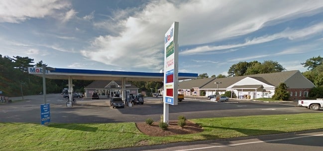
Property Record
68 S Main St, Assonet, MA 02702

Property Detail
68 S Main St
Storebuilding
Bristol
B
Massachusetts
B and X Area of moderate flood hazard, usually the area between the limits of the 100-year and 500-year floods.
3.13 AC
2025
Attleboro/New Bedford
2025
Boston
617101
Providence-Warwick, RI-MA
2,520 SF
FREE-000215-000000-000046
NEARBY LISTINGS FOR SALE OR LEASE
-
-
View all Assonet listings for sale on LoopNet.com
DEMOGRAPHICS near 68 S Main St
1 mile
3 mile
5 mile
2025 Total Population
1,514
10,854
38,330
2030 Population
1,526
11,057
39,091
Pop Growth 2025-2030
+ 0.79%
+ 1.87%
+ 1.99%
Average Age
42
42
43
2025 Total Households
538
4,211
14,478
HH Growth 2025-2030
+ 0.93%
+ 2.02%
+ 2.13%
Median Household Inc
$148,437
$101,412
$110,155
Avg Household Size
2.70
2.50
2.60
2025 Avg HH Vehicles
2.00
2.00
2.00
Median Home Value
$572,368
$506,014
$477,886
Median Year Built
1978
1979
1976
Nearby Places
Map Layers
Map Styles
 Street
 Aerial
Layers
 Traffic
 Biking
Places
Listings with unknown addresses are not visible on the map
- Restaurants
- Banks
- Shops
- Fitness
- Groceries
PUBLIC TRANSPORTATION
AIRPORT
Rhode Island Tf Green International
Drive
Walk
Distance
Rhode Island Tf Green International
45 min
29.1 mi
Freight Ports
Port of New Bedford Harbor
Drive
Walk
Distance
Port of New Bedford Harbor
27 min
20.6 mi
Nearby Properties
Address
Land Use
TOTAL SIZE
Lot Size
Zoning
Address
Land Use
TOTAL SIZE
Lot Size
Zoning
174.51 AC
I
Address
Land Use
TOTAL SIZE
Lot Size
Zoning
0.06 AC
A-2
Address
Land Use
TOTAL SIZE
Lot Size
Zoning
387.83 AC
I
Address
Land Use
TOTAL SIZE
Lot Size
Zoning
17.18 AC
IND
Address
Land Use
TOTAL SIZE
Lot Size
Zoning
53.87 AC
N/A
Address
Land Use
TOTAL SIZE
Lot Size
Zoning
18.65 AC
A-2
Address
Land Use
TOTAL SIZE
Lot Size
Zoning
65.74 AC
B
Address
Land Use
TOTAL SIZE
Lot Size
Zoning
497,656 SF
30.47 AC
INPK
Address
Land Use
TOTAL SIZE
Lot Size
Zoning
26.51 AC
G
Address
Land Use
TOTAL SIZE
Lot Size
Zoning
1,930 AC
INPK
Address
Land Use
TOTAL SIZE
Lot Size
Zoning
4.33 AC
B
Address
Land Use
TOTAL SIZE
Lot Size
Zoning
10,400 SF
54 AC
G
Address
Land Use
TOTAL SIZE
Lot Size
Zoning
39,944 SF
47.07 AC
I2
Address
Land Use
TOTAL SIZE
Lot Size
Zoning
34.88 AC
G
Address
Land Use
TOTAL SIZE
Lot Size
Zoning
2,295.68 AC
OSR
Address
Land Use
TOTAL SIZE
Lot Size
Zoning
87,806 SF
4 AC
B
Address
Land Use
TOTAL SIZE
Lot Size
Zoning
113,500 SF
9.56 AC
INPK
Address
Land Use
TOTAL SIZE
Lot Size
Zoning
36,216 SF
18.22 AC
N/A
Address
Land Use
TOTAL SIZE
Lot Size
Zoning
65,800 SF
24.31 AC
I2
Address
Land Use
TOTAL SIZE
Lot Size
Zoning
64,890 SF
6.54 AC
INPK
Address
Land Use
TOTAL SIZE
Lot Size
Zoning
649 AC
OSR
Address
Land Use
TOTAL SIZE
Lot Size
Zoning
12.08 AC
INPK
Address
Land Use
TOTAL SIZE
Lot Size
Zoning
7,867 SF
27 AC
R1
Address
Land Use
TOTAL SIZE
Lot Size
Zoning
3.99 AC
G
Address
Land Use
TOTAL SIZE
Lot Size
Zoning
53,873 SF
5.64 AC
INPK
Address
Land Use
TOTAL SIZE
Lot Size
Zoning
56,616 SF
15.07 AC
INPK
Address
Land Use
TOTAL SIZE
Lot Size
Zoning
37,620 SF
12.02 AC
N/A
Address
Land Use
TOTAL SIZE
Lot Size
Zoning
58,497 SF
5.92 AC
INPK
Address
Land Use
TOTAL SIZE
Lot Size
Zoning
2.50 AC
B
Address
Land Use
TOTAL SIZE
Lot Size
Zoning
39,594 SF
5.48 AC
INPK
The World's #1 Commercial Real Estate Marketplace
Connect with us
© 2026 CoStar Group
The information above has been obtained from sources believed reliable. While we do not doubt its accuracy we have not verified it and make no guarantee, warranty or representation about it. It is your responsibility to independently confirm its accuracy and completeness. Any projections, opinions, assumptions, or estimates used are for example only and do not represent the current or future performance of the property. The value of this transaction to you depends on tax and other factors which should be evaluated by your tax, financial, and legal advisors. You and your advisors should conduct a careful, independent investigation of the property to determine to your satisfaction the suitability of the property for your needs.