Property Record
680 Middlesex Tpke, Old Saybrook, CT 06475
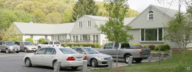

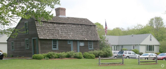
Property Detail
680 Middlesex Tpke
OSAY-000063-000001-000001
Lower Ct River Vly
Commercialnec
Connecticut
B2
1
B and X Area of moderate flood hazard, usually the area between the limits of the 100-year and 500-year floods.
0.55 AC
2025
SW Midlsx/Old Saybrk/Rt 9
2025
Hartford
670100
Hartford-West Hartford-East Hartford, CT
NEARBY LISTINGS FOR SALE OR LEASE
DEMOGRAPHICS near 680 Middlesex Tpke
1 mile
3 mile
5 mile
2025 Total Population
1,487
12,516
31,176
2030 Population
1,501
12,741
32,104
Pop Growth 2025-2030
+ 0.94%
+ 1.80%
+ 2.98%
Average Age
46
50
50
2025 Total Households
588
5,464
13,794
HH Growth 2025-2030
+ 1.02%
+ 1.89%
+ 3.14%
Median Household Inc
$147,553
$107,193
$110,864
Avg Household Size
2.40
2.20
2.20
2025 Avg HH Vehicles
2.00
2.00
2.00
Median Home Value
$589,189
$571,536
$556,818
Median Year Built
1977
1972
1970
Nearby Places
Map Layers
Map Styles
 Street
 Aerial
Layers
 Traffic
 Biking
Places
Listings with unknown addresses are not visible on the map
- Restaurants
- Banks
- Shops
- Fitness
- Groceries
PUBLIC TRANSPORTATION
COMMUTER RAIL
Old Saybrook (Shore Line East - Shore Line East)
Drive
Walk
Distance
Old Saybrook (Shore Line East - Shore Line East)
4 min
2.2 mi
Westbrook (Commuter Rail - Shore Line East)
Drive
Walk
Distance
Westbrook (Commuter Rail - Shore Line East)
8 min
5.3 mi
AIRPORT
Tweed/New Haven
Drive
Walk
Distance
Tweed/New Haven
38 min
29.2 mi
Freight Ports
Port of New Haven
Drive
Walk
Distance
Port of New Haven
38 min
29.8 mi
Nearby Properties
Address
Land Use
TOTAL SIZE
Lot Size
Zoning
Address
Land Use
TOTAL SIZE
Lot Size
Zoning
10.78 AC
B-2
Address
Land Use
TOTAL SIZE
Lot Size
Zoning
44.21 AC
RU80
Address
Land Use
TOTAL SIZE
Lot Size
Zoning
108.89 AC
RLC
Address
Land Use
TOTAL SIZE
Lot Size
Zoning
35.40 AC
B-2
Address
Land Use
TOTAL SIZE
Lot Size
Zoning
12.34 AC
RU40
Address
Land Use
TOTAL SIZE
Lot Size
Zoning
40,942 SF
7.45 AC
A
Address
Land Use
TOTAL SIZE
Lot Size
Zoning
20.17 AC
A
Address
Land Use
TOTAL SIZE
Lot Size
Zoning
12.35 AC
C-30
Address
Land Use
TOTAL SIZE
Lot Size
Zoning
101,587 SF
34.34 AC
A
Address
Land Use
TOTAL SIZE
Lot Size
Zoning
10.36 AC
RU40
Address
Land Use
TOTAL SIZE
Lot Size
Zoning
14.25 AC
A
Address
Land Use
TOTAL SIZE
Lot Size
Zoning
189,678 SF
44.72 AC
LI
Address
Land Use
TOTAL SIZE
Lot Size
Zoning
14.98 AC
VR
Address
Land Use
TOTAL SIZE
Lot Size
Zoning
72,128 SF
22.08 AC
I-1
Address
Land Use
TOTAL SIZE
Lot Size
Zoning
10.80 AC
I-1
Address
Land Use
TOTAL SIZE
Lot Size
Zoning
17,833 SF
3.87 AC
A
Address
Land Use
TOTAL SIZE
Lot Size
Zoning
7.36 AC
B1
Address
Land Use
TOTAL SIZE
Lot Size
Zoning
24,360 SF
7.78 AC
B-2
Address
Land Use
TOTAL SIZE
Lot Size
Zoning
11.80 AC
RU40
Address
Land Use
TOTAL SIZE
Lot Size
Zoning
291,816 SF
29.64 AC
I-1
Address
Land Use
TOTAL SIZE
Lot Size
Zoning
52,960 SF
32 AC
AA1
Address
Land Use
TOTAL SIZE
Lot Size
Zoning
120,144 SF
17.10 AC
RLM
Address
Land Use
TOTAL SIZE
Lot Size
Zoning
13.80 AC
RU80
Address
Land Use
TOTAL SIZE
Lot Size
Zoning
5.10 AC
AA-3
Address
Land Use
TOTAL SIZE
Lot Size
Zoning
8.44 AC
B-2
Address
Land Use
TOTAL SIZE
Lot Size
Zoning
3.58 AC
RU40
Address
Land Use
TOTAL SIZE
Lot Size
Zoning
22,970 SF
1.25 AC
A
Address
Land Use
TOTAL SIZE
Lot Size
Zoning
12.25 AC
MC
Address
Land Use
TOTAL SIZE
Lot Size
Zoning
1.48 AC
MC
Address
Land Use
TOTAL SIZE
Lot Size
Zoning
13,380 SF
3.27 AC
B-4
The World's #1 Commercial Real Estate Marketplace
Connect with us
© 2026 CoStar Group
The information above has been obtained from sources believed reliable. While we do not doubt its accuracy we have not verified it and make no guarantee, warranty or representation about it. It is your responsibility to independently confirm its accuracy and completeness. Any projections, opinions, assumptions, or estimates used are for example only and do not represent the current or future performance of the property. The value of this transaction to you depends on tax and other factors which should be evaluated by your tax, financial, and legal advisors. You and your advisors should conduct a careful, independent investigation of the property to determine to your satisfaction the suitability of the property for your needs.