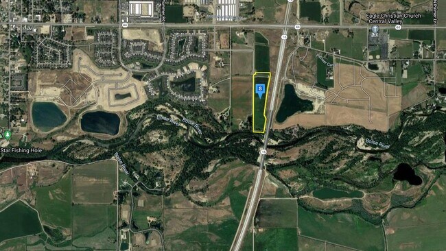
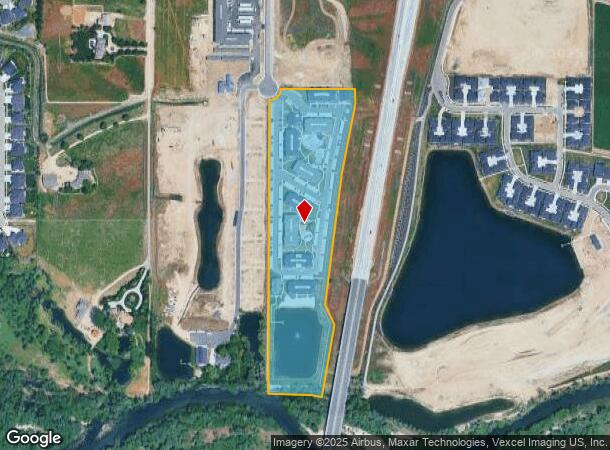
Property Record
680 S Calhoun Pl, Star, ID 83669
NEARBY LISTINGS FOR SALE OR LEASE
Property Detail
680 S Calhoun Pl
Boise City, ID
PAR #1500 OF W2NE4 & OF GOV LOT 2 SEC 16 4N 1W #120800-B
S0416131500
Ada
Commercialbuilding
Idaho
AE
2
16001C0140J
15.16 AC
2024
Star
2025
Boise City/Nampa
010228
DEMOGRAPHICS near 680 S Calhoun Pl
1 Mile
3 Mile
5 Mile
2024 Total Population
2,536
34,780
88,796
2029 Population
2,997
40,475
101,727
Pop Growth 2024-2029
+ 18.18%
+ 16.37%
+ 14.56%
Average Age
44
41
40
2024 Total Households
906
11,961
29,850
HH Growth 2024-2029
+ 18.21%
+ 16.65%
+ 14.87%
Median Household Inc
$71,219
$93,975
$100,956
Avg Household Size
2.80
2.90
2.90
2024 Avg HH Vehicles
2.00
2.00
2.00
Median Home Value
$716,137
$680,622
$538,590
Median Year Built
2010
2010
2009
Nearby Places
Map Layers
Map Styles
 Street
 Aerial
- Restaurants
- Banks
- Shops
- Fitness
- Groceries
PUBLIC TRANSPORTATION
AIRPORT
Boise Air Trml/Gowen Field
DRIVE
WALK
Distance
Boise Air Trml/Gowen Field
36 min
22.4 mi
Nearby Properties
Address
Land Use
TOTAL SIZE
Lot Size
Zoning
Address
Land Use
TOTAL SIZE
Lot Size
Zoning
342,567 SF
19.16 AC
MU-DA
Address
Land Use
TOTAL SIZE
Lot Size
Zoning
17.46 AC
R-15
Address
Land Use
TOTAL SIZE
Lot Size
Zoning
178,710 SF
13.47 AC
R-13
Address
Land Use
TOTAL SIZE
Lot Size
Zoning
265.60 AC
R-2-DA
Address
Land Use
TOTAL SIZE
Lot Size
Zoning
126,466 SF
5.29 AC
R-40
Address
Land Use
TOTAL SIZE
Lot Size
Zoning
227,392 SF
4.40 AC
L-O
Address
Land Use
TOTAL SIZE
Lot Size
Zoning
96,860 SF
12.62 AC
LI-DA
Address
Land Use
TOTAL SIZE
Lot Size
Zoning
170,333 SF
14.65 AC
C-3-DA
Address
Land Use
TOTAL SIZE
Lot Size
Zoning
152,895 SF
14.29 AC
C-G
Address
Land Use
TOTAL SIZE
Lot Size
Zoning
164,251 SF
21.52 AC
C-G
Address
Land Use
TOTAL SIZE
Lot Size
Zoning
2,496 SF
222.96 AC
R-2-DA
Address
Land Use
TOTAL SIZE
Lot Size
Zoning
174,428 SF
10 AC
MU
Address
Land Use
TOTAL SIZE
Lot Size
Zoning
246,075 SF
11.16 AC
C-2
Address
Land Use
TOTAL SIZE
Lot Size
Zoning
56,420 SF
10.27 AC
M1
Address
Land Use
TOTAL SIZE
Lot Size
Zoning
20,595 SF
2.32 AC
MU
Address
Land Use
TOTAL SIZE
Lot Size
Zoning
63,346 SF
6.87 AC
C-2
Address
Land Use
TOTAL SIZE
Lot Size
Zoning
132,187 SF
7.47 AC
MU
Address
Land Use
TOTAL SIZE
Lot Size
Zoning
89.84 AC
R-4-DA
Address
Land Use
TOTAL SIZE
Lot Size
Zoning
6,237 SF
1.83 AC
C-C
Address
Land Use
TOTAL SIZE
Lot Size
Zoning
58,697 SF
4.86 AC
CBD-DA
Address
Land Use
TOTAL SIZE
Lot Size
Zoning
16.61 AC
R-15
Address
Land Use
TOTAL SIZE
Lot Size
Zoning
18,785 SF
2.28 AC
C-3-DA
Address
Land Use
TOTAL SIZE
Lot Size
Zoning
12,372 SF
1.26 AC
C-C
Address
Land Use
TOTAL SIZE
Lot Size
Zoning
34,510 SF
3.20 AC
C-2
Address
Land Use
TOTAL SIZE
Lot Size
Zoning
171,082 SF
6.56 AC
C-G
Address
Land Use
TOTAL SIZE
Lot Size
Zoning
12.14 AC
C-G
Address
Land Use
TOTAL SIZE
Lot Size
Zoning
6,683 SF
9.62 AC
C-1-DA
Address
Land Use
TOTAL SIZE
Lot Size
Zoning
8,822 SF
1.20 AC
C-C
Address
Land Use
TOTAL SIZE
Lot Size
Zoning
125 SF
2.01 AC
C-G
The World's #1 Commercial Real Estate Marketplace
Connect with us
© 2025 CoStar Group
The information above has been obtained from sources believed reliable. While we do not doubt its accuracy we have not verified it and make no guarantee, warranty or representation about it. It is your responsibility to independently confirm its accuracy and completeness. Any projections, opinions, assumptions, or estimates used are for example only and do not represent the current or future performance of the property. The value of this transaction to you depends on tax and other factors which should be evaluated by your tax, financial, and legal advisors. You and your advisors should conduct a careful, independent investigation of the property to determine to your satisfaction the suitability of the property for your needs.