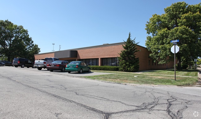
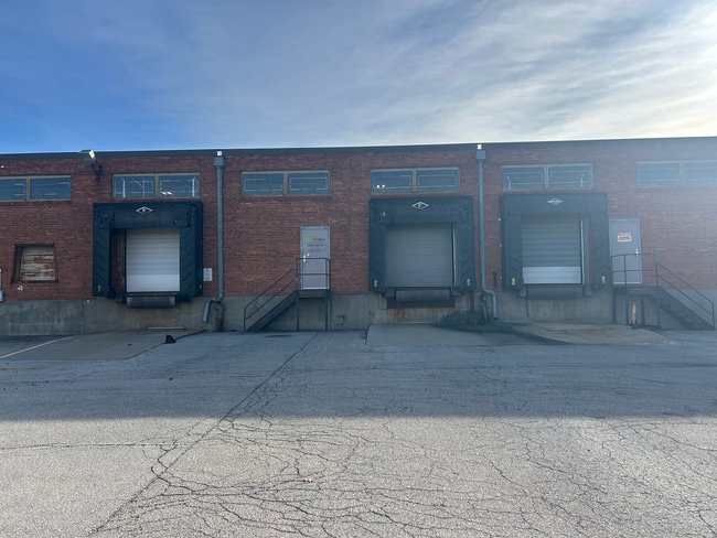
Property Record
6800 Squibb Rd, Mission, KS 66202
Current Lease Availabilities
NEARBY LISTINGS FOR SALE OR LEASE
Property Detail
6800 Squibb Rd
KF251208-2014
8-12-25 BEG 162.87' N & 200' WSE COR SW1/4 SW1/4 N 457.13' W 275' S 420.1' SELY 94' E 188.82' TO BEG EX .852 AC 1.998 AC M/L MIC 254K
Warehouse
Johnson
X
Kansas
20209C0170D
1.89 AC
2024
Merriam/Mission
2024
Kansas City
050302
Kansas City, MO-KS
41,720 SF
DEMOGRAPHICS near 6800 Squibb Rd
1 Mile
3 Mile
5 Mile
2024 Total Population
9,893
94,899
259,825
2029 Population
10,303
98,056
265,545
Pop Growth 2024-2029
+ 4.14%
+ 3.33%
+ 2.20%
Average Age
42
40
40
2024 Total Households
4,756
42,804
115,849
HH Growth 2024-2029
+ 4.42%
+ 3.55%
+ 2.34%
Median Household Inc
$75,679
$73,960
$77,921
Avg Household Size
2.00
2.20
2.20
2024 Avg HH Vehicles
2.00
2.00
2.00
Median Home Value
$271,542
$268,506
$278,000
Median Year Built
1958
1960
1961
Nearby Places
- Restaurants
- Banks
- Shops
- Fitness
- Groceries
PUBLIC TRANSPORTATION
COMMUTER RAIL
DRIVE
WALK
Distance
15 min
8.9 mi
AIRPORT
Kansas City International
DRIVE
WALK
Distance
Kansas City International
34 min
26.4 mi
Nearby Properties
Address
Land Use
TOTAL SIZE
Lot Size
Zoning
Address
Land Use
TOTAL SIZE
Lot Size
Zoning
857,568 SF
38.48 AC
PUD-G
Address
Land Use
TOTAL SIZE
Lot Size
Zoning
183,684 SF
36.94 AC
R-1A
Address
Land Use
TOTAL SIZE
Lot Size
Zoning
188,248 SF
4.78 AC
C-2
Address
Land Use
TOTAL SIZE
Lot Size
Zoning
312,446 SF
39.35 AC
R-1
Address
Land Use
TOTAL SIZE
Lot Size
Zoning
133,505 SF
16.41 AC
R-1
Address
Land Use
TOTAL SIZE
Lot Size
Zoning
212,475 SF
30.20 AC
PUB
Address
Land Use
TOTAL SIZE
Lot Size
Zoning
96,501 SF
6.49 AC
Address
Land Use
TOTAL SIZE
Lot Size
Zoning
79,437 SF
4.12 AC
DFD
Address
Land Use
TOTAL SIZE
Lot Size
Zoning
42,597 SF
4.39 AC
MS2
Address
Land Use
TOTAL SIZE
Lot Size
Zoning
63,471 SF
7.36 AC
PARK
Address
Land Use
TOTAL SIZE
Lot Size
Zoning
90,774 SF
1.73 AC
MS2
Address
Land Use
TOTAL SIZE
Lot Size
Zoning
168,438 SF
3.13 AC
C-O
Address
Land Use
TOTAL SIZE
Lot Size
Zoning
99,812 SF
3.85 AC
R-1A
Address
Land Use
TOTAL SIZE
Lot Size
Zoning
96,856 SF
15.76 AC
R-1
Address
Land Use
TOTAL SIZE
Lot Size
Zoning
93,418 SF
12.07 AC
R-1
Address
Land Use
TOTAL SIZE
Lot Size
Zoning
124,249 SF
6.13 AC
R-1B
Address
Land Use
TOTAL SIZE
Lot Size
Zoning
37,499 SF
3.72 AC
PUD-G
Address
Land Use
TOTAL SIZE
Lot Size
Zoning
106,648 SF
16.93 AC
R-1A
Address
Land Use
TOTAL SIZE
Lot Size
Zoning
70,952 SF
9.98 AC
R-1
Address
Land Use
TOTAL SIZE
Lot Size
Zoning
100,784 SF
4.68 AC
C-2B
Address
Land Use
TOTAL SIZE
Lot Size
Zoning
74,212 SF
8.01 AC
R-1
Address
Land Use
TOTAL SIZE
Lot Size
Zoning
74,802 SF
10.55 AC
CP-O
Address
Land Use
TOTAL SIZE
Lot Size
Zoning
36,769 SF
17.41 AC
R-1
Address
Land Use
TOTAL SIZE
Lot Size
Zoning
77,648 SF
6.90 AC
R-1
Address
Land Use
TOTAL SIZE
Lot Size
Zoning
311,454 SF
40.91 AC
PUD-G
Address
Land Use
TOTAL SIZE
Lot Size
Zoning
667,586 SF
18.06 AC
PUD-G
Address
Land Use
TOTAL SIZE
Lot Size
Zoning
34,745 SF
8.96 AC
PARK
Address
Land Use
TOTAL SIZE
Lot Size
Zoning
82,035 SF
8.49 AC
R-1
Address
Land Use
TOTAL SIZE
Lot Size
Zoning
34,366 SF
11.53 AC
R-1
Address
Land Use
TOTAL SIZE
Lot Size
Zoning
78,488 SF
5.95 AC
PUB
The World's #1 Commercial Real Estate Marketplace
Connect with us
© 2025 CoStar Group
The information above has been obtained from sources believed reliable. While we do not doubt its accuracy we have not verified it and make no guarantee, warranty or representation about it. It is your responsibility to independently confirm its accuracy and completeness. Any projections, opinions, assumptions, or estimates used are for example only and do not represent the current or future performance of the property. The value of this transaction to you depends on tax and other factors which should be evaluated by your tax, financial, and legal advisors. You and your advisors should conduct a careful, independent investigation of the property to determine to your satisfaction the suitability of the property for your needs.