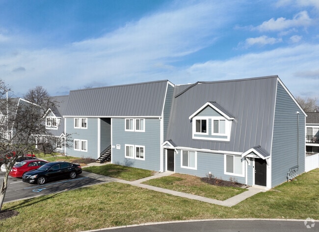
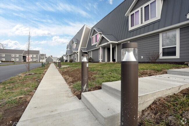
Property Record
6630 Brendon Way S Dr, Indianapolis, IN 46226

NEARBY LISTINGS FOR SALE OR LEASE
Property Detail
6630 Brendon Way S Dr
49-07-02-108-002.000-400
PT NE1/4 SE1/4 S2 T16 R4 BEG 348 E OF NW COR E565.75 S 46.06 SW 170 S 325 SE IRR 754.844 W246.13 NW IRR 435.24 N 987.171 TO BEG 13.814AC
Apartment
Marion
X
Indiana
18097C0160F
13.81 AC
2023
Brendonwood
2024
Indianapolis
330900
Indianapolis-Carmel-Anderson, IN
2,100 SF
DEMOGRAPHICS near 6630 Brendon Way S Dr
1 Mile
3 Mile
5 Mile
2024 Total Population
6,972
72,827
208,846
2029 Population
6,970
72,191
206,936
Pop Growth 2024-2029
(0.03%)
(0.87%)
(0.91%)
Average Age
36
38
38
2024 Total Households
3,013
30,179
89,224
HH Growth 2024-2029
+ 0.17%
(0.86%)
(0.98%)
Median Household Inc
$59,935
$53,928
$54,480
Avg Household Size
2.30
2.40
2.30
2024 Avg HH Vehicles
2.00
2.00
2.00
Median Home Value
$232,802
$199,719
$191,373
Median Year Built
1967
1968
1971
Nearby Places
Map Layers
Map Styles
 Street
 Aerial
- Restaurants
- Banks
- Shops
- Fitness
- Groceries
PUBLIC TRANSPORTATION
AIRPORT
Indianapolis International
DRIVE
WALK
Distance
Indianapolis International
43 min
24.6 mi
Freight Ports
Port of Toledo
DRIVE
WALK
Distance
Port of Toledo
261 min
218.6 mi
SALE & LEASE HISTORY
LISTING DATE
SALE/LEASE

Aug 29, 2017
For Sale
Nearby Properties
Address
Land Use
TOTAL SIZE
Lot Size
Zoning
Address
Land Use
TOTAL SIZE
Lot Size
Zoning
366,825 SF
26.60 AC
ZO01
Address
Land Use
TOTAL SIZE
Lot Size
Zoning
4,246 SF
89.83 AC
ZO01
Address
Land Use
TOTAL SIZE
Lot Size
Zoning
10,911 SF
11.56 AC
ZO01
Address
Land Use
TOTAL SIZE
Lot Size
Zoning
11,154 SF
21.99 AC
Address
Land Use
TOTAL SIZE
Lot Size
Zoning
532,932 SF
61.88 AC
ZO03
Address
Land Use
TOTAL SIZE
Lot Size
Zoning
6,366 SF
19.40 AC
ZO01
Address
Land Use
TOTAL SIZE
Lot Size
Zoning
4,217 SF
7.37 AC
ZO01
Address
Land Use
TOTAL SIZE
Lot Size
Zoning
143,890 SF
37.81 AC
ZO01
Address
Land Use
TOTAL SIZE
Lot Size
Zoning
91,717 SF
37.30 AC
Address
Land Use
TOTAL SIZE
Lot Size
Zoning
4,588 SF
24.33 AC
ZO01
Address
Land Use
TOTAL SIZE
Lot Size
Zoning
13,087 SF
57.88 AC
Address
Land Use
TOTAL SIZE
Lot Size
Zoning
136,336 SF
8.74 AC
ZO01
Address
Land Use
TOTAL SIZE
Lot Size
Zoning
1,120 SF
6.50 AC
ZO01
Address
Land Use
TOTAL SIZE
Lot Size
Zoning
6.73 AC
ZO01
Address
Land Use
TOTAL SIZE
Lot Size
Zoning
6,770 SF
38.91 AC
Address
Land Use
TOTAL SIZE
Lot Size
Zoning
5,670 SF
25.69 AC
Address
Land Use
TOTAL SIZE
Lot Size
Zoning
293,952 SF
12.88 AC
ZO01
Address
Land Use
TOTAL SIZE
Lot Size
Zoning
2,527 SF
23.16 AC
Address
Land Use
TOTAL SIZE
Lot Size
Zoning
65,095 SF
4.06 AC
ZO01
Address
Land Use
TOTAL SIZE
Lot Size
Zoning
1,903 SF
20.77 AC
ZO01
Address
Land Use
TOTAL SIZE
Lot Size
Zoning
1,066 SF
24.93 AC
Address
Land Use
TOTAL SIZE
Lot Size
Zoning
2,044 SF
16.53 AC
ZO01
Address
Land Use
TOTAL SIZE
Lot Size
Zoning
150,447 SF
45.78 AC
ZO01
Address
Land Use
TOTAL SIZE
Lot Size
Zoning
2,951 SF
15.45 AC
ZO01
Address
Land Use
TOTAL SIZE
Lot Size
Zoning
167,808 SF
14.95 AC
ZO01
Address
Land Use
TOTAL SIZE
Lot Size
Zoning
4,692 SF
25.76 AC
Address
Land Use
TOTAL SIZE
Lot Size
Zoning
42,026 SF
23.35 AC
ZO01
Address
Land Use
TOTAL SIZE
Lot Size
Zoning
4,000 SF
16.08 AC
ZO01
Address
Land Use
TOTAL SIZE
Lot Size
Zoning
1,865 SF
22.15 AC
ZO01
Address
Land Use
TOTAL SIZE
Lot Size
Zoning
304,900 SF
5.33 AC
ZO01
The World's #1 Commercial Real Estate Marketplace
Connect with us
© 2026 CoStar Group
The information above has been obtained from sources believed reliable. While we do not doubt its accuracy we have not verified it and make no guarantee, warranty or representation about it. It is your responsibility to independently confirm its accuracy and completeness. Any projections, opinions, assumptions, or estimates used are for example only and do not represent the current or future performance of the property. The value of this transaction to you depends on tax and other factors which should be evaluated by your tax, financial, and legal advisors. You and your advisors should conduct a careful, independent investigation of the property to determine to your satisfaction the suitability of the property for your needs.