Property Record
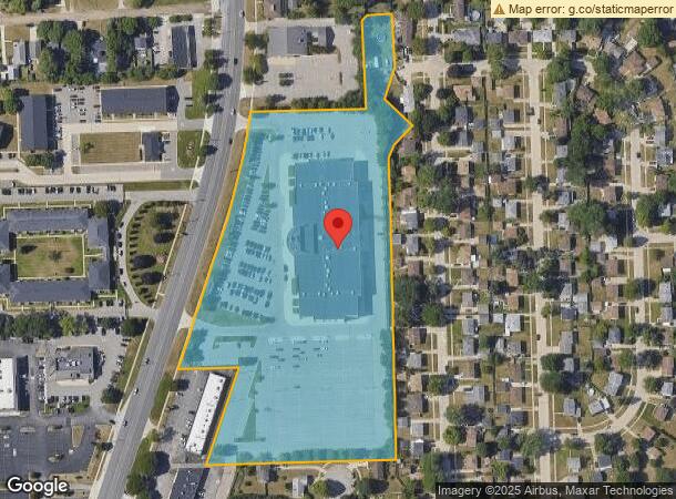
6800 N Wayne Rd, Westland, MI 48185


NEARBY LISTINGS FOR SALE OR LEASE
Property Detail
6800 N Wayne Rd
56-034-99-0003-705
PROPERTY EXEMPT FROM AD VALOREM TAXES AND ASSESSED ON THE SPECIAL ACT ROLL PURSUANT TO PA 261 OF 2003 EXPIRING 12/31/2016. PROPERTY EXEMPT FROM AD VALOREM TAXES AND ASSESSED PURSUANT TO PA 261 OF 2003 EXPIRING 12/31/2016. 09G2B1--M2B PT OF NW 1/4 OF
Theater
Wayne
X
Michigan
26163C0210E
0003
2025
9.90 AC
2025
Southern I-275 Corridor
567800
Detroit
67,572 SF
Detroit-Warren-Dearborn, MI
DEMOGRAPHICS near 6800 N Wayne Rd
1 Mile
3 Mile
5 Mile
2024 Total Population
14,231
99,658
256,388
2029 Population
13,717
95,587
246,147
Pop Growth 2024-2029
(3.61%)
(4.08%)
(3.99%)
Average Age
42
42
41
2024 Total Households
7,403
44,102
106,247
HH Growth 2024-2029
(3.59%)
(4.10%)
(4.03%)
Median Household Inc
$42,708
$63,808
$68,907
Avg Household Size
1.90
2.20
2.40
2024 Avg HH Vehicles
1.00
2.00
2.00
Median Home Value
$160,505
$166,664
$189,173
Median Year Built
1974
1965
1965
Nearby Places
Map Layers
Map Styles
 Street
 Aerial
- Restaurants
- Banks
- Shops
- Fitness
- Groceries
PUBLIC TRANSPORTATION
AIRPORT
Detroit Metro Wayne County
DRIVE
WALK
Distance
Detroit Metro Wayne County
23 min
12.9 mi
Windsor International
DRIVE
WALK
Distance
Windsor International
52 min
33.0 mi
Freight Ports
Port of Toledo
DRIVE
WALK
Distance
Port of Toledo
74 min
59.1 mi
Nearby Properties
Address
Land Use
TOTAL SIZE
Lot Size
Zoning
Address
Land Use
TOTAL SIZE
Lot Size
Zoning
741,173 SF
63.81 AC
Address
Land Use
TOTAL SIZE
Lot Size
Zoning
3,733,882 SF
183.17 AC
M-2
Address
Land Use
TOTAL SIZE
Lot Size
Zoning
1,316,911 SF
72.87 AC
M-1
Address
Land Use
TOTAL SIZE
Lot Size
Zoning
408,122 SF
23.31 AC
MR
Address
Land Use
TOTAL SIZE
Lot Size
Zoning
352,514 SF
26.40 AC
Address
Land Use
TOTAL SIZE
Lot Size
Zoning
480,910 SF
26.32 AC
Address
Land Use
TOTAL SIZE
Lot Size
Zoning
395,148 SF
9.67 AC
Address
Land Use
TOTAL SIZE
Lot Size
Zoning
249,795 SF
21.17 AC
Address
Land Use
TOTAL SIZE
Lot Size
Zoning
176,396 SF
11.76 AC
Address
Land Use
TOTAL SIZE
Lot Size
Zoning
188,958 SF
7.71 AC
Address
Land Use
TOTAL SIZE
Lot Size
Zoning
286,188 SF
40.21 AC
Address
Land Use
TOTAL SIZE
Lot Size
Zoning
285,136 SF
15.28 AC
Address
Land Use
TOTAL SIZE
Lot Size
Zoning
16.03 AC
MR
Address
Land Use
TOTAL SIZE
Lot Size
Zoning
206,130 SF
14.12 AC
Address
Land Use
TOTAL SIZE
Lot Size
Zoning
243,371 SF
16.04 AC
Address
Land Use
TOTAL SIZE
Lot Size
Zoning
199,952 SF
13.06 AC
Address
Land Use
TOTAL SIZE
Lot Size
Zoning
Address
Land Use
TOTAL SIZE
Lot Size
Zoning
76,430 SF
13.61 AC
C-3
Address
Land Use
TOTAL SIZE
Lot Size
Zoning
177,268 SF
17.11 AC
Address
Land Use
TOTAL SIZE
Lot Size
Zoning
197,774 SF
11.72 AC
Address
Land Use
TOTAL SIZE
Lot Size
Zoning
204,978 SF
10.28 AC
LI-1
Address
Land Use
TOTAL SIZE
Lot Size
Zoning
232,858 SF
39.67 AC
Address
Land Use
TOTAL SIZE
Lot Size
Zoning
11.38 AC
MR
Address
Land Use
TOTAL SIZE
Lot Size
Zoning
170,275 SF
16.53 AC
Address
Land Use
TOTAL SIZE
Lot Size
Zoning
238,980 SF
18.89 AC
Address
Land Use
TOTAL SIZE
Lot Size
Zoning
41.45 AC
C-3
Address
Land Use
TOTAL SIZE
Lot Size
Zoning
11.93 AC
MR
Address
Land Use
TOTAL SIZE
Lot Size
Zoning
137,400 SF
11.27 AC
Address
Land Use
TOTAL SIZE
Lot Size
Zoning
146,160 SF
8.78 AC
Address
Land Use
TOTAL SIZE
Lot Size
Zoning
165,144 SF
20.33 AC
LI-1
The World's #1 Commercial Real Estate Marketplace
Connect with us
© 2025 CoStar Group
The information above has been obtained from sources believed reliable. While we do not doubt its accuracy we have not verified it and make no guarantee, warranty or representation about it. It is your responsibility to independently confirm its accuracy and completeness. Any projections, opinions, assumptions, or estimates used are for example only and do not represent the current or future performance of the property. The value of this transaction to you depends on tax and other factors which should be evaluated by your tax, financial, and legal advisors. You and your advisors should conduct a careful, independent investigation of the property to determine to your satisfaction the suitability of the property for your needs.