Property Record
6800 Schaefer Rd, Dearborn, MI 48126
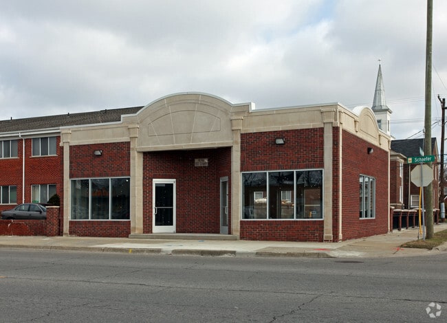

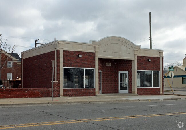
Property Detail
6800 Schaefer Rd
32-10-081-09-005
LOT 294 & 295 ROBERT OAKMAN & JOHN H WALSH FELICIAN PARK SUB
Storebuilding
Wayne
BB
Michigan
B and X Area of moderate flood hazard, usually the area between the limits of the 100-year and 500-year floods.
294-295
2025
0.11 AC
2025
Dearborn
573702
Detroit
1,346 SF
Detroit-Warren-Dearborn, MI
NEARBY LISTINGS FOR SALE OR LEASE
DEMOGRAPHICS near 6800 Schaefer Rd
1 mile
3 mile
5 mile
2025 Total Population
29,232
150,422
364,906
2030 Population
28,273
150,537
368,565
Pop Growth 2025-2030
(3.28%)
+ 0.08%
+ 1.00%
Average Age
34
35
37
2025 Total Households
7,923
49,794
131,993
HH Growth 2025-2030
(3.24%)
+ 0.42%
+ 1.32%
Median Household Inc
$44,739
$36,522
$38,991
Avg Household Size
3.60
2.90
2.70
2025 Avg HH Vehicles
2.00
1.00
1.00
Median Home Value
$218,695
$93,899
$99,908
Median Year Built
1948
1948
1948
Nearby Places
Map Layers
Map Styles
 Street
 Aerial
Transit
 Traffic
 Biking
Places
Listings with unknown addresses are not visible on the map
- Restaurants
- Banks
- Shops
- Fitness
- Groceries
PUBLIC TRANSPORTATION
COMMUTER RAIL
Drive
Walk
Distance
11 min
4.7 mi
Drive
Walk
Distance
14 min
7.7 mi
AIRPORT
Detroit Metro Wayne County
Drive
Walk
Distance
Detroit Metro Wayne County
29 min
17.3 mi
Windsor International
Drive
Walk
Distance
Windsor International
37 min
18.9 mi
Freight Ports
Drive
Walk
Distance
75 min
57.5 mi
Nearby Properties
Address
Land Use
TOTAL SIZE
Lot Size
Zoning
Address
Land Use
TOTAL SIZE
Lot Size
Zoning
830,075 SF
167.21 AC
BC
Address
Land Use
TOTAL SIZE
Lot Size
Zoning
590,116 SF
388.80 AC
ID
Address
Land Use
TOTAL SIZE
Lot Size
Zoning
475,972 SF
42.17 AC
RD
Address
Land Use
TOTAL SIZE
Lot Size
Zoning
1,043,110 SF
35.36 AC
RE
Address
Land Use
TOTAL SIZE
Lot Size
Zoning
153,040 SF
2.13 AC
BC
Address
Land Use
TOTAL SIZE
Lot Size
Zoning
324,414 SF
18.68 AC
RD
Address
Land Use
TOTAL SIZE
Lot Size
Zoning
304,206 SF
29.53 AC
RC
Address
Land Use
TOTAL SIZE
Lot Size
Zoning
854,358 SF
12.49 AC
BC
Address
Land Use
TOTAL SIZE
Lot Size
Zoning
783,976 SF
52.57 AC
M4
Address
Land Use
TOTAL SIZE
Lot Size
Zoning
78,450 SF
12.03 AC
BC
Address
Land Use
TOTAL SIZE
Lot Size
Zoning
429,654 SF
49.81 AC
TR
Address
Land Use
TOTAL SIZE
Lot Size
Zoning
228,519 SF
6.16 AC
BC
Address
Land Use
TOTAL SIZE
Lot Size
Zoning
551,788 SF
31.52 AC
BC
Address
Land Use
TOTAL SIZE
Lot Size
Zoning
198,237 SF
11.07 AC
RE
Address
Land Use
TOTAL SIZE
Lot Size
Zoning
562,922 SF
30 AC
BC
Address
Land Use
TOTAL SIZE
Lot Size
Zoning
80,861 SF
1.17 AC
BC
Address
Land Use
TOTAL SIZE
Lot Size
Zoning
810,000 SF
23.15 AC
BC
Address
Land Use
TOTAL SIZE
Lot Size
Zoning
111,008 SF
26.62 AC
IB
Address
Land Use
TOTAL SIZE
Lot Size
Zoning
365,040 SF
382 AC
M4
Address
Land Use
TOTAL SIZE
Lot Size
Zoning
520,522 SF
51.78 AC
M4
Address
Land Use
TOTAL SIZE
Lot Size
Zoning
192,813 SF
28.92 AC
TR
Address
Land Use
TOTAL SIZE
Lot Size
Zoning
590,652 SF
21.79 AC
TM
Address
Land Use
TOTAL SIZE
Lot Size
Zoning
145,702 SF
16.35 AC
TR
Address
Land Use
TOTAL SIZE
Lot Size
Zoning
148,491 SF
11.34 AC
BC
Address
Land Use
TOTAL SIZE
Lot Size
Zoning
303,705 SF
17.28 AC
ID
Address
Land Use
TOTAL SIZE
Lot Size
Zoning
72,326 SF
0.74 AC
BB
Address
Land Use
TOTAL SIZE
Lot Size
Zoning
637,820 SF
10.87 AC
BC
Address
Land Use
TOTAL SIZE
Lot Size
Zoning
331,121 SF
21.01 AC
BC
Address
Land Use
TOTAL SIZE
Lot Size
Zoning
102,920 SF
10.72 AC
BB
Address
Land Use
TOTAL SIZE
Lot Size
Zoning
153,668 SF
9.16 AC
RD
The World's #1 Commercial Real Estate Marketplace
Connect with us
© 2026 CoStar Group
The information above has been obtained from sources believed reliable. While we do not doubt its accuracy we have not verified it and make no guarantee, warranty or representation about it. It is your responsibility to independently confirm its accuracy and completeness. Any projections, opinions, assumptions, or estimates used are for example only and do not represent the current or future performance of the property. The value of this transaction to you depends on tax and other factors which should be evaluated by your tax, financial, and legal advisors. You and your advisors should conduct a careful, independent investigation of the property to determine to your satisfaction the suitability of the property for your needs.