Property Record
6800 Smith Rd, Simi Valley, CA 93063
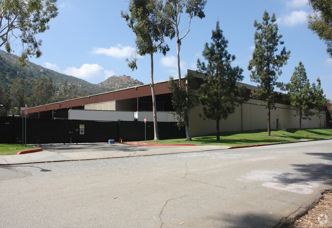


Property Detail
6800 Smith Rd
637-0-070-380
OFFICIAL RECS 371 PG 174
Lightindustrial
Ventura
L1
California
B and X Area of moderate flood hazard, usually the area between the limits of the 100-year and 500-year floods.
7.58 AC
2024
Moorpark/Simi Val
2025
Los Angeles
008304
Oxnard-Thousand Oaks-Ventura, CA
98,081 SF
NEARBY LISTINGS FOR SALE OR LEASE
DEMOGRAPHICS near 6800 Smith Rd
1 mile
3 mile
5 mile
2025 Total Population
5,581
38,911
178,449
2030 Population
5,610
38,477
178,265
Pop Growth 2025-2030
+ 0.52%
(1.12%)
(0.10%)
Average Age
44
43
42
2025 Total Households
2,010
14,135
61,196
HH Growth 2025-2030
+ 0.30%
(1.38%)
(0.32%)
Median Household Inc
$135,643
$117,940
$113,459
Avg Household Size
2.70
2.70
2.80
2025 Avg HH Vehicles
2.00
2.00
2.00
Median Home Value
$728,294
$780,951
$819,755
Median Year Built
1977
1980
1976
Nearby Places
Map Layers
Map Styles
 Street
 Aerial
Transit
 Traffic
 Biking
Places
Listings with unknown addresses are not visible on the map
- Restaurants
- Banks
- Shops
- Fitness
- Groceries
PUBLIC TRANSPORTATION
COMMUTER RAIL
Simi Valley (Ventura County Line - Southern California Regional Rail Authority (Metrolink))
Drive
Walk
Distance
Simi Valley (Ventura County Line - Southern California Regional Rail Authority (Metrolink))
7 min
3.2 mi
Chatsworth (Ventura County Line - Southern California Regional Rail Authority (Metrolink))
Drive
Walk
Distance
Chatsworth (Ventura County Line - Southern California Regional Rail Authority (Metrolink))
12 min
6.3 mi
AIRPORT
Bob Hope
Drive
Walk
Distance
Bob Hope
29 min
21.2 mi
Los Angeles International
Drive
Walk
Distance
Los Angeles International
49 min
37.1 mi
Nearby Properties
Address
Land Use
TOTAL SIZE
Lot Size
Zoning
Address
Land Use
TOTAL SIZE
Lot Size
Zoning
135,768 SF
5.27 AC
Address
Land Use
TOTAL SIZE
Lot Size
Zoning
1.86 AC
LACR
Address
Land Use
TOTAL SIZE
Lot Size
Zoning
96.68 AC
RE-A
Address
Land Use
TOTAL SIZE
Lot Size
Zoning
115.15 AC
RL-0
Address
Land Use
TOTAL SIZE
Lot Size
Zoning
112,130 SF
3.62 AC
Address
Land Use
TOTAL SIZE
Lot Size
Zoning
61,020 SF
3.21 AC
Address
Land Use
TOTAL SIZE
Lot Size
Zoning
53,730 SF
2.21 AC
Address
Land Use
TOTAL SIZE
Lot Size
Zoning
Address
Land Use
TOTAL SIZE
Lot Size
Zoning
78,540 SF
3.75 AC
RH-15
Address
Land Use
TOTAL SIZE
Lot Size
Zoning
101,728 SF
5.72 AC
RH-1
Address
Land Use
TOTAL SIZE
Lot Size
Zoning
41,130 SF
1.49 AC
Address
Land Use
TOTAL SIZE
Lot Size
Zoning
67,610 SF
2.82 AC
Address
Land Use
TOTAL SIZE
Lot Size
Zoning
640 SF
3.58 AC
RH-15
Address
Land Use
TOTAL SIZE
Lot Size
Zoning
99,812 SF
5.21 AC
RH-1
Address
Land Use
TOTAL SIZE
Lot Size
Zoning
102,140 SF
9.80 AC
RH-1.
Address
Land Use
TOTAL SIZE
Lot Size
Zoning
96,628 SF
5.53 AC
RVH-2
Address
Land Use
TOTAL SIZE
Lot Size
Zoning
41,154 SF
1.85 AC
RH15
Address
Land Use
TOTAL SIZE
Lot Size
Zoning
123,276 SF
1.32 AC
LACR
Address
Land Use
TOTAL SIZE
Lot Size
Zoning
2.63 AC
Address
Land Use
TOTAL SIZE
Lot Size
Zoning
84,676 SF
4.39 AC
RH-1.
Address
Land Use
TOTAL SIZE
Lot Size
Zoning
36,362 SF
2.20 AC
CPD
Address
Land Use
TOTAL SIZE
Lot Size
Zoning
1.53 AC
RMOD
Address
Land Use
TOTAL SIZE
Lot Size
Zoning
226,884 SF
24.12 AC
LAA2
Address
Land Use
TOTAL SIZE
Lot Size
Zoning
25,824 SF
3.29 AC
LCA21*
Address
Land Use
TOTAL SIZE
Lot Size
Zoning
96,104 SF
1.93 AC
LAC2
Address
Land Use
TOTAL SIZE
Lot Size
Zoning
80,636 SF
5.65 AC
M1
Address
Land Use
TOTAL SIZE
Lot Size
Zoning
75,100 SF
3.76 AC
RH-15
Address
Land Use
TOTAL SIZE
Lot Size
Zoning
59,637 SF
2.58 AC
RVH-
Address
Land Use
TOTAL SIZE
Lot Size
Zoning
99,404 SF
3.73 AC
M1
The World's #1 Commercial Real Estate Marketplace
Connect with us
© 2026 CoStar Group
The information above has been obtained from sources believed reliable. While we do not doubt its accuracy we have not verified it and make no guarantee, warranty or representation about it. It is your responsibility to independently confirm its accuracy and completeness. Any projections, opinions, assumptions, or estimates used are for example only and do not represent the current or future performance of the property. The value of this transaction to you depends on tax and other factors which should be evaluated by your tax, financial, and legal advisors. You and your advisors should conduct a careful, independent investigation of the property to determine to your satisfaction the suitability of the property for your needs.