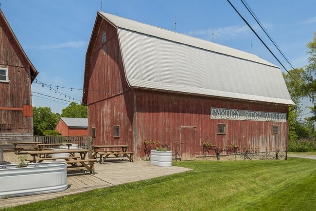
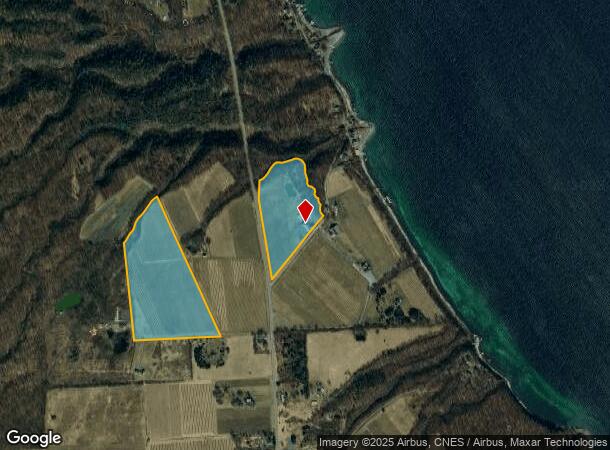
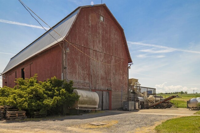
Property Record
6800 State Route 89, Ovid, NY 14521
NEARBY LISTINGS FOR SALE OR LEASE
-
-
View all Ovid listings for sale on LoopNet.com
Property Detail
6800 State Route 89
Other Market Areas
SPLIT 1992
Seneca Falls, NY
Seneca
453089-021-000-0001-026-012-0000
New York
Orchard
26.121
2025
15.20 AC
2024
Ithaca/Elmira
950802
DEMOGRAPHICS near 6800 State Route 89
1 mile
3 mile
5 mile
2024 Total Population
138
1,283
4,207
2029 Population
141
1,299
4,159
Pop Growth 2024-2029
+ 2.17%
+ 1.25%
(1.14%)
Average Age
39
41
41
2024 Total Households
50
477
1,490
HH Growth 2024-2029
+ 2.00%
+ 1.26%
(0.60%)
Median Household Inc
$74,999
$67,500
$65,708
Avg Household Size
2.60
2.50
2.40
2024 Avg HH Vehicles
2.00
2.00
2.00
Median Home Value
$189,999
$217,262
$187,897
Median Year Built
1961
1957
1958
Nearby Places
Map Layers
Map Styles
 Street
 Aerial
Transit
 Traffic
 Biking
Places
Listings with unknown addresses are not visible on the map
- Restaurants
- Banks
- Shops
- Fitness
- Groceries
PUBLIC TRANSPORTATION
AIRPORT
Ithaca Tompkins International
Drive
Walk
Distance
Ithaca Tompkins International
42 min
28.3 mi
Freight Ports
Albany, NY Port
Drive
Walk
Distance
Albany, NY Port
239 min
198.1 mi
SALE & LEASE HISTORY
LISTING DATE
SALE/LEASE

Jun 28, 2018
For Sale
Jul 30, 2018
For Sale
Jul 25, 2018
For Sale
Apr 26, 2020
For Sale
Nearby Properties
Address
Land Use
TOTAL SIZE
Lot Size
Zoning
Address
Land Use
TOTAL SIZE
Lot Size
Zoning
2,190 SF
141.40 AC
N00
Address
Land Use
TOTAL SIZE
Lot Size
Zoning
140.80 AC
Address
Land Use
TOTAL SIZE
Lot Size
Zoning
225.50 AC
Address
Land Use
TOTAL SIZE
Lot Size
Zoning
63 AC
Address
Land Use
TOTAL SIZE
Lot Size
Zoning
4,477 SF
6.30 AC
Address
Land Use
TOTAL SIZE
Lot Size
Zoning
3,489 SF
1.40 AC
Address
Land Use
TOTAL SIZE
Lot Size
Zoning
1,930 SF
98.60 AC
01
Address
Land Use
TOTAL SIZE
Lot Size
Zoning
1,800 SF
1.10 AC
Address
Land Use
TOTAL SIZE
Lot Size
Zoning
1,920 SF
0.39 AC
Address
Land Use
TOTAL SIZE
Lot Size
Zoning
3,800 SF
0.67 AC
02 - SINGL
Address
Land Use
TOTAL SIZE
Lot Size
Zoning
924 SF
5.50 AC
01
Address
Land Use
TOTAL SIZE
Lot Size
Zoning
2,309 SF
3.12 AC
02
Address
Land Use
TOTAL SIZE
Lot Size
Zoning
1,520 SF
0.32 AC
Address
Land Use
TOTAL SIZE
Lot Size
Zoning
3,300 SF
0.94 AC
01
Address
Land Use
TOTAL SIZE
Lot Size
Zoning
2,548 SF
1.20 AC
Address
Land Use
TOTAL SIZE
Lot Size
Zoning
1,560 SF
23.40 AC
N00
Address
Land Use
TOTAL SIZE
Lot Size
Zoning
4.17 AC
Address
Land Use
TOTAL SIZE
Lot Size
Zoning
13.85 AC
Address
Land Use
TOTAL SIZE
Lot Size
Zoning
3,620 SF
4.21 AC
01
Address
Land Use
TOTAL SIZE
Lot Size
Zoning
3,356 SF
0.88 AC
01
Address
Land Use
TOTAL SIZE
Lot Size
Zoning
462 SF
1.70 AC
01
Address
Land Use
TOTAL SIZE
Lot Size
Zoning
576 SF
2.10 AC
01
Address
Land Use
TOTAL SIZE
Lot Size
Zoning
1,598 SF
5.60 AC
Address
Land Use
TOTAL SIZE
Lot Size
Zoning
2,006 SF
63.80 AC
01
Address
Land Use
TOTAL SIZE
Lot Size
Zoning
1,976 SF
11.90 AC
01
Address
Land Use
TOTAL SIZE
Lot Size
Zoning
3,460 SF
0.21 AC
01
Address
Land Use
TOTAL SIZE
Lot Size
Zoning
1,629 SF
0.21 AC
Address
Land Use
TOTAL SIZE
Lot Size
Zoning
3,233 SF
3.25 AC
01
Address
Land Use
TOTAL SIZE
Lot Size
Zoning
1,650 SF
0.17 AC
Address
Land Use
TOTAL SIZE
Lot Size
Zoning
3,284 SF
1.60 AC
01
The World's #1 Commercial Real Estate Marketplace
Connect with us
© 2026 CoStar Group
The information above has been obtained from sources believed reliable. While we do not doubt its accuracy we have not verified it and make no guarantee, warranty or representation about it. It is your responsibility to independently confirm its accuracy and completeness. Any projections, opinions, assumptions, or estimates used are for example only and do not represent the current or future performance of the property. The value of this transaction to you depends on tax and other factors which should be evaluated by your tax, financial, and legal advisors. You and your advisors should conduct a careful, independent investigation of the property to determine to your satisfaction the suitability of the property for your needs.