Property Record
6801 Dixie Hwy, Louisville, KY 40258


NEARBY LISTINGS FOR SALE OR LEASE
Property Detail
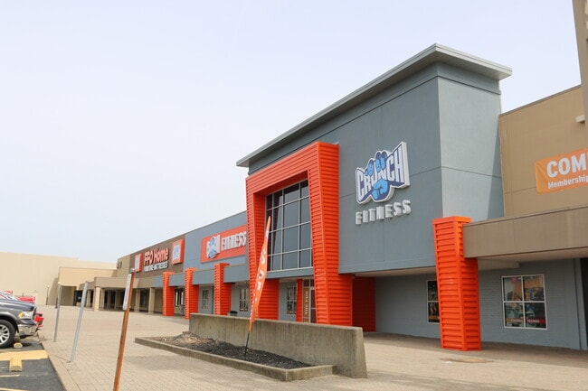
6801 Dixie Hwy
103205930000
Riviera Park
Storebuilding
23.57 AC
X
Jefferson
21111C0089F
Kentucky
2025
23.71 AC
2025
South Central
012203
Louisville
256,872 SF
Louisville-Jefferson County, KY-IN
DEMOGRAPHICS near 6801 Dixie Hwy
1 Mile
3 Mile
5 Mile
2024 Total Population
8,196
75,591
166,966
2029 Population
8,159
74,528
165,098
Pop Growth 2024-2029
(0.45%)
(1.41%)
(1.12%)
Average Age
40
40
39
2024 Total Households
3,529
30,517
67,022
HH Growth 2024-2029
(0.48%)
(1.45%)
(1.17%)
Median Household Inc
$55,461
$56,168
$49,853
Avg Household Size
2.30
2.40
2.40
2024 Avg HH Vehicles
2.00
2.00
2.00
Median Home Value
$192,324
$169,568
$158,335
Median Year Built
1968
1966
1964
Nearby Places
Map Layers
Map Styles
 Street
 Aerial
- Restaurants
- Banks
- Shops
- Fitness
- Groceries
PUBLIC TRANSPORTATION
AIRPORT
Louisville Muhammad Ali International
DRIVE
WALK
Distance
Louisville Muhammad Ali International
16 min
7.8 mi
Freight Ports
Port of Toledo
DRIVE
WALK
Distance
Port of Toledo
368 min
313.6 mi
SALE & LEASE HISTORY
LISTING DATE
SALE/LEASE

Sep 25, 2016
For Lease
Dec 16, 2019
For Lease
Nearby Properties
Address
Land Use
TOTAL SIZE
Lot Size
Zoning
Address
Land Use
TOTAL SIZE
Lot Size
Zoning
241,462 SF
25.28 AC
EZ1-ENTERP
Address
Land Use
TOTAL SIZE
Lot Size
Zoning
22,113 SF
19.01 AC
R4-RESIDEN
Address
Land Use
TOTAL SIZE
Lot Size
Zoning
16.31 AC
OR1-OFFICE
Address
Land Use
TOTAL SIZE
Lot Size
Zoning
26.79 AC
R4-RESIDEN
Address
Land Use
TOTAL SIZE
Lot Size
Zoning
2,880 SF
17.14 AC
R6-RESIDEN
Address
Land Use
TOTAL SIZE
Lot Size
Zoning
8.70 AC
R6-RESIDEN
Address
Land Use
TOTAL SIZE
Lot Size
Zoning
380,389 SF
31.06 AC
EZ1-ENTERP
Address
Land Use
TOTAL SIZE
Lot Size
Zoning
325,600 SF
17.15 AC
EZ1-ENTERP
Address
Land Use
TOTAL SIZE
Lot Size
Zoning
267,600 SF
28.63 AC
EZ1-ENTERP
Address
Land Use
TOTAL SIZE
Lot Size
Zoning
29.54 AC
R5-RESIDEN
Address
Land Use
TOTAL SIZE
Lot Size
Zoning
19,032 SF
5.88 AC
C1-COMMERC
Address
Land Use
TOTAL SIZE
Lot Size
Zoning
13,600 SF
14.89 AC
R7-RESIDEN
Address
Land Use
TOTAL SIZE
Lot Size
Zoning
300,000 SF
18.27 AC
EZ1-ENTERP
Address
Land Use
TOTAL SIZE
Lot Size
Zoning
234,597 SF
29.65 AC
C1-COMMERC
Address
Land Use
TOTAL SIZE
Lot Size
Zoning
4,250 SF
2.83 AC
OR1-OFFICE
Address
Land Use
TOTAL SIZE
Lot Size
Zoning
220,844 SF
29.19 AC
C2-COMMERC
Address
Land Use
TOTAL SIZE
Lot Size
Zoning
9.95 AC
Address
Land Use
TOTAL SIZE
Lot Size
Zoning
21.36 AC
Address
Land Use
TOTAL SIZE
Lot Size
Zoning
Address
Land Use
TOTAL SIZE
Lot Size
Zoning
117,174 SF
7.37 AC
C1-COMMERC
Address
Land Use
TOTAL SIZE
Lot Size
Zoning
11,136 SF
11.02 AC
R4-RESIDEN
Address
Land Use
TOTAL SIZE
Lot Size
Zoning
259,570 SF
20.38 AC
EZ1-ENTERP
Address
Land Use
TOTAL SIZE
Lot Size
Zoning
2,352 SF
2.42 AC
C2-COMMERC
Address
Land Use
TOTAL SIZE
Lot Size
Zoning
15,928 SF
13.67 AC
R4-RESIDEN
Address
Land Use
TOTAL SIZE
Lot Size
Zoning
269,280 SF
13.38 AC
EZ1-ENTERP
Address
Land Use
TOTAL SIZE
Lot Size
Zoning
Address
Land Use
TOTAL SIZE
Lot Size
Zoning
326,731 SF
25.44 AC
EZ1-ENTERP
Address
Land Use
TOTAL SIZE
Lot Size
Zoning
24,896 SF
5.47 AC
C1-COMMERC
Address
Land Use
TOTAL SIZE
Lot Size
Zoning
18.13 AC
EZ1-ENTERP
The World's #1 Commercial Real Estate Marketplace
Connect with us
© 2025 CoStar Group
The information above has been obtained from sources believed reliable. While we do not doubt its accuracy we have not verified it and make no guarantee, warranty or representation about it. It is your responsibility to independently confirm its accuracy and completeness. Any projections, opinions, assumptions, or estimates used are for example only and do not represent the current or future performance of the property. The value of this transaction to you depends on tax and other factors which should be evaluated by your tax, financial, and legal advisors. You and your advisors should conduct a careful, independent investigation of the property to determine to your satisfaction the suitability of the property for your needs.