Property Record
7020 Ne Corner Of Ward & Taylor Ave, Fort Smith, AR 72916


NEARBY LISTINGS FOR SALE OR LEASE
Property Detail
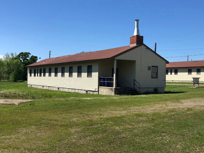
7020 Ne Corner Of Ward & Taylor Ave
Fort Smith, AR-OK
03-07-31
40001-0000-00108-00
PT N/2 & PT S/2 PT PARCEL NO. H-1
Governmentalpublicusegeneral
Sebastian
AE
Arkansas
05131C0135F
202.03 AC
0
Outlying Sebastian County
2025
Fort Smith
010301
DEMOGRAPHICS near 7020 Ne Corner Of Ward & Taylor Ave
1 Mile
3 Mile
5 Mile
2024 Total Population
11
9,565
22,141
2029 Population
11
9,869
22,677
Pop Growth 2024-2029
0.00%
+ 3.18%
+ 2.42%
Average Age
35
40
41
2024 Total Households
4
4,142
9,504
HH Growth 2024-2029
+ 25.00%
+ 3.28%
+ 2.46%
Median Household Inc
$14,999
$46,657
$56,949
Avg Household Size
2.40
2.30
2.30
2024 Avg HH Vehicles
1.00
2.00
2.00
Median Home Value
$99,999
$187,576
$192,065
Median Year Built
1989
2001
1992
Nearby Places
Map Layers
Map Styles
 Street
 Aerial
- Restaurants
- Banks
- Shops
- Fitness
- Groceries
PUBLIC TRANSPORTATION
AIRPORT
Fort Smith Regional
DRIVE
WALK
Distance
Fort Smith Regional
20 min
9.1 mi
Freight Ports
Tulsa Port of Inola
DRIVE
WALK
Distance
Tulsa Port of Inola
148 min
114.7 mi
SALE & LEASE HISTORY
LISTING DATE
SALE/LEASE

Jun 03, 2021
For Sale
Nearby Properties
Address
Land Use
TOTAL SIZE
Lot Size
Zoning
Address
Land Use
TOTAL SIZE
Lot Size
Zoning
124,455 SF
38.09 AC
Address
Land Use
TOTAL SIZE
Lot Size
Zoning
208,886 SF
212.42 AC
Address
Land Use
TOTAL SIZE
Lot Size
Zoning
342,092 SF
12.15 AC
Address
Land Use
TOTAL SIZE
Lot Size
Zoning
356,451 SF
44.13 AC
Address
Land Use
TOTAL SIZE
Lot Size
Zoning
89,157 SF
15.84 AC
Address
Land Use
TOTAL SIZE
Lot Size
Zoning
419,250 SF
22.86 AC
Address
Land Use
TOTAL SIZE
Lot Size
Zoning
105.25 AC
Address
Land Use
TOTAL SIZE
Lot Size
Zoning
168,195 SF
33.51 AC
Address
Land Use
TOTAL SIZE
Lot Size
Zoning
111,684 SF
19.56 AC
Address
Land Use
TOTAL SIZE
Lot Size
Zoning
90,000 SF
7.93 AC
Address
Land Use
TOTAL SIZE
Lot Size
Zoning
145,467 SF
15.14 AC
Address
Land Use
TOTAL SIZE
Lot Size
Zoning
80,847 SF
38.07 AC
Address
Land Use
TOTAL SIZE
Lot Size
Zoning
105,410 SF
11.02 AC
Address
Land Use
TOTAL SIZE
Lot Size
Zoning
40,551 SF
5 AC
Address
Land Use
TOTAL SIZE
Lot Size
Zoning
30,311 SF
4.46 AC
Address
Land Use
TOTAL SIZE
Lot Size
Zoning
86,780 SF
20.16 AC
Address
Land Use
TOTAL SIZE
Lot Size
Zoning
42,988 SF
6.98 AC
Address
Land Use
TOTAL SIZE
Lot Size
Zoning
38,212 SF
5.73 AC
Address
Land Use
TOTAL SIZE
Lot Size
Zoning
23,548 SF
4.30 AC
Address
Land Use
TOTAL SIZE
Lot Size
Zoning
56,421 SF
20 AC
Address
Land Use
TOTAL SIZE
Lot Size
Zoning
44,810 SF
7.70 AC
Address
Land Use
TOTAL SIZE
Lot Size
Zoning
35,641 SF
0.96 AC
Address
Land Use
TOTAL SIZE
Lot Size
Zoning
317,972 SF
36.19 AC
Address
Land Use
TOTAL SIZE
Lot Size
Zoning
86,522 SF
4.20 AC
Address
Land Use
TOTAL SIZE
Lot Size
Zoning
206,400 SF
11 AC
Address
Land Use
TOTAL SIZE
Lot Size
Zoning
13,759 SF
2.12 AC
Address
Land Use
TOTAL SIZE
Lot Size
Zoning
60,596 SF
10 AC
Address
Land Use
TOTAL SIZE
Lot Size
Zoning
38,228 SF
9.30 AC
Address
Land Use
TOTAL SIZE
Lot Size
Zoning
24,263 SF
6.74 AC
Address
Land Use
TOTAL SIZE
Lot Size
Zoning
3,700 SF
1 AC
The World's #1 Commercial Real Estate Marketplace
Connect with us
© 2026 CoStar Group
The information above has been obtained from sources believed reliable. While we do not doubt its accuracy we have not verified it and make no guarantee, warranty or representation about it. It is your responsibility to independently confirm its accuracy and completeness. Any projections, opinions, assumptions, or estimates used are for example only and do not represent the current or future performance of the property. The value of this transaction to you depends on tax and other factors which should be evaluated by your tax, financial, and legal advisors. You and your advisors should conduct a careful, independent investigation of the property to determine to your satisfaction the suitability of the property for your needs.