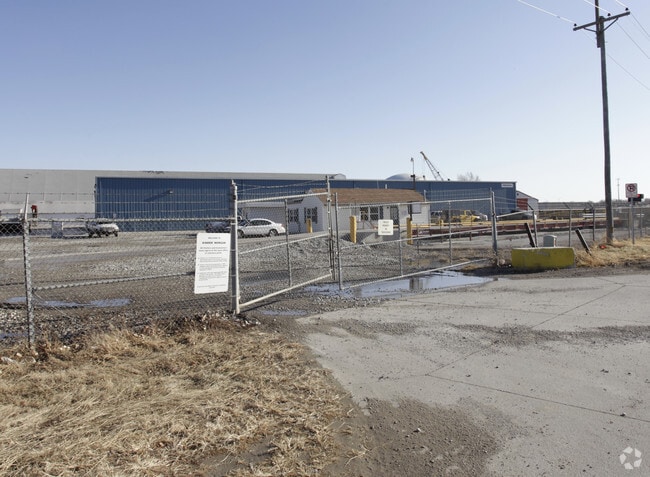
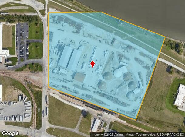
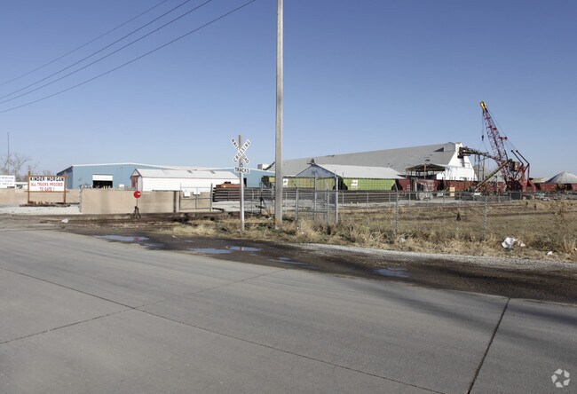
Property Record
6801 N 9Th St, Omaha, NE 68112
NEARBY LISTINGS FOR SALE OR LEASE
Property Detail
6801 N 9Th St
4305-0000-02
Lands
Warehouse
LANDS SEC-TWN-RGE 35-16-13 IRR S 700 N 925 E 900 W 940 FT NW 1/4 NW 1/4 19.38 AC
AE
Douglas
31055C0233H
Nebraska
2024
19.38 AC
2025
Northeast Omaha
000500
Omaha/Council Bluffs
52,000 SF
Omaha, NE-IA
DEMOGRAPHICS near 6801 N 9Th St
1 Mile
3 Mile
5 Mile
2024 Total Population
1,833
41,790
149,507
2029 Population
1,960
42,730
152,325
Pop Growth 2024-2029
+ 6.93%
+ 2.25%
+ 1.88%
Average Age
37
37
37
2024 Total Households
702
14,623
60,100
HH Growth 2024-2029
+ 6.84%
+ 2.30%
+ 2.06%
Median Household Inc
$42,466
$40,116
$45,441
Avg Household Size
2.60
2.60
2.30
2024 Avg HH Vehicles
2.00
2.00
2.00
Median Home Value
$122,321
$108,994
$149,511
Median Year Built
1975
1954
1956
Nearby Places
Map Layers
Map Styles
 Street
 Aerial
- Restaurants
- Banks
- Shops
- Fitness
- Groceries
PUBLIC TRANSPORTATION
COMMUTER RAIL
Omaha Amtrak Station (California Zephyr - Amtrak)
DRIVE
WALK
Distance
Omaha Amtrak Station (California Zephyr - Amtrak)
12 min
6.9 mi
Omaha Amtrak Station (California Zephyr - Amtrak)
DRIVE
WALK
Distance
Omaha Amtrak Station (California Zephyr - Amtrak)
13 min
7.2 mi
AIRPORT
Eppley Airfield
DRIVE
WALK
Distance
Eppley Airfield
8 min
3.3 mi
Freight Ports
Tulsa Port Of Catoosa
DRIVE
WALK
Distance
Tulsa Port Of Catoosa
469 min
423.3 mi
Nearby Properties
Address
Land Use
TOTAL SIZE
Lot Size
Zoning
Address
Land Use
TOTAL SIZE
Lot Size
Zoning
39.68 AC
Address
Land Use
TOTAL SIZE
Lot Size
Zoning
18.12 AC
Address
Land Use
TOTAL SIZE
Lot Size
Zoning
540,097 SF
20.98 AC
GI
Address
Land Use
TOTAL SIZE
Lot Size
Zoning
184,154 SF
9.93 AC
Address
Land Use
TOTAL SIZE
Lot Size
Zoning
69,554 SF
3.45 AC
Address
Land Use
TOTAL SIZE
Lot Size
Zoning
200,000 SF
11.49 AC
GI
Address
Land Use
TOTAL SIZE
Lot Size
Zoning
164,320 SF
6.88 AC
Address
Land Use
TOTAL SIZE
Lot Size
Zoning
142,451 SF
19.14 AC
Address
Land Use
TOTAL SIZE
Lot Size
Zoning
2.11 AC
Address
Land Use
TOTAL SIZE
Lot Size
Zoning
2.23 AC
Address
Land Use
TOTAL SIZE
Lot Size
Zoning
113,216 SF
12.93 AC
GI
Address
Land Use
TOTAL SIZE
Lot Size
Zoning
119,236 SF
Address
Land Use
TOTAL SIZE
Lot Size
Zoning
Address
Land Use
TOTAL SIZE
Lot Size
Zoning
111,770 SF
2.65 AC
Address
Land Use
TOTAL SIZE
Lot Size
Zoning
149,796 SF
13.08 AC
GI
Address
Land Use
TOTAL SIZE
Lot Size
Zoning
97,422 SF
4.06 AC
Address
Land Use
TOTAL SIZE
Lot Size
Zoning
383,283 SF
11.94 AC
GI
Address
Land Use
TOTAL SIZE
Lot Size
Zoning
198,000 SF
14.90 AC
GI
Address
Land Use
TOTAL SIZE
Lot Size
Zoning
1.78 AC
Address
Land Use
TOTAL SIZE
Lot Size
Zoning
246,595 SF
17.53 AC
HI
Address
Land Use
TOTAL SIZE
Lot Size
Zoning
1.90 AC
Address
Land Use
TOTAL SIZE
Lot Size
Zoning
4.76 AC
Address
Land Use
TOTAL SIZE
Lot Size
Zoning
90,000 SF
7.64 AC
GI
Address
Land Use
TOTAL SIZE
Lot Size
Zoning
1.96 AC
Address
Land Use
TOTAL SIZE
Lot Size
Zoning
88,628 SF
7.80 AC
GI
Address
Land Use
TOTAL SIZE
Lot Size
Zoning
9.25 AC
Address
Land Use
TOTAL SIZE
Lot Size
Zoning
62,500 SF
9.84 AC
Address
Land Use
TOTAL SIZE
Lot Size
Zoning
88,125 SF
18.15 AC
GI
Address
Land Use
TOTAL SIZE
Lot Size
Zoning
86,745 SF
7.17 AC
The World's #1 Commercial Real Estate Marketplace
Connect with us
© 2026 CoStar Group
The information above has been obtained from sources believed reliable. While we do not doubt its accuracy we have not verified it and make no guarantee, warranty or representation about it. It is your responsibility to independently confirm its accuracy and completeness. Any projections, opinions, assumptions, or estimates used are for example only and do not represent the current or future performance of the property. The value of this transaction to you depends on tax and other factors which should be evaluated by your tax, financial, and legal advisors. You and your advisors should conduct a careful, independent investigation of the property to determine to your satisfaction the suitability of the property for your needs.