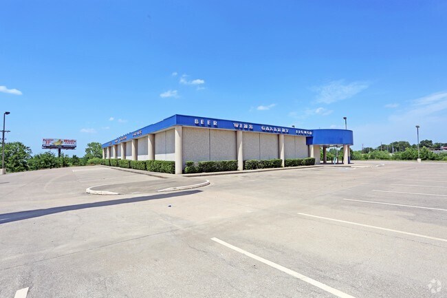
Property Record
6801 Old Randol Mill Rd, Fort Worth, TX 76120


NEARBY LISTINGS FOR SALE OR LEASE
Property Detail
6801 Old Randol Mill Rd
Dallas-Fort Worth-Arlington, TX
Village Creek Subdivision
04903579
VILLAGE CREEK SUBDIVISION BLOCK 1 LOT 2
Commercialnec
Tarrant
AE
Texas
48439C0215L
2
2024
8.91 AC
2025
East Fort Worth
106526
Dallas/Ft Worth
53,406 SF
DEMOGRAPHICS near 6801 Old Randol Mill Rd
1 mile
3 mile
5 mile
2024 Total Population
6,292
80,497
237,176
2029 Population
6,659
85,120
250,439
Pop Growth 2024-2029
+ 5.83%
+ 5.74%
+ 5.59%
Average Age
35
37
37
2024 Total Households
2,301
31,305
88,012
HH Growth 2024-2029
+ 5.91%
+ 5.86%
+ 5.65%
Median Household Inc
$50,153
$57,415
$57,994
Avg Household Size
2.60
2.50
2.60
2024 Avg HH Vehicles
2.00
2.00
2.00
Median Home Value
$267,690
$235,263
$226,513
Median Year Built
1989
1981
1974
Nearby Places
Map Layers
Map Styles
 Street
 Aerial
Transit
 Traffic
 Biking
Places
Listings with unknown addresses are not visible on the map
- Restaurants
- Banks
- Shops
- Fitness
- Groceries
PUBLIC TRANSPORTATION
COMMUTER RAIL
Richland Hills (Trinity Railway Express - Dallas Area Rapid Transit (DART))
Drive
Walk
Distance
Richland Hills (Trinity Railway Express - Dallas Area Rapid Transit (DART))
6 min
2.4 mi
Drive
Walk
Distance
7 min
3.1 mi
AIRPORT
Dallas-Fort Worth International
Drive
Walk
Distance
Dallas-Fort Worth International
27 min
19.0 mi
Dallas Love Field
Drive
Walk
Distance
Dallas Love Field
38 min
27.7 mi
SALE & LEASE HISTORY
LISTING DATE
SALE/LEASE

Sep 28, 2016
For Sale
Mar 15, 2017
For Lease
Nearby Properties
Address
Land Use
TOTAL SIZE
Lot Size
Zoning
Address
Land Use
TOTAL SIZE
Lot Size
Zoning
231,871 SF
17.08 AC
Address
Land Use
TOTAL SIZE
Lot Size
Zoning
260,590 SF
15.30 AC
Address
Land Use
TOTAL SIZE
Lot Size
Zoning
221,946 SF
31.17 AC
Address
Land Use
TOTAL SIZE
Lot Size
Zoning
232,295 SF
21.49 AC
Address
Land Use
TOTAL SIZE
Lot Size
Zoning
268,643 SF
12.50 AC
Address
Land Use
TOTAL SIZE
Lot Size
Zoning
445,900 SF
29.07 AC
Address
Land Use
TOTAL SIZE
Lot Size
Zoning
526,195 SF
40.84 AC
Address
Land Use
TOTAL SIZE
Lot Size
Zoning
306,524 SF
24.92 AC
Address
Land Use
TOTAL SIZE
Lot Size
Zoning
403,363 SF
24.03 AC
Address
Land Use
TOTAL SIZE
Lot Size
Zoning
228,667 SF
12.17 AC
Address
Land Use
TOTAL SIZE
Lot Size
Zoning
176,735 SF
10.62 AC
Address
Land Use
TOTAL SIZE
Lot Size
Zoning
123,801 SF
10.44 AC
Address
Land Use
TOTAL SIZE
Lot Size
Zoning
197,881 SF
9.98 AC
Address
Land Use
TOTAL SIZE
Lot Size
Zoning
207,138 SF
14.50 AC
Address
Land Use
TOTAL SIZE
Lot Size
Zoning
128,208 SF
43.67 AC
Address
Land Use
TOTAL SIZE
Lot Size
Zoning
300,000 SF
16.60 AC
Address
Land Use
TOTAL SIZE
Lot Size
Zoning
187,684 SF
9.20 AC
Address
Land Use
TOTAL SIZE
Lot Size
Zoning
222,978 SF
12.46 AC
Address
Land Use
TOTAL SIZE
Lot Size
Zoning
171,690 SF
7.87 AC
Address
Land Use
TOTAL SIZE
Lot Size
Zoning
170,046 SF
11.34 AC
Address
Land Use
TOTAL SIZE
Lot Size
Zoning
220,922 SF
15.32 AC
Address
Land Use
TOTAL SIZE
Lot Size
Zoning
204,636 SF
9.98 AC
Address
Land Use
TOTAL SIZE
Lot Size
Zoning
200,081 SF
10.38 AC
Address
Land Use
TOTAL SIZE
Lot Size
Zoning
198,256 SF
7.96 AC
Address
Land Use
TOTAL SIZE
Lot Size
Zoning
196,098 SF
7.95 AC
Address
Land Use
TOTAL SIZE
Lot Size
Zoning
209,157 SF
21.89 AC
Address
Land Use
TOTAL SIZE
Lot Size
Zoning
191,331 SF
8.04 AC
Address
Land Use
TOTAL SIZE
Lot Size
Zoning
127,090 SF
11.16 AC
Address
Land Use
TOTAL SIZE
Lot Size
Zoning
185,804 SF
9.73 AC
Address
Land Use
TOTAL SIZE
Lot Size
Zoning
91,912 SF
10.10 AC
The World's #1 Commercial Real Estate Marketplace
Connect with us
© 2026 CoStar Group
The information above has been obtained from sources believed reliable. While we do not doubt its accuracy we have not verified it and make no guarantee, warranty or representation about it. It is your responsibility to independently confirm its accuracy and completeness. Any projections, opinions, assumptions, or estimates used are for example only and do not represent the current or future performance of the property. The value of this transaction to you depends on tax and other factors which should be evaluated by your tax, financial, and legal advisors. You and your advisors should conduct a careful, independent investigation of the property to determine to your satisfaction the suitability of the property for your needs.