Property Record
6802 W 6200 Blvd S, West Valley City, UT 84118
NEARBY LISTINGS FOR SALE OR LEASE
Property Detail
6802 W 6200 Blvd S
Salt Lake City, UT
950006-J
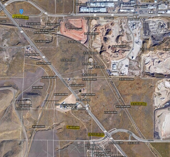
20-15-326-002-0000
BEG N 893723 W 2555.414 FT & N 00530 W 24.75 FT FR SE COR OF SEC 15, T 2S, R 2W, S L M; N 893723 W 278.325 FT; NWLY ALG CURVE TO R 713.336 FT; N 291640 W 200 FT; S 604320 W 12.5 FT; N 291640 W 700 FT; N 604320 E 50 FT; N 291640 W 1402.229 FT M OR L;
Industrialacreage
Salt Lake
X
Utah
49035C0275G
62.51 AC
2024
West Valley/Lake Park
2025
Salt Lake City
113805
DEMOGRAPHICS near 6802 W 6200 Blvd S
1 Mile
3 Mile
5 Mile
2024 Total Population
2,968
72,368
234,074
2029 Population
2,972
73,129
237,154
Pop Growth 2024-2029
+ 0.13%
+ 1.05%
+ 1.32%
Average Age
32
33
35
2024 Total Households
745
19,197
65,244
HH Growth 2024-2029
0.00%
+ 0.97%
+ 1.23%
Median Household Inc
$118,108
$92,964
$86,168
Avg Household Size
3.90
3.70
3.50
2024 Avg HH Vehicles
3.00
3.00
2.00
Median Home Value
$445,454
$362,689
$364,724
Median Year Built
1999
1994
1989
Nearby Places
Map Layers
Map Styles
 Street
 Aerial
- Restaurants
- Banks
- Shops
- Fitness
- Groceries
PUBLIC TRANSPORTATION
AIRPORT
Salt Lake City International
DRIVE
WALK
Distance
Salt Lake City International
18 min
12.9 mi
Freight Ports
Port of Stockton
DRIVE
WALK
Distance
Port of Stockton
709 min
691.3 mi
Nearby Properties
Address
Land Use
TOTAL SIZE
Lot Size
Zoning
Address
Land Use
TOTAL SIZE
Lot Size
Zoning
338,177 SF
21.91 AC
M-1
Address
Land Use
TOTAL SIZE
Lot Size
Zoning
308,722 SF
21.29 AC
M-1
Address
Land Use
TOTAL SIZE
Lot Size
Zoning
1,113,459 SF
80.09 AC
M
Address
Land Use
TOTAL SIZE
Lot Size
Zoning
613,674 SF
1,309.05 AC
M
Address
Land Use
TOTAL SIZE
Lot Size
Zoning
329,306 SF
14.67 AC
5005
Address
Land Use
TOTAL SIZE
Lot Size
Zoning
308,722 SF
20.45 AC
M-1
Address
Land Use
TOTAL SIZE
Lot Size
Zoning
188,632 SF
12.11 AC
PC
Address
Land Use
TOTAL SIZE
Lot Size
Zoning
187,717 SF
15.02 AC
R-M
Address
Land Use
TOTAL SIZE
Lot Size
Zoning
536,706 SF
12.80 AC
SC-2
Address
Land Use
TOTAL SIZE
Lot Size
Zoning
200,665 SF
20.95 AC
4192
Address
Land Use
TOTAL SIZE
Lot Size
Zoning
836,998 SF
14.25 AC
SC-2
Address
Land Use
TOTAL SIZE
Lot Size
Zoning
250,027 SF
8.46 AC
PF
Address
Land Use
TOTAL SIZE
Lot Size
Zoning
186,337 SF
20 AC
1107
Address
Land Use
TOTAL SIZE
Lot Size
Zoning
411,226 SF
7.22 AC
SC-2
Address
Land Use
TOTAL SIZE
Lot Size
Zoning
297,972 SF
45.67 AC
M
Address
Land Use
TOTAL SIZE
Lot Size
Zoning
856,805 SF
782.87 AC
A-20
Address
Land Use
TOTAL SIZE
Lot Size
Zoning
71,093 SF
29.58 AC
PF
Address
Land Use
TOTAL SIZE
Lot Size
Zoning
281,172 SF
12.91 AC
MI
Address
Land Use
TOTAL SIZE
Lot Size
Zoning
244,871 SF
14.53 AC
4144
Address
Land Use
TOTAL SIZE
Lot Size
Zoning
350,675 SF
36.41 AC
M
Address
Land Use
TOTAL SIZE
Lot Size
Zoning
342.97 AC
M
Address
Land Use
TOTAL SIZE
Lot Size
Zoning
95,998 SF
9.46 AC
1107
Address
Land Use
TOTAL SIZE
Lot Size
Zoning
391,140 SF
17.41 AC
M
Address
Land Use
TOTAL SIZE
Lot Size
Zoning
211,058 SF
21.71 AC
C-2
Address
Land Use
TOTAL SIZE
Lot Size
Zoning
178,750 SF
9.94 AC
M-1
Address
Land Use
TOTAL SIZE
Lot Size
Zoning
338,399 SF
355 AC
M
Address
Land Use
TOTAL SIZE
Lot Size
Zoning
86.14 AC
4192
Address
Land Use
TOTAL SIZE
Lot Size
Zoning
124,619 SF
60.10 AC
M
Address
Land Use
TOTAL SIZE
Lot Size
Zoning
80,912 SF
12.08 AC
4192
Address
Land Use
TOTAL SIZE
Lot Size
Zoning
211.48 AC
M
The World's #1 Commercial Real Estate Marketplace
Connect with us
© 2025 CoStar Group
The information above has been obtained from sources believed reliable. While we do not doubt its accuracy we have not verified it and make no guarantee, warranty or representation about it. It is your responsibility to independently confirm its accuracy and completeness. Any projections, opinions, assumptions, or estimates used are for example only and do not represent the current or future performance of the property. The value of this transaction to you depends on tax and other factors which should be evaluated by your tax, financial, and legal advisors. You and your advisors should conduct a careful, independent investigation of the property to determine to your satisfaction the suitability of the property for your needs.