Property Record
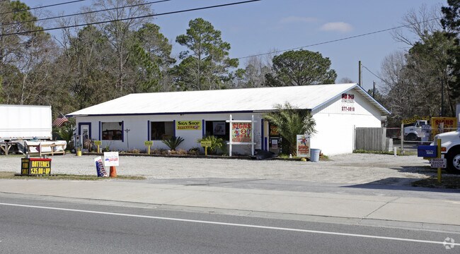
6804 Highway 77, Panama City, FL 32409


NEARBY LISTINGS FOR SALE OR LEASE
Property Detail
6804 Highway 77
Panama City-Panama City Beach, FL
St A Bay Pecan & Fig Grove Co
08625-000-000
34 2S 14W -36- 101D ST A BAY PECAN & FIG GROVE CO BEG 200 S OF NE COR LOT 40 TH S 150 W 307 TO E LINE HWY 77 NLY ALG HWY TO A PT W OF POB TH E TO POB LESS ST LESS TO HWY 77 R/W (3202 SQ FT) ORB 4042 P 1109
Storemultistory
Bay
AE
Florida
12005C0219J
40
2024
0.98 AC
2025
Panama City
000203
Other Market Areas
2,700 SF
DEMOGRAPHICS near 6804 Highway 77
1 Mile
3 Mile
5 Mile
2024 Total Population
1,066
12,576
32,299
2029 Population
1,146
13,158
33,853
Pop Growth 2024-2029
+ 7.50%
+ 4.63%
+ 4.81%
Average Age
40
41
40
2024 Total Households
400
4,709
12,150
HH Growth 2024-2029
+ 8.00%
+ 5.14%
+ 5.22%
Median Household Inc
$46,532
$67,987
$71,663
Avg Household Size
2.70
2.60
2.60
2024 Avg HH Vehicles
2.00
2.00
2.00
Median Home Value
$163,792
$251,735
$250,852
Median Year Built
1992
1989
1992
Nearby Places
Map Layers
Map Styles
 Street
 Aerial
- Restaurants
- Banks
- Shops
- Fitness
- Groceries
PUBLIC TRANSPORTATION
AIRPORT
Northwest Florida Beaches International
DRIVE
WALK
Distance
Northwest Florida Beaches International
22 min
14.4 mi
Freight Ports
Port of Panama City
DRIVE
WALK
Distance
Port of Panama City
21 min
10.0 mi
Nearby Properties
Address
Land Use
TOTAL SIZE
Lot Size
Zoning
Address
Land Use
TOTAL SIZE
Lot Size
Zoning
50,491 SF
6.48 AC
BC14
Address
Land Use
TOTAL SIZE
Lot Size
Zoning
89,000 SF
4.65 AC
BC15
Address
Land Use
TOTAL SIZE
Lot Size
Zoning
135,852 SF
34.90 AC
C5
Address
Land Use
TOTAL SIZE
Lot Size
Zoning
241.76 AC
BC01
Address
Land Use
TOTAL SIZE
Lot Size
Zoning
443.25 AC
UND
Address
Land Use
TOTAL SIZE
Lot Size
Zoning
42,809 SF
0.77 AC
PSP
Address
Land Use
TOTAL SIZE
Lot Size
Zoning
27,485 SF
4.71 AC
BC16
Address
Land Use
TOTAL SIZE
Lot Size
Zoning
2,895 SF
97.83 AC
Address
Land Use
TOTAL SIZE
Lot Size
Zoning
69,020 SF
4.44 AC
BC14
Address
Land Use
TOTAL SIZE
Lot Size
Zoning
133,000 SF
23.94 AC
C5
Address
Land Use
TOTAL SIZE
Lot Size
Zoning
16,165 SF
1.72 AC
RB
Address
Land Use
TOTAL SIZE
Lot Size
Zoning
24,134 SF
5.17 AC
UND
Address
Land Use
TOTAL SIZE
Lot Size
Zoning
50,754 SF
7.07 AC
MRA
Address
Land Use
TOTAL SIZE
Lot Size
Zoning
6.65 AC
BC13
Address
Land Use
TOTAL SIZE
Lot Size
Zoning
73,792 SF
7.53 AC
PSP
Address
Land Use
TOTAL SIZE
Lot Size
Zoning
31 AC
BC16
Address
Land Use
TOTAL SIZE
Lot Size
Zoning
1,600 SF
14.26 AC
BC15
Address
Land Use
TOTAL SIZE
Lot Size
Zoning
57,580 SF
4.01 AC
BC05
Address
Land Use
TOTAL SIZE
Lot Size
Zoning
5,472 SF
1.84 AC
RB
Address
Land Use
TOTAL SIZE
Lot Size
Zoning
231.05 AC
BC08
Address
Land Use
TOTAL SIZE
Lot Size
Zoning
40 AC
COM
Address
Land Use
TOTAL SIZE
Lot Size
Zoning
3,440 SF
3.60 AC
UND
Address
Land Use
TOTAL SIZE
Lot Size
Zoning
17,169 SF
4.06 AC
BC14
Address
Land Use
TOTAL SIZE
Lot Size
Zoning
61,523 SF
19.60 AC
COM
Address
Land Use
TOTAL SIZE
Lot Size
Zoning
6,597 SF
1.65 AC
Address
Land Use
TOTAL SIZE
Lot Size
Zoning
24,484 SF
3.44 AC
PSP
Address
Land Use
TOTAL SIZE
Lot Size
Zoning
61 AC
COM
Address
Land Use
TOTAL SIZE
Lot Size
Zoning
12,060 SF
50.03 AC
BC14
Address
Land Use
TOTAL SIZE
Lot Size
Zoning
3,163 SF
1.33 AC
RB
Address
Land Use
TOTAL SIZE
Lot Size
Zoning
13,770 SF
2.07 AC
SB
The World's #1 Commercial Real Estate Marketplace
Connect with us
© 2026 CoStar Group
The information above has been obtained from sources believed reliable. While we do not doubt its accuracy we have not verified it and make no guarantee, warranty or representation about it. It is your responsibility to independently confirm its accuracy and completeness. Any projections, opinions, assumptions, or estimates used are for example only and do not represent the current or future performance of the property. The value of this transaction to you depends on tax and other factors which should be evaluated by your tax, financial, and legal advisors. You and your advisors should conduct a careful, independent investigation of the property to determine to your satisfaction the suitability of the property for your needs.