Property Record
6809 159Th St, Tinley Park, IL 60477


NEARBY LISTINGS FOR SALE OR LEASE
Property Detail
6809 159Th St
28-19-105-003-0000
Cook
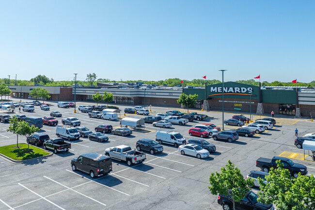
Regionalshoppingcenterormallwithanchorstore
Illinois
X
17.50 AC
17031C0706J
South Route 45
2023
Chicago
2024
Chicago-Naperville-Elgin, IL-IN-WI
825303
DEMOGRAPHICS near 6809 159Th St
1 Mile
3 Mile
5 Mile
2024 Total Population
10,890
86,045
205,212
2029 Population
10,494
83,336
200,190
Pop Growth 2024-2029
(3.64%)
(3.15%)
(2.45%)
Average Age
43
42
42
2024 Total Households
4,353
33,533
78,031
HH Growth 2024-2029
(4.02%)
(3.45%)
(2.71%)
Median Household Inc
$78,964
$83,876
$82,065
Avg Household Size
2.50
2.50
2.50
2024 Avg HH Vehicles
2.00
2.00
2.00
Median Home Value
$242,352
$253,569
$252,527
Median Year Built
1977
1979
1979
Nearby Places
Map Layers
Map Styles
 Street
 Aerial
- Restaurants
- Banks
- Shops
- Fitness
- Groceries
PUBLIC TRANSPORTATION
COMMUTER RAIL
Tinley Park Station (Rock Island District Line - Northeast Illinois Regional Commuter Railroad (Metra))
DRIVE
WALK
Distance
Tinley Park Station (Rock Island District Line - Northeast Illinois Regional Commuter Railroad (Metra))
5 min
1.9 mi
Oak Forest Station (Rock Island District Line - Northeast Illinois Regional Commuter Railroad (Metra))
DRIVE
WALK
Distance
Oak Forest Station (Rock Island District Line - Northeast Illinois Regional Commuter Railroad (Metra))
6 min
2.9 mi
AIRPORT
Chicago Midway International
DRIVE
WALK
Distance
Chicago Midway International
27 min
16.3 mi
Chicago O'Hare International
DRIVE
WALK
Distance
Chicago O'Hare International
51 min
35.2 mi
Freight Ports
Port Milwaukee
DRIVE
WALK
Distance
Port Milwaukee
132 min
106.9 mi
Nearby Properties
Address
Land Use
TOTAL SIZE
Lot Size
Zoning
Address
Land Use
TOTAL SIZE
Lot Size
Zoning
Address
Land Use
TOTAL SIZE
Lot Size
Zoning
266,729 SF
20.64 AC
Address
Land Use
TOTAL SIZE
Lot Size
Zoning
6.16 AC
Address
Land Use
TOTAL SIZE
Lot Size
Zoning
132,193 SF
16.49 AC
Address
Land Use
TOTAL SIZE
Lot Size
Zoning
Address
Land Use
TOTAL SIZE
Lot Size
Zoning
280,313 SF
12.75 AC
Address
Land Use
TOTAL SIZE
Lot Size
Zoning
114,484 SF
14.88 AC
Address
Land Use
TOTAL SIZE
Lot Size
Zoning
273,000 SF
20.69 AC
Address
Land Use
TOTAL SIZE
Lot Size
Zoning
203,359 SF
12.56 AC
Address
Land Use
TOTAL SIZE
Lot Size
Zoning
208,523 SF
7.05 AC
Address
Land Use
TOTAL SIZE
Lot Size
Zoning
47,125 SF
5.85 AC
Address
Land Use
TOTAL SIZE
Lot Size
Zoning
124,846 SF
Address
Land Use
TOTAL SIZE
Lot Size
Zoning
110,590 SF
10.30 AC
Address
Land Use
TOTAL SIZE
Lot Size
Zoning
85,290 SF
9.25 AC
Address
Land Use
TOTAL SIZE
Lot Size
Zoning
72,935 SF
2.90 AC
Address
Land Use
TOTAL SIZE
Lot Size
Zoning
59,948 SF
5.02 AC
Address
Land Use
TOTAL SIZE
Lot Size
Zoning
79,625 SF
3.89 AC
Address
Land Use
TOTAL SIZE
Lot Size
Zoning
53,768 SF
3.91 AC
Address
Land Use
TOTAL SIZE
Lot Size
Zoning
3.87 AC
Address
Land Use
TOTAL SIZE
Lot Size
Zoning
125,337 SF
11.57 AC
Address
Land Use
TOTAL SIZE
Lot Size
Zoning
61,641 SF
6.84 AC
Address
Land Use
TOTAL SIZE
Lot Size
Zoning
9.28 AC
Address
Land Use
TOTAL SIZE
Lot Size
Zoning
79,931 SF
1.91 AC
Address
Land Use
TOTAL SIZE
Lot Size
Zoning
1.38 AC
Address
Land Use
TOTAL SIZE
Lot Size
Zoning
28,519 SF
0.90 AC
Address
Land Use
TOTAL SIZE
Lot Size
Zoning
66,004 SF
7.47 AC
Address
Land Use
TOTAL SIZE
Lot Size
Zoning
80,723 SF
2.47 AC
Address
Land Use
TOTAL SIZE
Lot Size
Zoning
4.89 AC
Address
Land Use
TOTAL SIZE
Lot Size
Zoning
7.03 AC
The World's #1 Commercial Real Estate Marketplace
Connect with us
© 2025 CoStar Group
The information above has been obtained from sources believed reliable. While we do not doubt its accuracy we have not verified it and make no guarantee, warranty or representation about it. It is your responsibility to independently confirm its accuracy and completeness. Any projections, opinions, assumptions, or estimates used are for example only and do not represent the current or future performance of the property. The value of this transaction to you depends on tax and other factors which should be evaluated by your tax, financial, and legal advisors. You and your advisors should conduct a careful, independent investigation of the property to determine to your satisfaction the suitability of the property for your needs.