Property Record
6809 Randol Mill Rd, Fort Worth, TX 76120


Save to a Folder
{{folder.Name}}
{{folder.ListingIds.length}} Properties
{{folder.ListingIds.length}} Property
Create a New Folder
This Property Is For Sale
Property Detail
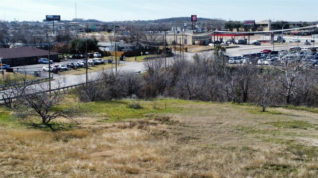
6809 Randol Mill Rd
Dallas-Fort Worth-Arlington, TX
RAY, ROBERT SURVEY ABSTRACT 1290 TRACT 2A3
40097110
TARRANT
Residentialacreage
Texas
B and X Area of moderate flood hazard, usually the area between the limits of the 100-year and 500-year floods.
4.62 AC
2025
Arlington/Mansfield
2025
Dallas/Ft Worth
106526
NEARBY LISTINGS FOR SALE OR LEASE
DEMOGRAPHICS near 6809 Randol Mill Rd
1 mile
3 mile
5 mile
2025 Total Population
6,600
82,126
242,939
2030 Population
7,051
86,685
255,983
Pop Growth 2025-2030
+ 6.83%
+ 5.55%
+ 5.37%
Average Age
36
38
38
2025 Total Households
2,386
32,153
90,794
HH Growth 2025-2030
+ 7.04%
+ 5.79%
+ 5.52%
Median Household Inc
$65,566
$63,720
$66,562
Avg Household Size
2.70
2.50
2.60
2025 Avg HH Vehicles
2.00
2.00
2.00
Median Home Value
$278,295
$283,471
$272,879
Median Year Built
1993
1982
1975
Nearby Places
Map Layers
Map Styles
 Street
 Aerial
Layers
 Traffic
 Biking
Places
Listings with unknown addresses are not visible on the map
- Restaurants
- Banks
- Shops
- Fitness
- Groceries
PUBLIC TRANSPORTATION
COMMUTER RAIL
Drive
Walk
Distance
5 min
2.7 mi
Drive
Walk
Distance
11 min
5.2 mi
AIRPORT
Dallas-Fort Worth International
Drive
Walk
Distance
Dallas-Fort Worth International
26 min
18.7 mi
Dallas Love Field
Drive
Walk
Distance
Dallas Love Field
36 min
27.3 mi
Nearby Properties
Address
Land Use
TOTAL SIZE
Lot Size
Zoning
Address
Land Use
TOTAL SIZE
Lot Size
Zoning
231,871 SF
17.08 AC
Address
Land Use
TOTAL SIZE
Lot Size
Zoning
260,590 SF
15.30 AC
Address
Land Use
TOTAL SIZE
Lot Size
Zoning
232,295 SF
21.49 AC
Address
Land Use
TOTAL SIZE
Lot Size
Zoning
268,643 SF
12.50 AC
Address
Land Use
TOTAL SIZE
Lot Size
Zoning
445,900 SF
29.07 AC
Address
Land Use
TOTAL SIZE
Lot Size
Zoning
526,195 SF
40.84 AC
Address
Land Use
TOTAL SIZE
Lot Size
Zoning
306,524 SF
24.92 AC
Address
Land Use
TOTAL SIZE
Lot Size
Zoning
176,735 SF
10.62 AC
Address
Land Use
TOTAL SIZE
Lot Size
Zoning
197,881 SF
9.98 AC
Address
Land Use
TOTAL SIZE
Lot Size
Zoning
207,138 SF
14.50 AC
Address
Land Use
TOTAL SIZE
Lot Size
Zoning
128,208 SF
43.67 AC
Address
Land Use
TOTAL SIZE
Lot Size
Zoning
300,000 SF
16.60 AC
Address
Land Use
TOTAL SIZE
Lot Size
Zoning
187,684 SF
9.20 AC
Address
Land Use
TOTAL SIZE
Lot Size
Zoning
222,978 SF
12.46 AC
Address
Land Use
TOTAL SIZE
Lot Size
Zoning
171,690 SF
7.87 AC
Address
Land Use
TOTAL SIZE
Lot Size
Zoning
170,046 SF
11.34 AC
Address
Land Use
TOTAL SIZE
Lot Size
Zoning
220,922 SF
15.32 AC
Address
Land Use
TOTAL SIZE
Lot Size
Zoning
204,636 SF
9.98 AC
Address
Land Use
TOTAL SIZE
Lot Size
Zoning
200,081 SF
10.38 AC
Address
Land Use
TOTAL SIZE
Lot Size
Zoning
198,256 SF
7.96 AC
Address
Land Use
TOTAL SIZE
Lot Size
Zoning
196,098 SF
7.95 AC
Address
Land Use
TOTAL SIZE
Lot Size
Zoning
209,157 SF
21.89 AC
Address
Land Use
TOTAL SIZE
Lot Size
Zoning
191,331 SF
8.04 AC
Address
Land Use
TOTAL SIZE
Lot Size
Zoning
127,090 SF
11.16 AC
Address
Land Use
TOTAL SIZE
Lot Size
Zoning
185,804 SF
9.73 AC
Address
Land Use
TOTAL SIZE
Lot Size
Zoning
91,912 SF
10.10 AC
Address
Land Use
TOTAL SIZE
Lot Size
Zoning
485,896 SF
26.89 AC
Address
Land Use
TOTAL SIZE
Lot Size
Zoning
1,880 SF
36.03 AC
Address
Land Use
TOTAL SIZE
Lot Size
Zoning
178,923 SF
10.67 AC
Address
Land Use
TOTAL SIZE
Lot Size
Zoning
178,773 SF
10 AC
The World's #1 Commercial Real Estate Marketplace
Connect with us
© 2026 CoStar Group
The information above has been obtained from sources believed reliable. While we do not doubt its accuracy we have not verified it and make no guarantee, warranty or representation about it. It is your responsibility to independently confirm its accuracy and completeness. Any projections, opinions, assumptions, or estimates used are for example only and do not represent the current or future performance of the property. The value of this transaction to you depends on tax and other factors which should be evaluated by your tax, financial, and legal advisors. You and your advisors should conduct a careful, independent investigation of the property to determine to your satisfaction the suitability of the property for your needs.