Property Record
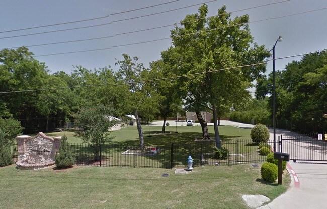
681 Mckenzie St, Lewisville, TX 75057


This Property Is For Sale
Property Detail
681 Mckenzie St
Dallas-Fort Worth-Arlington, TX
FUENTE DE VIDA MINISTRIES ADDN BLK A LOT 1
R272344
Denton
Commercialnec
Texas
B and X Area of moderate flood hazard, usually the area between the limits of the 100-year and 500-year floods.
1
0
1.85 AC
2025
Lewisville
021618
Dallas/Ft Worth
5,880 SF
NEARBY LISTINGS FOR SALE OR LEASE
DEMOGRAPHICS near 681 Mckenzie St
1 mile
3 mile
5 mile
2024 Total Population
8,877
93,449
223,252
2029 Population
10,083
104,052
247,012
Pop Growth 2024-2029
+ 13.59%
+ 11.35%
+ 10.64%
Average Age
37
37
38
2024 Total Households
2,871
36,332
83,898
HH Growth 2024-2029
+ 14.04%
+ 11.56%
+ 11.01%
Median Household Inc
$79,101
$78,521
$102,072
Avg Household Size
2.90
2.50
2.60
2024 Avg HH Vehicles
2.00
2.00
2.00
Median Home Value
$253,116
$341,468
$428,771
Median Year Built
1988
1992
1995
Nearby Places
Map Layers
Map Styles
 Street
 Aerial
Transit
 Traffic
 Biking
Places
Listings with unknown addresses are not visible on the map
- Restaurants
- Banks
- Shops
- Fitness
- Groceries
PUBLIC TRANSPORTATION
COMMUTER RAIL
Old Town Station (A-train - Denton County Transportation Authority)
Drive
Walk
Distance
Old Town Station (A-train - Denton County Transportation Authority)
2 min
15 min
0.8 mi
Hebron Station (A-train - Denton County Transportation Authority)
Drive
Walk
Distance
Hebron Station (A-train - Denton County Transportation Authority)
8 min
4.0 mi
AIRPORT
Dallas-Fort Worth International
Drive
Walk
Distance
Dallas-Fort Worth International
17 min
11.6 mi
Dallas Love Field
Drive
Walk
Distance
Dallas Love Field
29 min
20.7 mi
Freight Ports
Port of Shreveport
Drive
Walk
Distance
Port of Shreveport
236 min
218.2 mi
Nearby Properties
Address
Land Use
TOTAL SIZE
Lot Size
Zoning
Address
Land Use
TOTAL SIZE
Lot Size
Zoning
334,685 SF
38.12 AC
Address
Land Use
TOTAL SIZE
Lot Size
Zoning
599,705 SF
10.38 AC
Address
Land Use
TOTAL SIZE
Lot Size
Zoning
835,344 SF
143.50 AC
Address
Land Use
TOTAL SIZE
Lot Size
Zoning
323,048 SF
14.78 AC
Address
Land Use
TOTAL SIZE
Lot Size
Zoning
382,330 SF
21.43 AC
3B
Address
Land Use
TOTAL SIZE
Lot Size
Zoning
385,247 SF
22.59 AC
3B
Address
Land Use
TOTAL SIZE
Lot Size
Zoning
412,389 SF
16.69 AC
3B
Address
Land Use
TOTAL SIZE
Lot Size
Zoning
354,546 SF
19.38 AC
3B
Address
Land Use
TOTAL SIZE
Lot Size
Zoning
424,064 SF
22.15 AC
2B
Address
Land Use
TOTAL SIZE
Lot Size
Zoning
340,081 SF
18.06 AC
6
Address
Land Use
TOTAL SIZE
Lot Size
Zoning
411,223 SF
24.07 AC
3B
Address
Land Use
TOTAL SIZE
Lot Size
Zoning
344,926 SF
19.93 AC
3B
Address
Land Use
TOTAL SIZE
Lot Size
Zoning
380,316 SF
26.10 AC
Address
Land Use
TOTAL SIZE
Lot Size
Zoning
347,181 SF
18.51 AC
3B
Address
Land Use
TOTAL SIZE
Lot Size
Zoning
295,098 SF
10.65 AC
Address
Land Use
TOTAL SIZE
Lot Size
Zoning
392,646 SF
19.65 AC
3B
Address
Land Use
TOTAL SIZE
Lot Size
Zoning
266,959 SF
3.83 AC
Address
Land Use
TOTAL SIZE
Lot Size
Zoning
297,636 SF
9.43 AC
Address
Land Use
TOTAL SIZE
Lot Size
Zoning
310,788 SF
15.05 AC
Address
Land Use
TOTAL SIZE
Lot Size
Zoning
315,084 SF
13.76 AC
3B
Address
Land Use
TOTAL SIZE
Lot Size
Zoning
295,668 SF
13.03 AC
Address
Land Use
TOTAL SIZE
Lot Size
Zoning
659,218 SF
34.29 AC
Address
Land Use
TOTAL SIZE
Lot Size
Zoning
312,926 SF
10.07 AC
Address
Land Use
TOTAL SIZE
Lot Size
Zoning
345,310 SF
11.71 AC
Address
Land Use
TOTAL SIZE
Lot Size
Zoning
599,800 SF
31.44 AC
Address
Land Use
TOTAL SIZE
Lot Size
Zoning
288,735 SF
15.50 AC
3B
Address
Land Use
TOTAL SIZE
Lot Size
Zoning
455,074 SF
28.61 AC
Address
Land Use
TOTAL SIZE
Lot Size
Zoning
344,932 SF
18.28 AC
3G
Address
Land Use
TOTAL SIZE
Lot Size
Zoning
385,026 SF
7.46 AC
Address
Land Use
TOTAL SIZE
Lot Size
Zoning
284,869 SF
12.49 AC
3B
The World's #1 Commercial Real Estate Marketplace
Connect with us
© 2026 CoStar Group
The information above has been obtained from sources believed reliable. While we do not doubt its accuracy we have not verified it and make no guarantee, warranty or representation about it. It is your responsibility to independently confirm its accuracy and completeness. Any projections, opinions, assumptions, or estimates used are for example only and do not represent the current or future performance of the property. The value of this transaction to you depends on tax and other factors which should be evaluated by your tax, financial, and legal advisors. You and your advisors should conduct a careful, independent investigation of the property to determine to your satisfaction the suitability of the property for your needs.