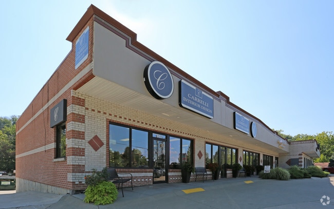
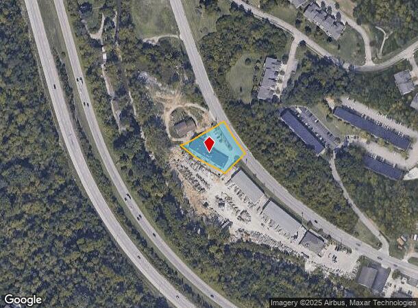
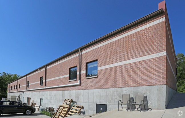
Property Record
6811 Harrison Ave, Cincinnati, OH 45247
Current Lease Availabilities
NEARBY LISTINGS FOR SALE OR LEASE
Property Detail
6811 Harrison Ave
550-0322-0024
HARRISON AV FT IRR R2-T2-S36 SW
Regionalshoppingcenterormallwithanchorstore
Hamilton
A
Ohio
39061C0185E
4
2024
0.63 AC
2024
Forest Park/West
020601
Cincinnati/Dayton
3,130 SF
Cincinnati, OH-KY-IN
DEMOGRAPHICS near 6811 Harrison Ave
1 Mile
3 Mile
5 Mile
2024 Total Population
6,485
28,566
103,097
2029 Population
6,347
27,950
100,750
Pop Growth 2024-2029
(2.13%)
(2.16%)
(2.28%)
Average Age
41
42
41
2024 Total Households
2,726
11,402
41,510
HH Growth 2024-2029
(2.27%)
(2.30%)
(2.45%)
Median Household Inc
$81,695
$91,577
$77,440
Avg Household Size
2.40
2.50
2.40
2024 Avg HH Vehicles
2.00
2.00
2.00
Median Home Value
$233,147
$250,206
$195,890
Median Year Built
1992
1985
1971
Nearby Places
- Restaurants
- Banks
- Shops
- Fitness
- Groceries
PUBLIC TRANSPORTATION
AIRPORT
Cincinnati/Northern Kentucky International
DRIVE
WALK
Distance
Cincinnati/Northern Kentucky International
28 min
24.1 mi
Freight Ports
Virginia Port Authority - Richmond
DRIVE
WALK
Distance
Virginia Port Authority - Richmond
1 min
410.9 mi
Nearby Properties
Address
Land Use
TOTAL SIZE
Lot Size
Zoning
Address
Land Use
TOTAL SIZE
Lot Size
Zoning
5.38 AC
OO
Address
Land Use
TOTAL SIZE
Lot Size
Zoning
12.23 AC
Address
Land Use
TOTAL SIZE
Lot Size
Zoning
83.15 AC
Address
Land Use
TOTAL SIZE
Lot Size
Zoning
474 SF
9.59 AC
A
Address
Land Use
TOTAL SIZE
Lot Size
Zoning
1,671 SF
21.48 AC
CCUP
Address
Land Use
TOTAL SIZE
Lot Size
Zoning
14.43 AC
Address
Land Use
TOTAL SIZE
Lot Size
Zoning
Address
Land Use
TOTAL SIZE
Lot Size
Zoning
4.68 AC
E
Address
Land Use
TOTAL SIZE
Lot Size
Zoning
29,084 SF
30.10 AC
DD
Address
Land Use
TOTAL SIZE
Lot Size
Zoning
20.34 AC
Address
Land Use
TOTAL SIZE
Lot Size
Zoning
360 SF
7.79 AC
F
Address
Land Use
TOTAL SIZE
Lot Size
Zoning
19.52 AC
EE
Address
Land Use
TOTAL SIZE
Lot Size
Zoning
18.30 AC
EE
Address
Land Use
TOTAL SIZE
Lot Size
Zoning
8,580 SF
19.31 AC
DD
Address
Land Use
TOTAL SIZE
Lot Size
Zoning
Address
Land Use
TOTAL SIZE
Lot Size
Zoning
35,496 SF
13.86 AC
A
Address
Land Use
TOTAL SIZE
Lot Size
Zoning
8.69 AC
EE
Address
Land Use
TOTAL SIZE
Lot Size
Zoning
2.76 AC
EE
Address
Land Use
TOTAL SIZE
Lot Size
Zoning
Address
Land Use
TOTAL SIZE
Lot Size
Zoning
37,169 SF
12.82 AC
A
Address
Land Use
TOTAL SIZE
Lot Size
Zoning
Address
Land Use
TOTAL SIZE
Lot Size
Zoning
4,439 SF
1,059.01 AC
AA
Address
Land Use
TOTAL SIZE
Lot Size
Zoning
Address
Land Use
TOTAL SIZE
Lot Size
Zoning
2,700 SF
5.30 AC
A
Address
Land Use
TOTAL SIZE
Lot Size
Zoning
Address
Land Use
TOTAL SIZE
Lot Size
Zoning
69.35 AC
Address
Land Use
TOTAL SIZE
Lot Size
Zoning
84,210 SF
11.36 AC
A2
Address
Land Use
TOTAL SIZE
Lot Size
Zoning
49,284 SF
8.94 AC
A
Address
Land Use
TOTAL SIZE
Lot Size
Zoning
4.59 AC
EE
Address
Land Use
TOTAL SIZE
Lot Size
Zoning
1,208 SF
5.37 AC
EE
The World's #1 Commercial Real Estate Marketplace
Connect with us
© 2025 CoStar Group
The information above has been obtained from sources believed reliable. While we do not doubt its accuracy we have not verified it and make no guarantee, warranty or representation about it. It is your responsibility to independently confirm its accuracy and completeness. Any projections, opinions, assumptions, or estimates used are for example only and do not represent the current or future performance of the property. The value of this transaction to you depends on tax and other factors which should be evaluated by your tax, financial, and legal advisors. You and your advisors should conduct a careful, independent investigation of the property to determine to your satisfaction the suitability of the property for your needs.