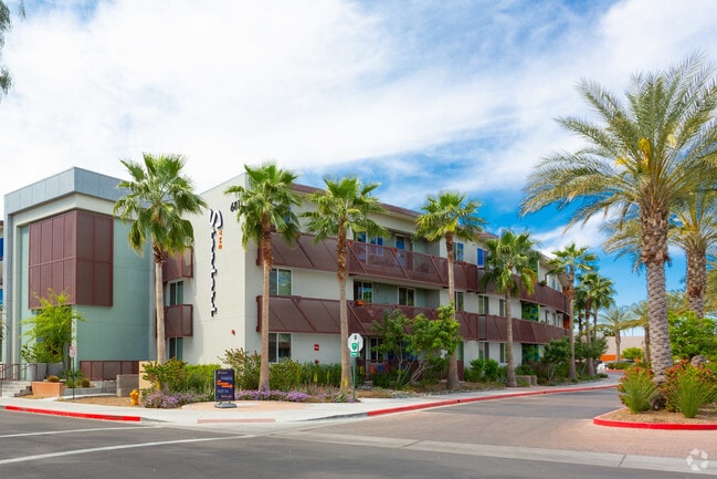
Property Record
6811 E Main St, Scottsdale, AZ 85251


NEARBY LISTINGS FOR SALE OR LEASE
Property Detail
6811 E Main St
130-11-239A
Hotel Valley Ho Land Division
Apartment
HOTEL VALLEY HO LAND DIVISION MCR 720-9 PCL 3A DAF COM N4 COR SEC 27 TH S 785.33F TH E 40.00F TH CONT E 141.91F TH N 56D 59M E 107.83F TPOB TH CONT N 56D 59M E 93.03F TO NON TAN CUR RAD 251.92F BRG S 5D 28M E TH NELY 178.00F ALG SD CUR TO NON TAN CUR
X
Maricopa
04013C2235M
Arizona
2025
3.02 AC
2025
Old Town
217201
Phoenix
190,043 SF
Phoenix-Mesa-Chandler, AZ
DEMOGRAPHICS near 6811 E Main St
1 mile
3 mile
5 mile
2024 Total Population
19,152
117,209
246,656
2029 Population
21,122
129,195
270,997
Pop Growth 2024-2029
+ 10.29%
+ 10.23%
+ 9.87%
Average Age
40
42
40
2024 Total Households
10,581
58,177
116,465
HH Growth 2024-2029
+ 10.46%
+ 10.54%
+ 10.13%
Median Household Inc
$83,247
$84,094
$76,123
Avg Household Size
1.80
1.90
2.00
2024 Avg HH Vehicles
1.00
2.00
2.00
Median Home Value
$656,632
$490,635
$523,316
Median Year Built
1989
1976
1978
Nearby Places
Map Layers
Map Styles
 Street
 Aerial
Transit
 Traffic
 Biking
Places
Listings with unknown addresses are not visible on the map
- Restaurants
- Banks
- Shops
- Fitness
- Groceries
PUBLIC TRANSPORTATION
AIRPORT
Phoenix Sky Harbor International
Drive
Walk
Distance
Phoenix Sky Harbor International
18 min
9.1 mi
Nearby Properties
Address
Land Use
TOTAL SIZE
Lot Size
Zoning
Address
Land Use
TOTAL SIZE
Lot Size
Zoning
Address
Land Use
TOTAL SIZE
Lot Size
Zoning
1,870,689 SF
46.77 AC
I-P
Address
Land Use
TOTAL SIZE
Lot Size
Zoning
2,636,740 SF
21.88 AC
C-DT
Address
Land Use
TOTAL SIZE
Lot Size
Zoning
33,483 SF
7.82 AC
PF
Address
Land Use
TOTAL SIZE
Lot Size
Zoning
1,457,213 SF
41.78 AC
PUD
Address
Land Use
TOTAL SIZE
Lot Size
Zoning
9,160 SF
2.57 AC
DDMU2
Address
Land Use
TOTAL SIZE
Lot Size
Zoning
649,656 SF
10.19 AC
PAD
Address
Land Use
TOTAL SIZE
Lot Size
Zoning
981,325 SF
8.31 AC
Address
Land Use
TOTAL SIZE
Lot Size
Zoning
3.77 AC
PNC
Address
Land Use
TOTAL SIZE
Lot Size
Zoning
44,971 SF
2.06 AC
C-R
Address
Land Use
TOTAL SIZE
Lot Size
Zoning
3,010 SF
35.44 AC
R110
Address
Land Use
TOTAL SIZE
Lot Size
Zoning
307,604 SF
37.83 AC
R-7
Address
Land Use
TOTAL SIZE
Lot Size
Zoning
301,376 SF
8.77 AC
PAD
Address
Land Use
TOTAL SIZE
Lot Size
Zoning
688,550 SF
149.95 AC
R-6
Address
Land Use
TOTAL SIZE
Lot Size
Zoning
776,898 SF
27.32 AC
C-R
Address
Land Use
TOTAL SIZE
Lot Size
Zoning
440,573 SF
19.10 AC
SUPR
Address
Land Use
TOTAL SIZE
Lot Size
Zoning
1,229,384 SF
4.81 AC
Address
Land Use
TOTAL SIZE
Lot Size
Zoning
457,979 SF
9.26 AC
CO
Address
Land Use
TOTAL SIZE
Lot Size
Zoning
392,172 SF
7.50 AC
DM2
Address
Land Use
TOTAL SIZE
Lot Size
Zoning
62,497 SF
130.73 AC
R-6
Address
Land Use
TOTAL SIZE
Lot Size
Zoning
439,600 SF
8.52 AC
DDCC2
Address
Land Use
TOTAL SIZE
Lot Size
Zoning
8,051 SF
3.19 AC
R-43
Address
Land Use
TOTAL SIZE
Lot Size
Zoning
617,776 SF
4.53 AC
DDMU2
Address
Land Use
TOTAL SIZE
Lot Size
Zoning
282,287 SF
38.68 AC
R-10
Address
Land Use
TOTAL SIZE
Lot Size
Zoning
639,643 SF
5.43 AC
PAD
Address
Land Use
TOTAL SIZE
Lot Size
Zoning
289,633 SF
9.11 AC
R-10
Address
Land Use
TOTAL SIZE
Lot Size
Zoning
530,384 SF
5.24 AC
C-DT
Address
Land Use
TOTAL SIZE
Lot Size
Zoning
Address
Land Use
TOTAL SIZE
Lot Size
Zoning
590,903 SF
9.41 AC
C-DT
Address
Land Use
TOTAL SIZE
Lot Size
Zoning
438,373 SF
11.35 AC
The World's #1 Commercial Real Estate Marketplace
Connect with us
© 2026 CoStar Group
The information above has been obtained from sources believed reliable. While we do not doubt its accuracy we have not verified it and make no guarantee, warranty or representation about it. It is your responsibility to independently confirm its accuracy and completeness. Any projections, opinions, assumptions, or estimates used are for example only and do not represent the current or future performance of the property. The value of this transaction to you depends on tax and other factors which should be evaluated by your tax, financial, and legal advisors. You and your advisors should conduct a careful, independent investigation of the property to determine to your satisfaction the suitability of the property for your needs.