Property Record
6813 E Rosedale St, Fort Worth, TX 76112


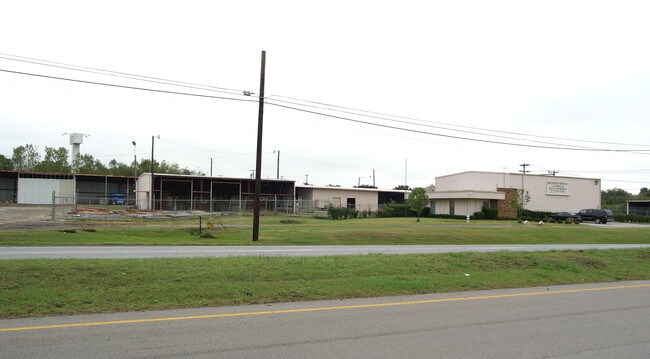

Property Detail
6813 E Rosedale St
Dallas-Fort Worth-Arlington, TX
SPUR ADDITION LOT 4
02946084
TARRANT
Commercialnec
Texas
B and X Area of moderate flood hazard, usually the area between the limits of the 100-year and 500-year floods.
4
2025
0.43 AC
2025
East Ft Worth
101302
Dallas/Ft Worth
5,553 SF
NEARBY LISTINGS FOR SALE OR LEASE
DEMOGRAPHICS near 6813 E Rosedale St
1 mile
3 mile
5 mile
2025 Total Population
6,540
95,099
241,955
2030 Population
6,878
100,613
254,896
Pop Growth 2025-2030
+ 5.17%
+ 5.80%
+ 5.35%
Average Age
38
38
38
2025 Total Households
2,276
35,315
88,282
HH Growth 2025-2030
+ 5.27%
+ 6.00%
+ 5.50%
Median Household Inc
$65,867
$60,107
$66,176
Avg Household Size
2.80
2.60
2.70
2025 Avg HH Vehicles
2.00
2.00
2.00
Median Home Value
$189,052
$249,110
$275,839
Median Year Built
1959
1977
1979
Nearby Places
Map Layers
Map Styles
 Street
 Aerial
Transit
 Traffic
 Biking
Places
Listings with unknown addresses are not visible on the map
- Restaurants
- Banks
- Shops
- Fitness
- Groceries
PUBLIC TRANSPORTATION
COMMUTER RAIL
Trinity Lakes Station (TRINITY RAILWAY - Dallas Area Rapid Transit (DART))
Drive
Walk
Distance
Trinity Lakes Station (TRINITY RAILWAY - Dallas Area Rapid Transit (DART))
11 min
6.8 mi
Bell Station (TRINITY RAILWAY - Dallas Area Rapid Transit (DART))
Drive
Walk
Distance
Bell Station (TRINITY RAILWAY - Dallas Area Rapid Transit (DART))
16 min
9.2 mi
AIRPORT
Dallas-Fort Worth International
Drive
Walk
Distance
Dallas-Fort Worth International
31 min
22.7 mi
Dallas Love Field
Drive
Walk
Distance
Dallas Love Field
41 min
31.3 mi
Freight Ports
Port of Shreveport
Drive
Walk
Distance
Port of Shreveport
243 min
223.3 mi
SALE & LEASE HISTORY
LISTING DATE
SALE/LEASE

Oct 23, 2024
For Sale
Nearby Properties
Address
Land Use
TOTAL SIZE
Lot Size
Zoning
Address
Land Use
TOTAL SIZE
Lot Size
Zoning
163,000 SF
12.36 AC
Address
Land Use
TOTAL SIZE
Lot Size
Zoning
268,643 SF
12.50 AC
Address
Land Use
TOTAL SIZE
Lot Size
Zoning
171,769 SF
4.96 AC
Address
Land Use
TOTAL SIZE
Lot Size
Zoning
388,905 SF
27.61 AC
Address
Land Use
TOTAL SIZE
Lot Size
Zoning
306,524 SF
24.92 AC
Address
Land Use
TOTAL SIZE
Lot Size
Zoning
131,582 SF
10.61 AC
Address
Land Use
TOTAL SIZE
Lot Size
Zoning
176,735 SF
10.62 AC
Address
Land Use
TOTAL SIZE
Lot Size
Zoning
197,881 SF
9.98 AC
Address
Land Use
TOTAL SIZE
Lot Size
Zoning
190,755 SF
33.09 AC
Address
Land Use
TOTAL SIZE
Lot Size
Zoning
187,684 SF
9.20 AC
Address
Land Use
TOTAL SIZE
Lot Size
Zoning
222,978 SF
12.46 AC
Address
Land Use
TOTAL SIZE
Lot Size
Zoning
220,922 SF
15.32 AC
Address
Land Use
TOTAL SIZE
Lot Size
Zoning
133,193 SF
14.56 AC
Address
Land Use
TOTAL SIZE
Lot Size
Zoning
144,164 SF
9.31 AC
Address
Land Use
TOTAL SIZE
Lot Size
Zoning
204,636 SF
9.98 AC
Address
Land Use
TOTAL SIZE
Lot Size
Zoning
200,081 SF
10.38 AC
Address
Land Use
TOTAL SIZE
Lot Size
Zoning
198,256 SF
7.96 AC
Address
Land Use
TOTAL SIZE
Lot Size
Zoning
196,098 SF
7.95 AC
Address
Land Use
TOTAL SIZE
Lot Size
Zoning
127,090 SF
11.16 AC
Address
Land Use
TOTAL SIZE
Lot Size
Zoning
185,804 SF
9.73 AC
Address
Land Use
TOTAL SIZE
Lot Size
Zoning
91,912 SF
10.10 AC
Address
Land Use
TOTAL SIZE
Lot Size
Zoning
178,923 SF
10.67 AC
Address
Land Use
TOTAL SIZE
Lot Size
Zoning
178,773 SF
10 AC
Address
Land Use
TOTAL SIZE
Lot Size
Zoning
208,085 SF
12 AC
Address
Land Use
TOTAL SIZE
Lot Size
Zoning
161,934 SF
9.89 AC
Address
Land Use
TOTAL SIZE
Lot Size
Zoning
167,976 SF
10 AC
Address
Land Use
TOTAL SIZE
Lot Size
Zoning
194,637 SF
13.75 AC
Address
Land Use
TOTAL SIZE
Lot Size
Zoning
209,784 SF
48.86 AC
Address
Land Use
TOTAL SIZE
Lot Size
Zoning
182,272 SF
7.86 AC
Address
Land Use
TOTAL SIZE
Lot Size
Zoning
147,089 SF
7.46 AC
The World's #1 Commercial Real Estate Marketplace
Connect with us
© 2026 CoStar Group
The information above has been obtained from sources believed reliable. While we do not doubt its accuracy we have not verified it and make no guarantee, warranty or representation about it. It is your responsibility to independently confirm its accuracy and completeness. Any projections, opinions, assumptions, or estimates used are for example only and do not represent the current or future performance of the property. The value of this transaction to you depends on tax and other factors which should be evaluated by your tax, financial, and legal advisors. You and your advisors should conduct a careful, independent investigation of the property to determine to your satisfaction the suitability of the property for your needs.